We’re ending off the weekend with some seasonably warm but dry weather. We’ll top out in the upper 80s with a matching heat index and partly cloudy skies. Over the next few days, we’ll have a repeat with temperatures reaching the mid to upper 80s each day and increasing lows overnight.
As the Helene-fused low moves out to the east, we’ll see a brief high pressure system move into the mid-South. This will bring in more northerly winds across the area from Tuesday and Wednesday. Between this, a dry front and a broad cold front from Canada will move across the area shifting winds to the east.
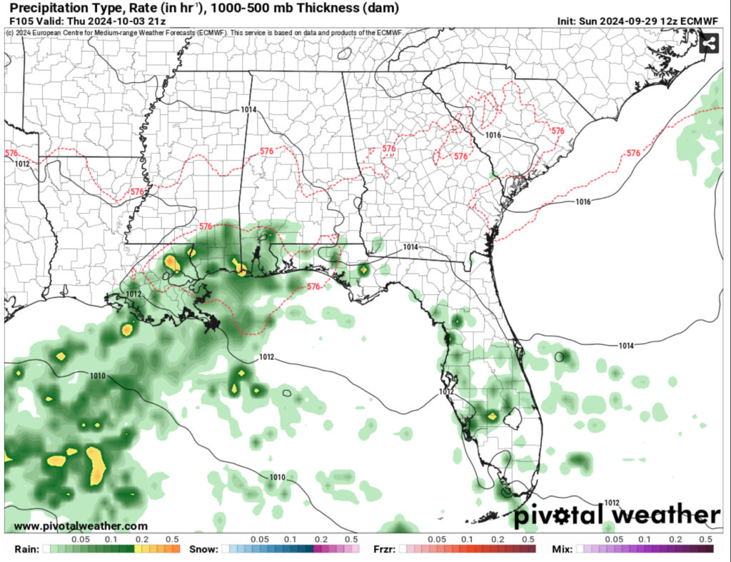
I’ll get to the tropical discussion in a minute, but it will have an effect on our rain chances on Thursday and Friday. The tropical low will bring in more moisture from the Gulf which will give us a decent shot for rain. Temperatures won’t differ much from the past few days, however the cloud cover and humidity will increase as we go into the weekend.
The Tropics
As we’re in the aftermath of Helene, all eyes are on the western Caribbean again as another Central American Gyre is developing south of the Yucatán. Right now, it’s still a mix of unorganized storms wrapped around a broad area of low pressure. Our main problem right now is a few factors: model output, organization, and the mid-latitudes.
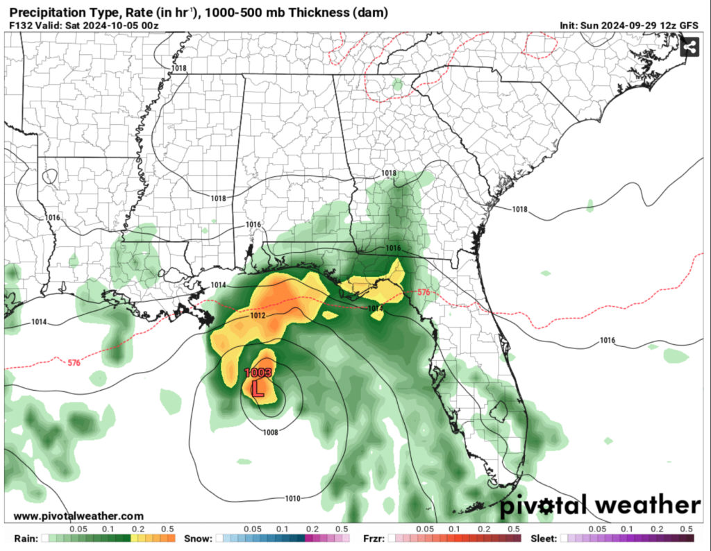
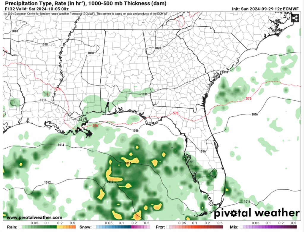
Both of these model outputs are vastly different from each other. While it’s still 5 days out from what this system may turn into, we’ll have to wait a little longer for the models to come into agreement as to what this system might do. The GFS has it looking more like a tropical storm by Friday while the Euro looks much more broad and disorganized.
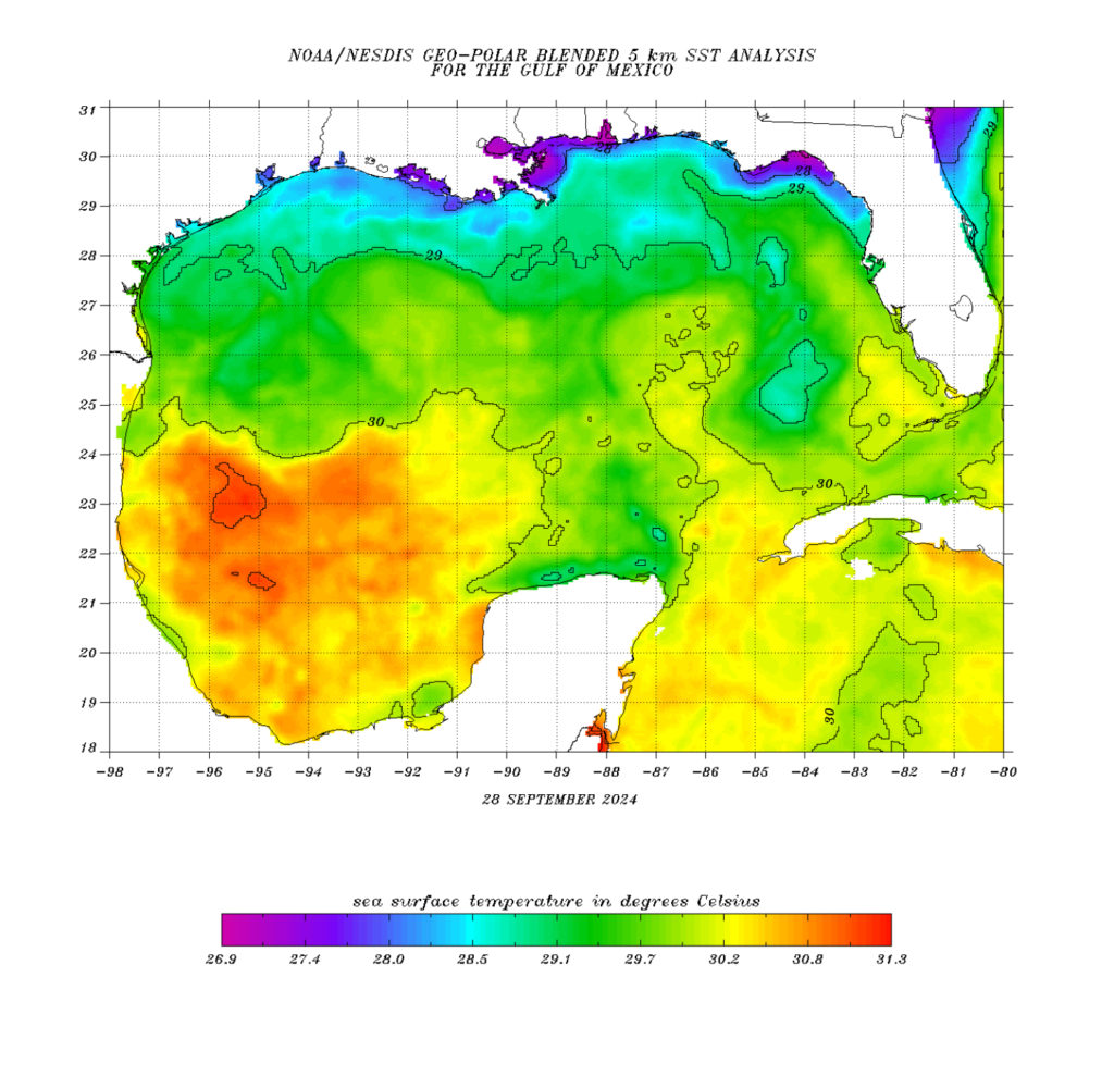
Organization is also another factor. This low is pretty broad and spans across much of the Caribbean. It does have plenty to work with in terms of driving force and warm water, the main thing it will need is to become more organized with strong convection and a tighter gradient as it organizes. There is enough wind behind it to move out of the Caribbean and a possible channel for it to feed itself as it moves up the Gulf.
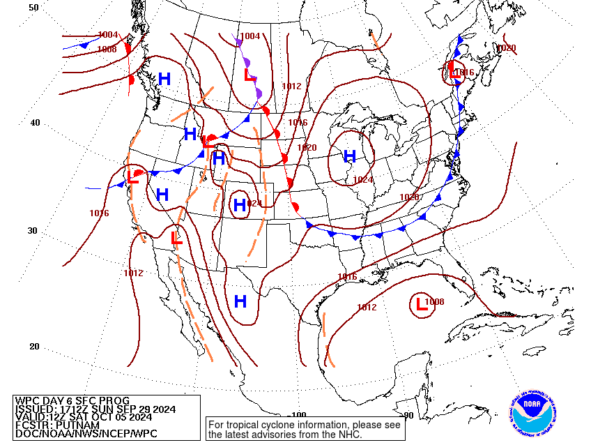
Our last factor is the mid-latitudes. The biggest point where the models differ is the location of the Canadian cold front. With the cold front, the Canadian model also shows this system moving in the Gulf but being stopped by this front before it reaches land. I’m not sure how much I believe it yet, but we’ll have to see as the models update over the next few days.
On a side note, another tropical low may move towards the western Gulf and possibly towards eastern Texas which we’ll have to keep an eye on. So we’ll keep you updated over the next few days as this low and the other low develops and possibly moves to the Gulf.
The Weekend
Okay, after all this, the weekend looks a little bit up in the air (no pun intended) but overall dry. Temperatures will reach the mid to upper 80s and fall into the mid to upper 60s.
Regional Day-to-Day Forecast
Tonight – Mostly clear, with a low in the mid 60s. Northwest wind around 5 mph becoming calm in the evening.
Monday – Patchy fog before 7am. Otherwise, sunny, with a high in the upper 80s. Calm wind becoming west northwest around 5 mph in the afternoon.
Monday Night – Mostly clear, with a low in the mid 60s. Calm wind.
Tuesday – Sunny, with a high in the upper 80s. Calm wind becoming north around 5 mph in the afternoon.
Tuesday Night – Mostly clear, with a low in the upper 60s. North wind around 5 mph.
Wednesday – Sunny, with a high in the upper 80s. North northeast wind around 5 mph.
Wednesday Night – Mostly clear, with a low in the mid 60s. North northeast wind around 5 mph becoming calm in the evening.
Thursday – Mostly sunny, with a high in the mid to upper 80s. East wind around 5 mph.
Thursday Night – A slight chance of rain before 1am, then a slight chance of showers after 1am. Mostly cloudy, with a low in the upper 60s. East wind around 5 mph becoming calm. Chance of precipitation is 20%.
Friday – A slight chance of showers, then a chance of showers and thunderstorms after 1pm. Partly sunny, with a high in the mid 80s. Chance of precipitation is 30%.
Friday Night – Partly cloudy, with a low in the upper 60s.
Saturday – Mostly sunny, with a high in the mid 80s.
Saturday Night – Partly cloudy, with a low in the mid 60s.
Sunday – A 20 percent chance of showers. Sunny, with a high in the mid 80s.


Let us hope, for the sake of those in Georgia, Alabama, and Tennessee, that the EURO is right THIS time.