Passing showers and storms today, thought, I may have went a little high on the chance for rain today. Down below I put a 40-percent chance, and while I looked it all over and all of the model guidance supports that number, I’m not sure I support that number. But, hey, I’ve been wrong before!
Most of the impacts from Fred will stay to the east of South Mississippi. The showers and storms that are possible today are mainly just summertime storms. There may be some extra ‘umph’ added to some of teh rain showers due to Fred, but any direct impacts will be quarantined to the east.
As Fred moves away, we will hold onto a chance for rain in the region through the week and into the weekend. Pretty typical August weather.
The good news is it does look like the Heat Index won’t be as much of a problem. Instead of “Feels like” temperatures around 105, it will be a bit closer to 100.
Tropics
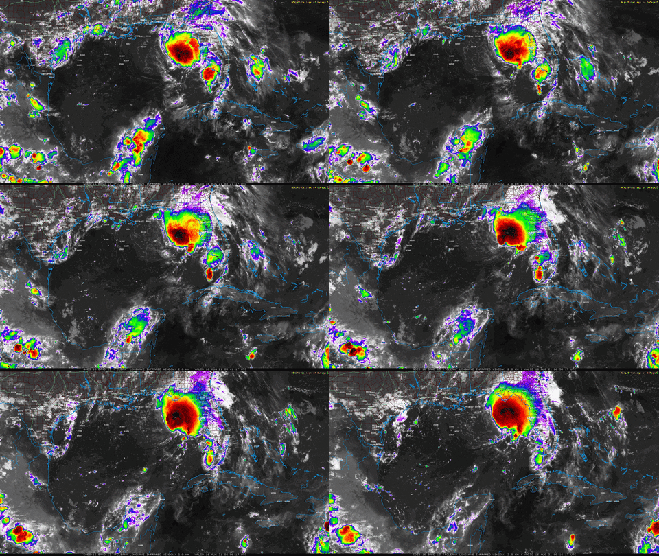
Fred is about 18 hours from landfall across the Florida panhandle. As it continues to drift north and gain strength, its path is pretty well locked in at this point.

Fred is a lopsided storm, like many tropical storms that end up in a semi-sheared environment. Basically all of the impacts from Fred will be to the east of the center of low pressure. Looking at the infrared imagery this morning, you can see the increased convection trying to develop around the center. Fred is doing a good job at making a push for a stronger Tropical Storm, but it is – frankly – just going to run out of time.

Impacts to the west of, roughly, Pensacola will be mainly two things: A stronger breeze, passing ctropical showers.

“No Impacts” is probably too strict a descriptor, as there will be “some impacts” but not many of much consequence.
And in fact, I’ve held on to a 40-percent chance for showers and storms across South Mississippi today, and it may be even more sparse than that, depending on how much subsidence there is on the periphery of Fred. There are times when these systems are trying to wrap themselves up that there is some extra sinking air along the edge of the storms. And sinking air will really slow down thunderstorm development.
Day-to-Day Forecast
Today
Patchy fog this morning turning to partly cloudy skies this afternoon. There will be a 40-percent chance of showers and thunderstorms. Highs around 90.
Tonight
A few clouds. Lows in the lower 70s.
Tuesday
Mostly sunny with a handful of storms possible in the afternoon. Highs in the lower 90s. The chance of rain 30-percent.
Tuesday Night
Partly cloudy. Lows in the mid 70s.
Wednesday
Passing clouds with a 40-percent chance for storms. Highs in the lower 90s.
Wednesday Night
Partly cloudy. Lows in the mid 70s.
Thursday
Passing clouds with a better shot for summertime storms. Highs in the lower 90s. The chance you see a storm is looking to be around 60-percent.
Thursday Night
Partly cloudy. Lows in the mid 70s.
Friday
Partly cloudy. Highs in the lower 90s. The chance of rain 40-percent.
Friday Night
Partly cloudy. Lows in the lower 70s.
Saturday
Partly cloudy. Highs in the lower 90s. The chance of rain 40-percent.
Saturday Night
Partly cloudy. Lows in the lower 70s.
Sunday
Mostly sunny. Highs in the mid 90s. The chance of rain 20-percent.

