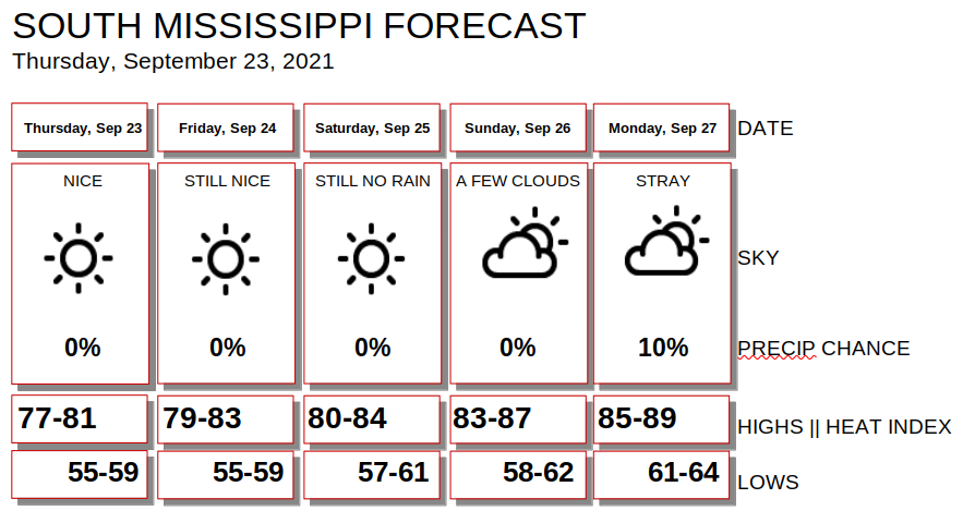
Things continue to look boring during the next few days. In fact, mostly sunny skies and no chance for rain will be the forecast through about Sunday. It looks like by Monday, another shot for rain will sneak back into the forecast.

And the chance for rain on Monday even looks pretty meager. We are talking a 10-percent shot at this point. At best.
Depending on which model you look at, there may be some more rain that tries to push back into the region by Wednesday or Thursday. The GFS computer weather model is a little drier while the ECMWF computer weather model is a bit wetter.
Both suggest by late next week, the chance for rain returns. But each one suggests it returns underneath completely different atmospheric conditions.

And, honestly, neither is correct. There are probably little pieces of each that are accurate, but overall, either of these will end up verifying. Both look a bit goofy for different reasons.
So, for now, I’d say: “Enjoy the weather!” because beyond about six days out the forecast starts to diverge a bit and we don’t have a clear indication about what it will look like
Today
Sunny. Highs in the upper 70s.
Tonight
Clear. Lows in the upper 50s.
Friday
Sunny. Highs in the upper 70s.
Friday Night
Mostly clear. Lows in the upper 50s.
Saturday
Sunny. Highs in the lower 80s.
Saturday Night
Mostly clear. Lows around 50.
Sunday
Sunny. Highs in the mid 80s.
Sunday Night
Mostly clear. Lows around 60.
Monday
Sunny. Highs in the upper 80s.
Monday Night
Partly cloudy. Lows in the lower 60s.
Tuesday
A 20 percent chance of showers in the afternoon. Mostly sunny. Highs in the mid 80s.
Tuesday Night
Partly cloudy. Lows in the mid 60s.
Wednesday
Mostly sunny with a 20 percent chance of showers. Highs in the mid 80s.
Graphical Forecast


