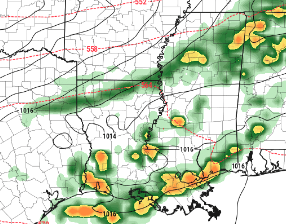
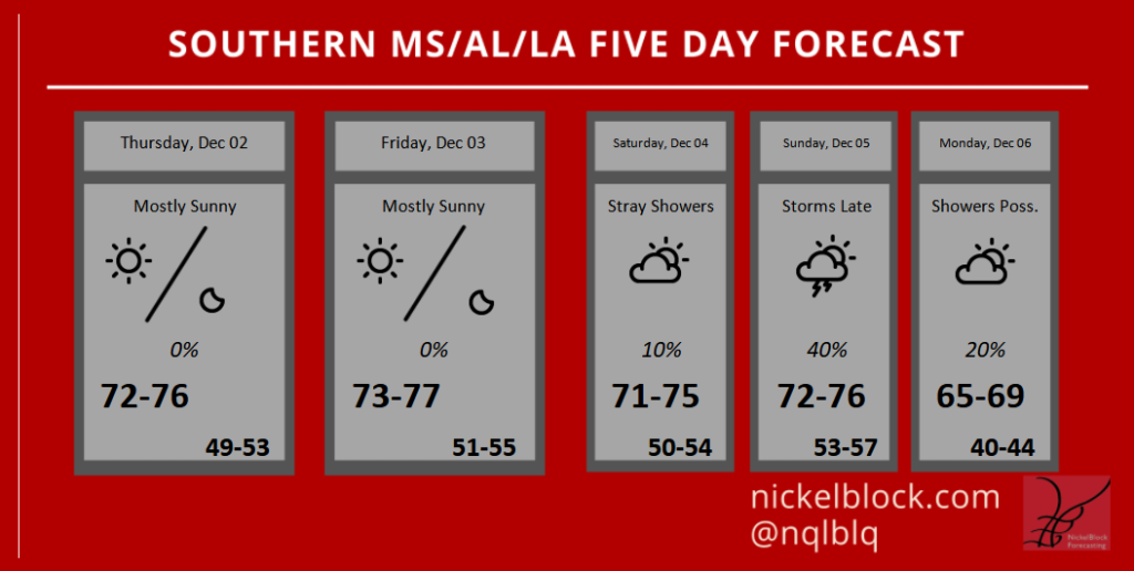
It looks like the next meaningful chance for rain won’t swing through the area until we get through the weekend. So, in the meantime, enjoy the mostly sunny skies!
Okay, well, technically, there may be a stray shower possible on Saturday and then storms return late Sunday night. But for all intents and purposes things are looking good until next week.

The next system that pushes through late Sunday and into Monday will be apart of a shift that will open the door for multiple rounds of rain next week and into next weekend. A parade of storm systems will offer up chances for storms and the potential for severe weather, as it appears, by later next week.
Thankfully, at this point, widespread severe weather isn’t in the cards at this time. Given that we will get a shot of cooler drier air behind this first front on Monday means we will have to wait for the wind to flip back to the south to pool some of the warmer moist air needed for storms.
And the question right now is ‘how long does that take?’ and ‘Is there enough of it to pop off actual severe weather?’
That is why, right now, the thinking is by late next week, a strong storm here or there and one or two storms that strengthens past severe limits can’t be ruled out. But a widespread severe weather outbreak isn’t anything I’m too concerned about. I’ll continue to monitor things and if anything changes, I’ll (as always!) post an update.
Day to Day Forecast
Today
Areas of fog in the morning. Partly cloudy in the morning, then clearing. Highs in the mid 70s.
Tonight
Patchy fog after midnight. Partly cloudy. Lows in the lower 50s.
Friday
Patchy fog in the morning. Mostly cloudy in the morning then becoming partly cloudy. Highs in the mid 70s.
Friday Night
Partly cloudy. Lows in the mid 50s.
Saturday
Mostly sunny. Highs in the mid 70s.
Saturday Night
Partly cloudy. Lows in the mid 50s.
Sunday
Partly cloudy. Highs in the mid 70s.
Sunday Night
Mostly cloudy with storms possible overnight. Lows in the mid 50s. The chance of rain 40-percent.
Monday
Partly cloudy with chance of showers and slight chance of thunderstorms in the morning, then mostly sunny in the afternoon. Highs in the mid 60s. The chance of rain 20-percent.
Monday Night
Mostly clear. Cooler. Lows around 40.
Tuesday
Partly cloudy. Highs in the mid 60s.
Tuesday Night
Partly cloudy with a 20-percent chance of showers. Lows in the mid 50s.
Wednesday
Mostly cloudy with a 40-percent chance of showers. Highs in the upper 60s.
Graphical Forecast

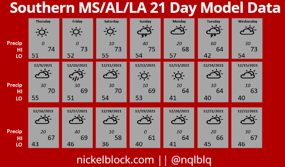
21-Day Model Data
This section is going to be inherently less accurate, but will hopefully give you a glimpse into the future a bit. This is some raw model data pulled for the next three weeks. This isn’t changed by me – or any one else – so the numbers may look different than the forecast above. That is because it is straight from the weather models.


