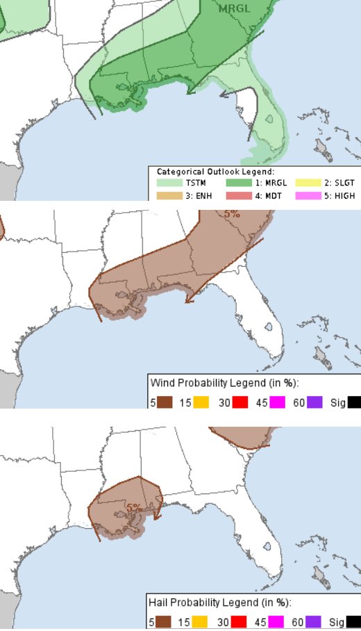
Another day with a chance for showers and storms and the potential for a severe storm here or there. The main threat with storms today will be brief heavy rain, lightning, gusty wind, and small hail. The tornado threat is very, very low. Not quite zero, but nearly ignorable.

After today, we should have a few drier days in the area as we move through the rest of the week. Then, starting Friday night, we will see better chances for rain through the weekend. The good news is that the threat for severe weather is low (and the tornado threat is near zero) the bad news is that you may want to think about having back-up plans for the weekend if you were planning to be outside.
So far it doesn’t look like a washout, but baseball games or afternoon parties may have to deal with some passing storms.
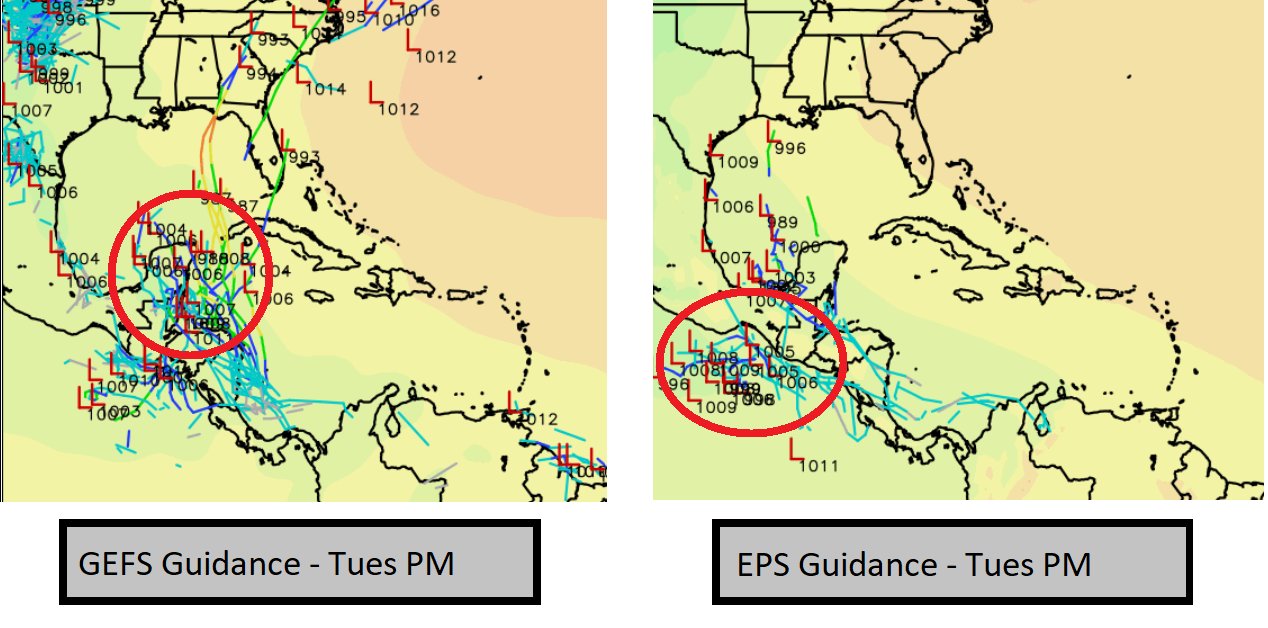
Looking past this weekend and into next week, there are still rumblings within the model guidance that some sort of sub-tropical / tropical system may try to develop from the Central American Gyre by next Tuesday. The question right now that all of us meteorologists are asking is, “where” will it form.

The American model, the GEFS, shows more of the development happening on the east side of Central America and the area of low pressure drifting north into the Gulf. While the European model, the EPS, shows more evidence that the area of low pressure forms on the west side of Central America.
Neither shows much strengthening with anything that does try to develop. Recall that nearly every tropical system that has formed from the Central American Gyre in recent memory has been disorganized, one-sided and weak. The big outlier is Hurricane Michael back in 2018.
But, again, that is the outlier.
Most of these CAG systems end up like Tropical Storm Cindy (2017), Tropical Storm Alberto (2018), Tropical Storm Nestor (2019), Tropical Storm Cristobal (2020), and Tropical Storm Claudette (2021).
Sure, they can cause problems – Cindy, for example was a bit of a flooding / severe event for south Mississippi / Louisiana – but not your A-typical type tropical system.
It is something worth monitoring, sure, but at this time nothing worth worrying about. Nor is this a ‘sign’ that Hurricane Season will be ‘worse’ or ‘better’ or ‘more active’ than it would look if this weren’t out there.
Instead, this is a ‘sign’ that you should check that Hurricane Preparedness Kit, make sure you have insurance, and all of the pieces in place to ride out this Summer.
Day to Day Forecast
Today
Mostly sunny with afternoon showers and storms possible. A severe storm can’t be ruled out. Chance of rain 40-percent.
Tonight
Mostly cloudy with a chance for storms before midnight. Lows in the upper 60s. Chance of rain 30-percent.
Tuesday
Sunny. Highs in the lower 90s.
Tuesday Night
Mostly clear. Lows in the upper 60s.
Wednesday
Mostly sunny. Highs in the lower 90s.
Wednesday Night
Partly cloudy. Lows in the upper 60s.
Thursday
Sunny. Highs in the lower 90s.
Thursday Night
Mostly clear. Lows in the upper 60s.
Friday
Sunny. Highs in the lower 90s.
Friday Night
Partly cloudy with a chance for a storms overnight. Lows around 70. Chance of rain 20-percent.
Saturday
Mostly cloudy with storms possible. A severe storm can’t be ruled out. Highs in the lower 90s. Chance of rain 60-percent.
Saturday Night
Mostly cloudy with a chance of showers and thunderstorms. Lows in the upper 60s. Chance of rain 30-percent.
Sunday
Partly sunny with storms possible. Highs in the upper 80s. Chance of rain 40-percent.

