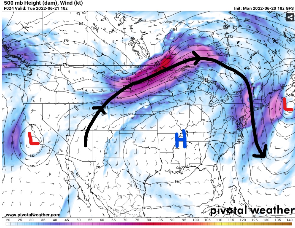
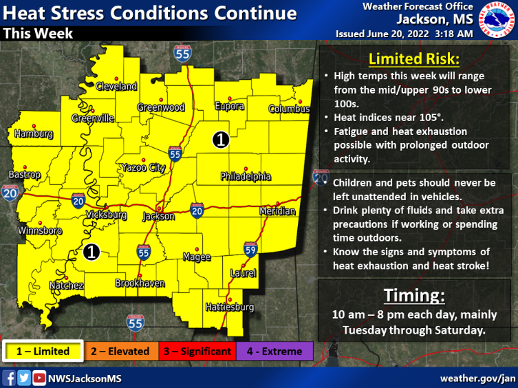
More of the same weather continues for the rest of the week as moisture returns coupled with high temperatures to bring back those high heat indices. The upper-level high pressure ridge is still parked over our region allowing temperatures to reach the upper 90s in most areas.
Most of the severe weather in the country is focused around the perimeter of the ridge leaving SW Mississippi to only see pop up showers and storms from daytime heating. This trend will continue as the ridge begins to shift back to the west.

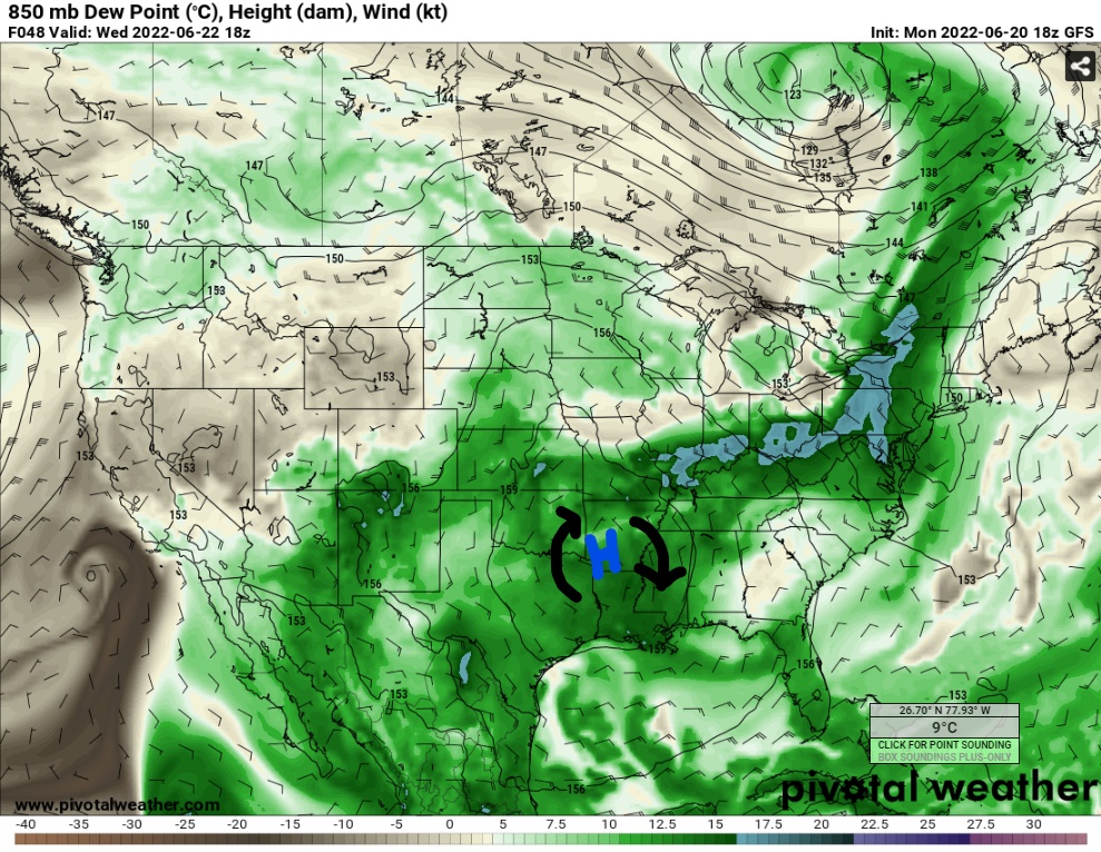
Moisture returns to the area beginning on Tuesday as winds are from the east-southeast. Dewpoints will creep back up into the upper 60s. These dewpoints exist in the lower layer of the atmosphere with 850mb dewpoints in the 60s. Some areas could see dewpoints reach the 70s which will increase the heat indices to around 105F and 110F in some area. Temperatures will rise to the upper 90s and even possible triple digits on Tuesday. The rest of the week will see pretty consistent temperatures in the 90s.

Rain chances for Tuesday and Wednesday are minimal as large scale sinking motion from the high pressure dominates. Isolated showers and storms could still pop off as there is plenty of daytime heating and increasing moisture. The sea breeze near the coast and outflow boundaries from other storms could help the chances of the area receiving precipitation.
Again, this would be very isolated in nature.
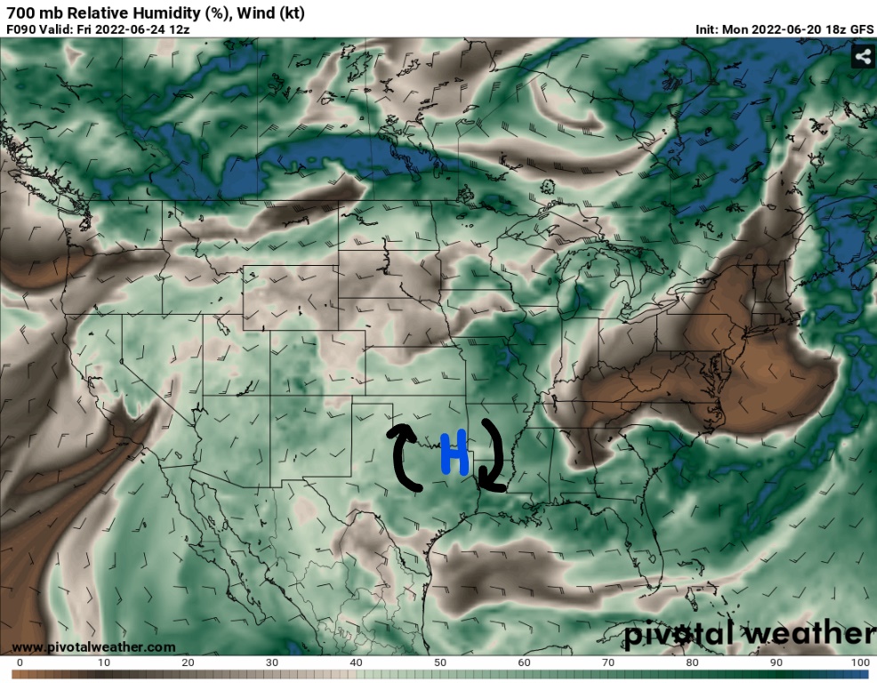
As the week progresses, the upper-level ridge will begin to shift to the west towards Texas. Higher moisture will wrap clockwise around the low-level and mid-level highs and sit over the Mississippi Valley into the weekend. Rain chances will increase on the east side of the high heading into the weekend where relative humidity reaches 60-percent.
Day-to-Day Forecast
Tuesday
Sunny and hot with a 20-percent chance of rain. High temperatures in the upper 90s with heat indices up to 105F. Lows in the mid-to-upper 70s.
Wednesday
Sunny and hot with a 30-percent chance of rain. High temperatures in the upper 90s and heat indices ranging between 100F and 105F. Lows in the mid 70s.
Thursday
Sunny and hot with a 20-percent chance of rain. Highs in the upper 90s with heat indices ranging between 100F and 105F. Lows in the mid 70s.
Friday
Clear skies with a 30-percent chance of rain. Highs will reach the upper 90s and lower 100s. Heat indices between 100F and 105F. Overnight lows in the mid 70s.
Saturday
Partly cloudy with a 30-percent chance of showers or storms in the late afternoon. Highs reaching past 100F and heat indices up to 105F. Overnight lows in the mid-to-upper 70s.
Sunday
Partly cloudy with a 40-percent chance of thunderstorms in the late afternoon. Highs will surge to the upper 90s and lower 100s. Heat indices will range between 105F and 110F. Overnight lows in the mid 70s.
Monday
Cloudy conditions with a 30-percent of storms in the evening hours. Highs dip back into the mid 90s with heat indices from 95F to 100F. Overnight lows in the low 70s.


One thought on “Moisture Returns as Heat Strengthens Mid-Week: SW MS Weather Forecast – 6/21/22”
Comments are closed.