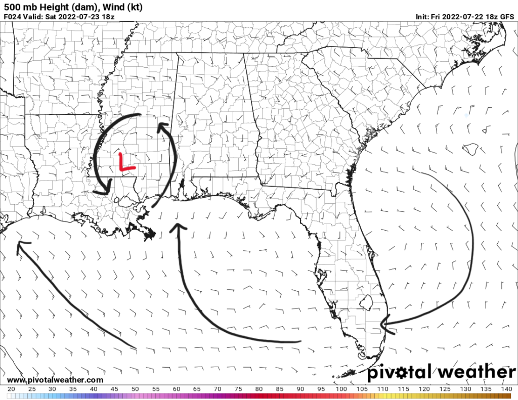
Happy weekend everyone! The main stories for this weekend will be spotty thunderstorms and the return of the heat. Currently over SE Mississippi is this mesoscale low bringing some storms with it. This mesoscale convective vortex (MCV) is basically a warm-core, counterclockwise spinning low in the mid-levels. It leads to ascent in the atmosphere to allow for convection. This can be easily seen on satellite and radar from Friday night.
This MCV will be expected to move slowly towards the west over the next couple days. As it does so, it will bring scattered storms with it. Southerly flow will be most present on the east side of the MCV which will bring moisture up from the Gulf. Dewpoints will hover around 70F and precipitable water values will be around 1.75″.

Storms rotating around this low will develop during the afternoon Saturday when daytime heating kicks in. Some of the storms could be slow movers to present to risk of locally heavy rainfall with ample moisture in the environment. Modest CAPE values of 2000-2500 J/kg will exist over the area on Saturday to support some possible strong storms with gusty winds and heavy rain. The Euro model is suggesting at scattered thunderstorms into the afternoon hours Saturday before they dwindle down from loss of daytime heating, and thus decreased instability.

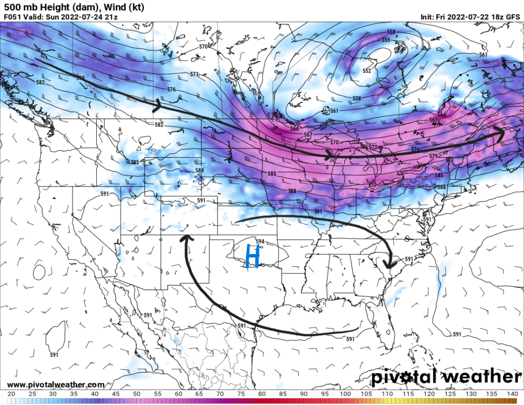
As Sunday comes, the upper-level ridge over the Southwest will begin to stretch towards the east. In doing so, the MCV will dissipate. Rain chances will decrease a bit to become more diurnally driven storms that are isolated to scattered in nature.

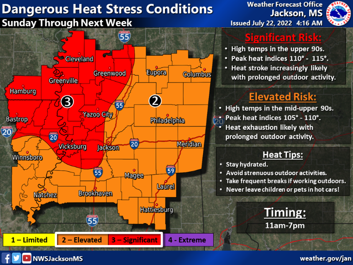
As the ridge builds over the area, subsidence (synoptic scale sinking motion) will promote an increase in temperatures. Highs will begin to reach back into the mid 90s as dewpoints stay in the mid 90s. This will bring the risk for extreme heat with heat index values reaching past 100F. Any rainfall will help cool off the atmosphere but leave the area humid. Temperatures will not back off until an upper-level trough that models are pointing at moves into the Northeast by the end of next week. This could bring some more cloud cover and higher rain chances.
But as for Sunday into the next week, limit time outdoors and stay hydrated to avoid the risks of heat stress.

Day-to-Day Forecast
Saturday
Mostly cloudy with a 60-percent chance of scattered thunderstorms starting in the afternoon. Expect locally heavy rainfall in some parts. Highs will be centered around 90F with heat index values around 100F. Lows in the mid 70s.
Sunday
Partly cloudy with a 40-percent chance of showers and storms in the afternoon. Highs in the mid 90s with heat index values reaching 105F. Lows in the mid 70s.
Monday
Sunny with a 40-percent chance of showers and storms in the afternoon. Highs in the mid 90s with heat index values reaching 105F. Lows in the mid 70s.
Tuesday
Mostly sunny with a 40-percent chance of precipitation. Highs in the mid 90s with heat indices around 100F. Lows in the mid 70s.
Wednesday
Mostly sunny with a 30-percent chance of precipitation. Highs in the mid 90s with heat indices around 100F. Lows in the mid 70s.
Thursday
Partly cloudy with a 30-percent chance of precipitation. Highs in the mid 90s with heat indices around 100F. Lows in the mid 70s.
Friday
Mostly cloudy with a 60-percent chance of precipitation. Highs in the low 90s with heat indices around 100F. Lows in the mid 70s.

