For this look at the continental United States, we will be focusing on three regions: the Pacific Northwest, the Great Plains, and the Southeast.

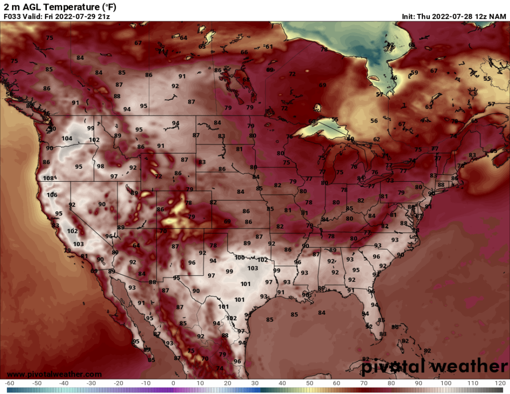
Today and tomorrow, the ridging pattern in place over the Pacific Northwest will persist, bringing hot temperatures. Highs above 100 are forecast as far north as interior Washington state, as you can see from the map above.
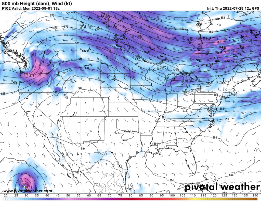
By Monday, however, a trough coming in from the Pacific will enter the region, cooling down the temperatures and bringing a chance of precipitation. The ridge will move off to the east. The map below shows the troughing pattern over the Pacific Northwest.

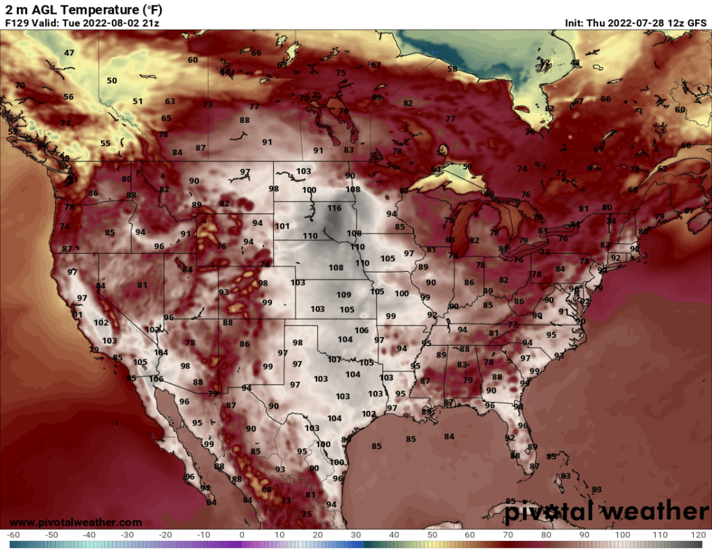
As the ridge moves east, the heat will move with it. The Great Plains are forecast to have hot temperatures for the first few days of the upcoming week, with temperatures above 100 extending over even the northern Plains. The image below shows the GFS forecast for the heat on Tuesday. Bear in mind that the GFS tends to overestimate temperatures during the summer, so do not panic when you see 116 over northern South Dakota. Temperatures over 100 are feasible, but not temperatures that high.

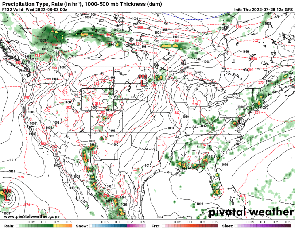
While temperatures ramp up in the central US, the Southeast may see a temporary cooldown early in the week. A cold front will move through the area Monday through Wednesday, bringing down temperatures slightly and bringing rain and thunderstorms. The precipitation in the Southeast is shown on the map below. It remains to be seen how long this temporary cooldown will last.


