A few storms possible again today with more rain possible as we head through tomorrow and Saturday. I know some folks are getting really tired of this daily rainfall stuff, but there is a light at the end of this soggy tunnel.
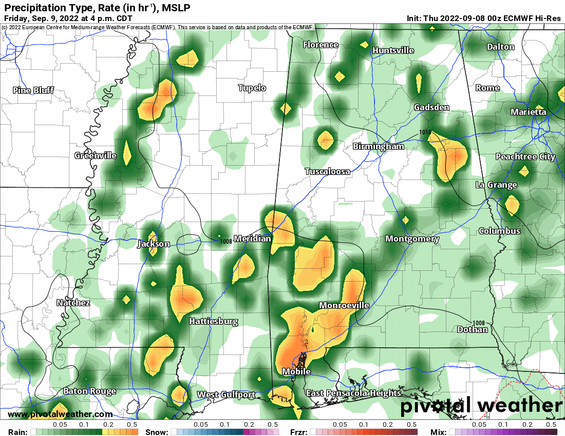
Each afternoon during the next three days, model guidance breaks out chances for storms. Below is a look at what the Euro thinks the radar may look like around 4p. I think it is over-doing things a bit, but I do tend to think – particularly tomorrow – afternoon storms will be widespread.


Rainfall totals aren’t overly robust, though. It looks like between 0.5″ to 2.5″ of rain across the region. While the model guidance isn’t very aggressive witht he rainfall totals, I do think some spots will be unlucky enough to see up to 2.5″ of rain.


Once we get through the rain during the next few days, we look to dry out into next week. And then it looks like we may stay drier through most of next week and into the following weekend.
DAY TO DAY FORECAST
Today
Partly sunny with a chance for storms. Highs in the upper 80s. Chance of rain 50 percent.
Tonight
Mostly cloudy with a few storms overnight. Chance of rain 30 percent.
Friday
Partly sunny with storms likely. Highs in the mid 80s. Chance of rain 80 percent. Rainfall totals up to 1.5″ possible.
Friday Night
Mostly cloudy with a few storms possible. Lows in the upper 60s. Chance of rain 50 percent.
Saturday
Mostly sunny with storms possible. Highs in the upper 80s. Southeast winds around 5 mph. Chance of rain 40 percent.
Saturday Night
Partly cloudy. Lows around 70.
Sunday
Mostly sunny with a few storms possible. Highs in the upper 80s. Chance of rain 20 percent.
Sunday Night
Partly cloudy. Lows around 70.
Monday
Mostly sunny. Highs in the upper 80s. Chance of rain 20 percent.
Monday Night
Partly cloudy. Lows in the mid 60s.
Tuesday
Mostly sunny. Highs in the mid 80s.
Tuesday Night
Mostly clear. Lows in the lower 60s.
Wednesday
Sunny. Highs in the upper 80s.

