This morning I gave ChatGPT the forecast and asked it to rewrite it as a cowboy in the wild wild west and it got rather creative.
Yeehaw, folks! Gather ’round and listen up to the 320 AM CDT report for Tuesday, May 23, 2023. Today and tonight, we got ourselves a mid-level disturbance slowly pivoting across the Deep South like a snake in the grass. And guess what? It’s bringin’ along a moister airmass that’s crept its way into east MS, where we got ourselves a heapin’ load of low cloudiness this mornin’.
Hold onto your hats, ’cause there’s another round of isolated to scattered diurnal convection headin’ our way today. The best chances are further east, where that moisture’s got a good grip. And you know what? That low cloudiness ain’t plannin’ on leavin’ anytime soon. It’s gonna stick around, messin’ with today’s high temperatures across east MS. Some places might not even make it to the 80s. Well, ain’t that a kick in the stirrups? But don’t you worry, by late afternoon and evening, that NE/E low-level flow will start pullin’ in some drier air, puttin’ a stop to most of that convection.
And listen up, cowboys and cowgirls! Them dewpoints are gonna drop into the mid/upper 50s, makin’ way for a mighty cool Wednesday mornin’, especially east of I-55. So, prepare yourselves for a refreshing start to the day. Now, let’s rustle up the forecast for Wednesday through early next week.
We’re ridin’ into a dry pattern that’s gonna stick around for most of the forecast period. Persistent troughing’s lendin’ a hand to that northerly flow, wrappin’ dry air around the base of the trough like a trusty ol’ lasso. With clear skies on the horizon, temperatures are gonna climb into the middle 80s, defying that northerly breeze. Hold onto your saddles, ’cause come Wednesday night and Thursday, a cold front’s gonna sag south, bringin’ in even drier air. But fear not, partner! That dry air’s gonna keep rain chances at bay, despite the front passin’ on through.
Now, here’s where the excitement builds up like a showdown in the old saloon. We got ourselves an amplified ridge and trough up yonder in southern Canada, creatin’ the perfect setup for an upper low to deepen its roots as it travels ’round the base of the trough. Come Thursday night and Friday, that low’s gonna get cut off, leavin’ us in the midst of some mighty interesting weather. Our guidance is finally startin’ to see eye to eye. The Euro’s finally surrenderin’ and movin’ west to line up with the GFS. This here scenario is likely to bring us a cooler and wetter weekend, especially up north and in the eastern parts.
But hold your horses, folks! The western parts of our territory still seem to favor a drier outcome. Dry air’s gonna wrap its arms ’round the backside of that low, while the east gets a taste of return flow. If that western trend keeps goin’, we might just have return flow all ’round. We’ll have to keep an eye on future forecasts to see how them rain chances play out. But even with that return flow, it’s gonna be an uphill battle against that dry air left behind by Thursday’s cold front. So, expect them rain chances to be scattered like a herd of wild mustangs.
As that upper low finally takes its leave, headin’ east early next week, we’re in for a warming trend. Return flow’s gonna bring in warm temperatures and moisture, like a summer breeze blowin’ through the canyon. Them PWATs are likely to jump back up to 1.5+ inches, and we’ll be back sizzlin’ in the low 90s before you can say “howdy”!
Happy trails, folks!
There was a lot said there without a lot of helpful information – yet again. But that’s okay. Its a chatbot, so it is supposed to be chatty.
The long-and-short is that we have another two days with shots for afternoon storms here and there and then things dry out. We end up ‘in between’ everything that is happening in Texas and then out east. In short, we are in a bit of a weather void. Not a bad place to be, honestly. It should be dry for a few days.
But that also means it will be hot. Highs will be in the mid to upper 80s to around 90.
EXTRA WEATHER MAPS
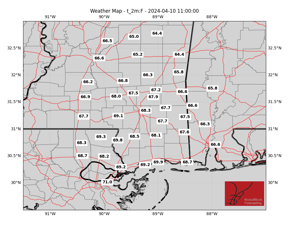
Here is a look at some extra weather data!
Select Data Set:

If you’d like to see any weather data in particular here, make a request! I’ll do my best to see what I can find.
REGIONAL DAY TO DAY FORECAST
Today: Partly sunny. A chance of showers and thunderstorms this afternoon. Highs in the mid 80s. Northeast winds 5 to 10 mph. Chance of rain 40 percent.
Tonight: Mostly cloudy. A slight chance of showers and thunderstorms in the evening. Lows in the lower 60s. Northeast winds 5 to 10 mph. Chance of rain 20 percent.
Wednesday: Mostly cloudy. Highs in the upper 70s. Northeast winds 5 to 10 mph.
Wednesday Night: Partly cloudy in the evening, then becoming mostly clear. Lows around 60. Northeast winds 5 to 10 mph.
Thursday: Sunny. Highs in the upper 80s. North winds 5 to 10 mph.
Thursday Night: Mostly clear. Lows in the lower 60s.
Friday: Sunny. Highs around 90.
Friday Night: Mostly clear. Lows in the lower 60s.
Saturday: Sunny. Highs in the mid 80s.
Saturday Night: Mostly clear. Lows in the lower 60s.
Sunday: Sunny. Highs around 90.
Sunday Night: Mostly clear. Lows in the lower 60s.
Memorial Day: Sunny. Highs in the upper 80s.

