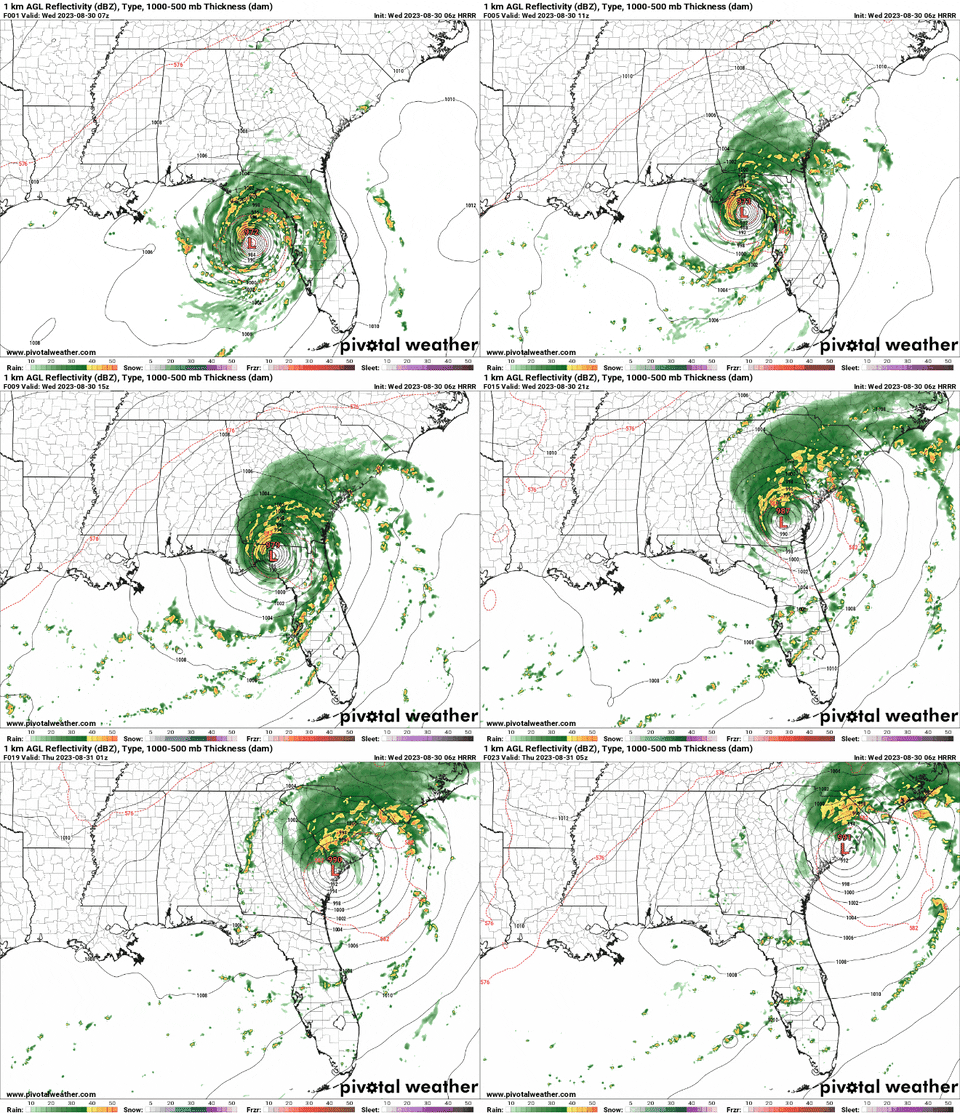
Despite all of the moisture and a weak boundary nearby, it looks like today might be dry. That is the benefit (or not benefit) of being on the backside of a tropical system. And in particular a very powerful topical system
Hurricane Idalia is set to make landfall this morning. Likely around 7am near Fish Creek, Florida.

For us, it means drier conditions today, and tomorrow. But then as we move into riday and through the holiday weekend we may see slightly better chances for rain.
REGIONAL DAY TO DAY FORECAST
Today: Mostly sunny. Highs in the lower 90s. North winds 10 to 15 mph. Chance of rain 10 percent.
Tonight: Partly cloudy in the evening, then clearing. Lows around 70. North winds 5 to 10 mph.
Thursday: Mostly sunny. Highs in the mid 90s. Northeast winds around 5 mph. Chance of rain 10 percent.
Thursday Night: Partly cloudy. Lows in the lower 70s. East winds around 5 mph. Chance of rain 10 percent.
Friday: Mostly sunny with a chance for afternoon storms. Highs in the lower 90s. Chance of rain 40 percent.
Friday Night: Mostly cloudy with a chance for storms before midnight. Lows in the lower 70s. Chance of rain 20 percent.
Saturday: Partly sunny with scattered storms possible. Highs in the upper 80s. Chance of rain 40 percent.
Saturday Night: Partly cloudy. Lows in the lower 70s. Chance of rain 20 percent.
Sunday: Mostly sunny. A slight chance of showers and thunderstorms in the morning, then a chance of showers and thunderstorms in the afternoon. Highs in the lower 90s. Chance of rain 50 percent.
Sunday Night: Mostly clear. Lows in the lower 70s.
Labor Day: Sunny. A slight chance of showers and thunderstorms in the afternoon. Highs in the mid 90s. Chance of rain 20 percent.
Monday Night: Mostly clear. Lows in the lower 70s.
Tuesday: Sunny. A slight chance of showers and thunderstorms in the afternoon. Highs in the upper 90s. Chance of rain 20 percent.

