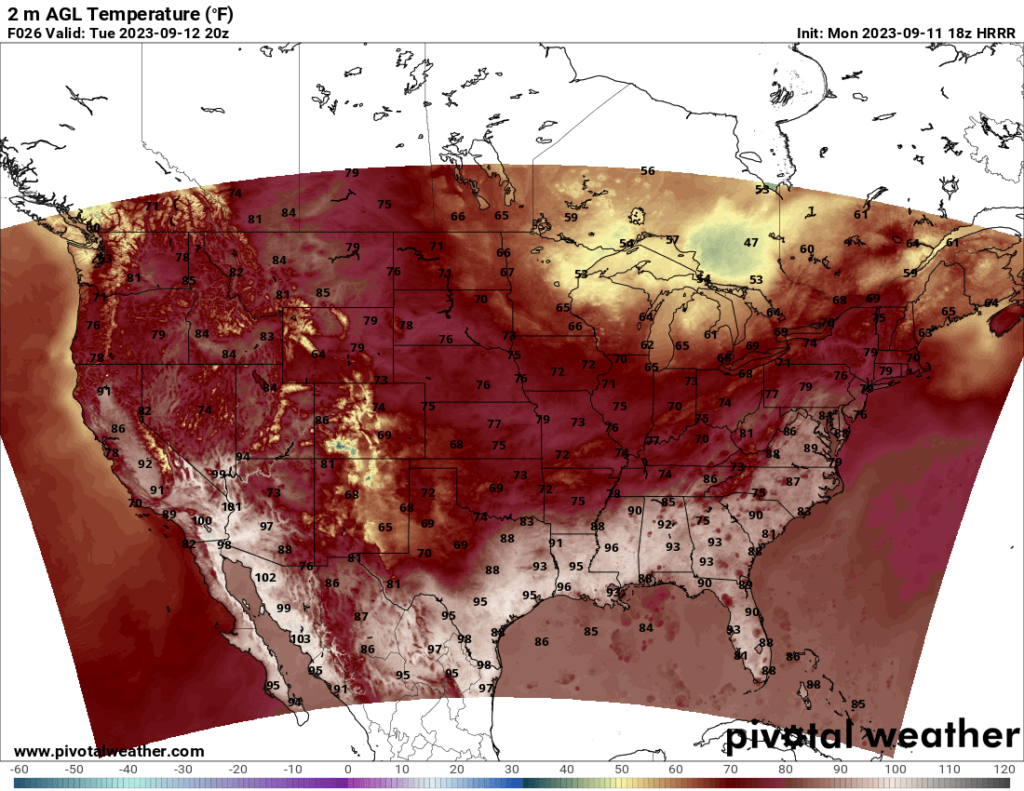
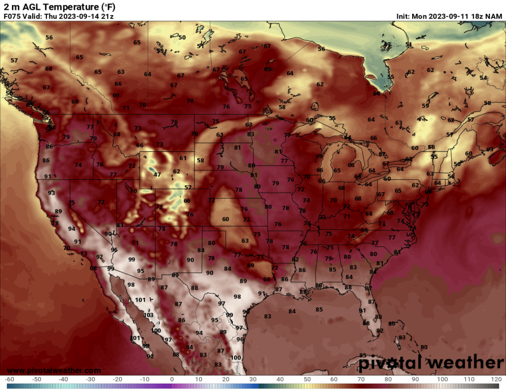
Temperatures across the US are starting to feel like fall, at least for much of the country. The hot temperatures are now confined to the southernmost parts of the country. The central US, which had above average temperatures for much of the summer, are expected to see highs in the 70s in most of the region, which will no doubt be a relief to those tired of the heat.
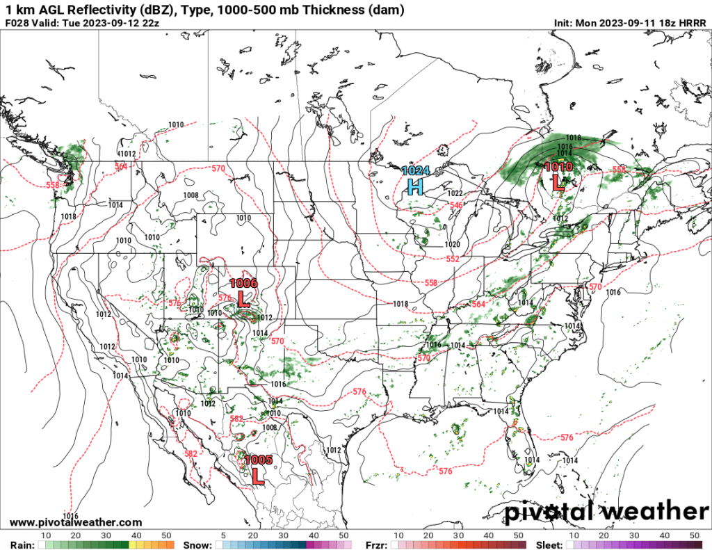
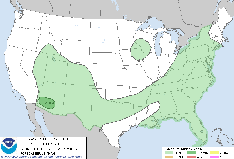
Much of the US could see a chance for showers and thunderstorms at times. A low pressure system in Quebec is expected to bring a line of storms across much of the eastern US over the next couple days. The SPC currently has a Marginal Risk in parts of New England on Wednesday, noting a risk of damaging winds and possibly an isolated tornado as well. The shear is strong and the moisture is plentiful, so the severe potential will largely be determined on what areas get the most instability. Instability across much of the area is forecast to be fairly low, but localized areas of increased CAPE may be enough to get a severe storm going, owing to all the shear.
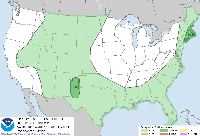
The other risk areas the SPC has are a Marginal Risk Tuesday over southern Arizona for wind and hail and a Marginal Risk Wednesday over far west Texas and eastern New Mexico, most likely for wind and hail. The tornado threat is low for both of those areas, but wind and hail threats should still never be ignored. Overall, though, the severe risks across the US over the next few days are not too high, and any severe storms should be isolated.
