Nice weather in Plains, cold to frigid temps in New England, rainy Pacific Northwest: CONUS Monday-Thursday Forecast – 12/3/2023

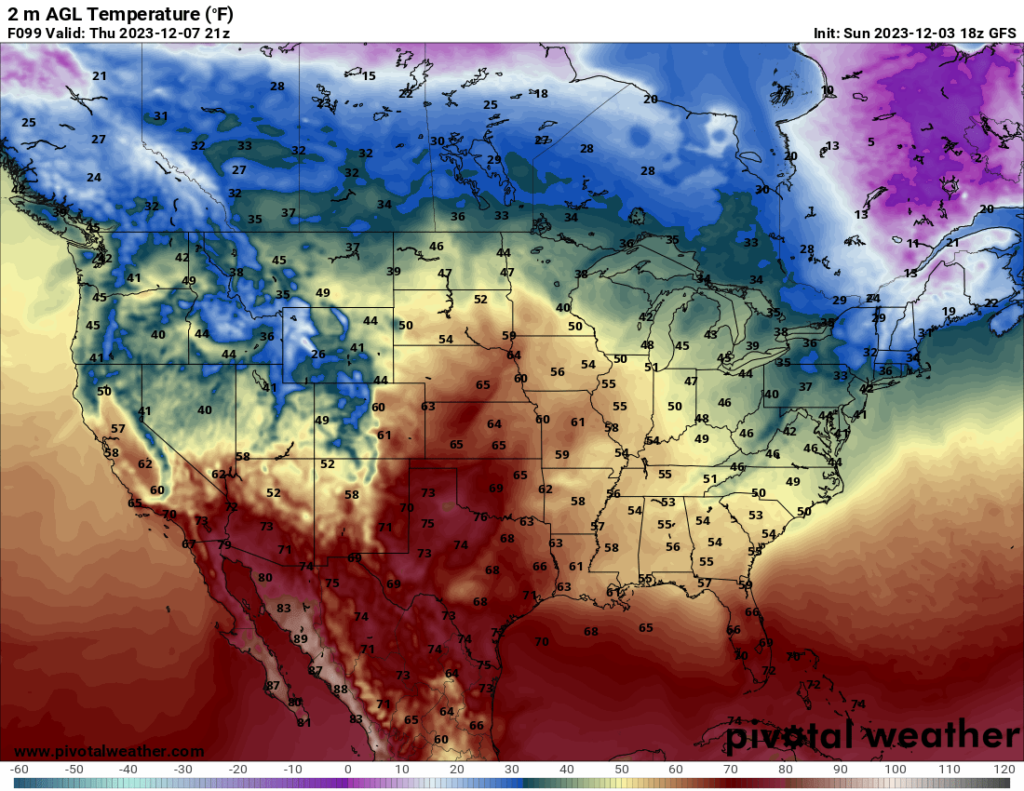
Looking ahead to the week, warmer temperatures are expected across the Plains, especially during the middle of the week as a ridge moves over the area. On Thursday, 60+ highs could be seen as far north as Nebraska.
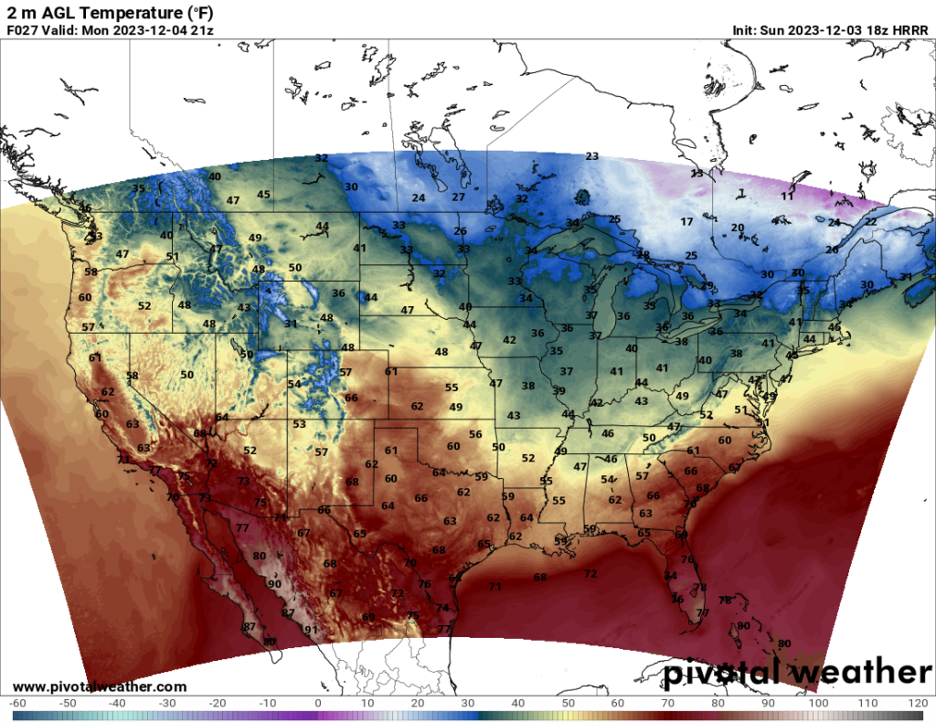
Temperature estimate 3 PM CST Monday according to HRRR model // Courtesy: Pivotal Weather
Temperature estimate 3 PM CST Thursday according to GFS model // Courtesy: Pivotal Weather

While the ridge moves across the middle of the country, a trough will move across the East Coast region of the US. This will result in cold to frigid temperatures in the Northeast, with lows in the northernmost parts of new England reaching the single digits and possibly even the negatives in a few places Tuesday night and Wednesday night.
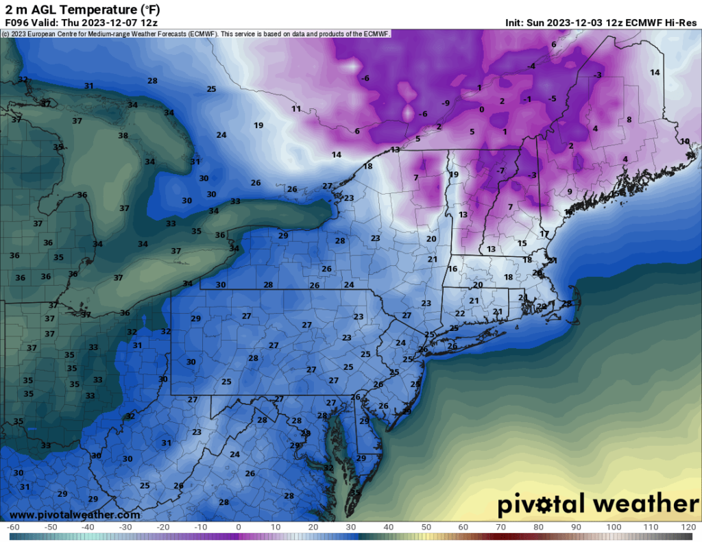
Temperature estimate 7 AM EST Thursday according to ECMWF Hi-Res model // Courtesy: Pivotal Weather

Most of the country will remain dry for the first half of the week. One notable exception is the Pacific Northwest. The coastal areas of Washington and Oregon are expected to see several inches of rainfall over the next few days. The map below shows the estimated rainfall amount between midday today and the end of the day Thursday.
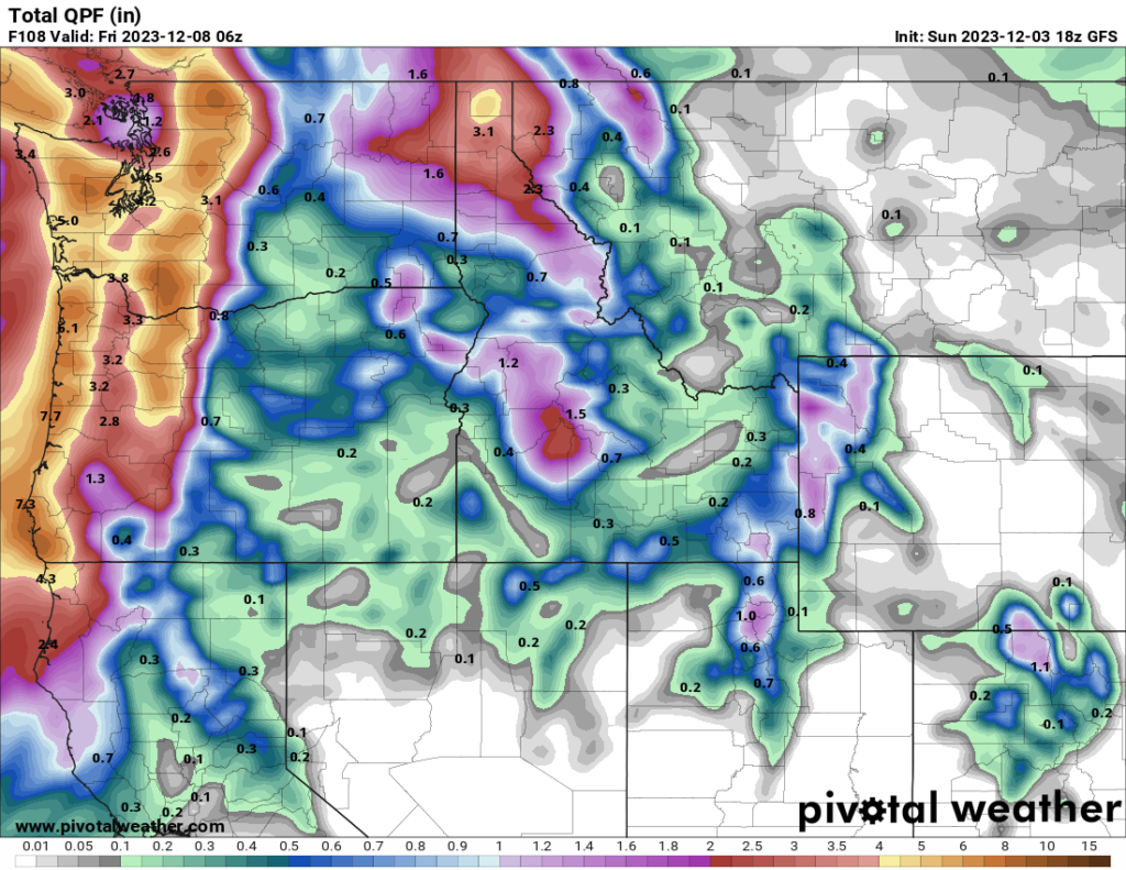
Precipitation estimate between 10 AM PST Sunday and 10 PM PST Thursday according to GFS model // Courtesy: Pivotal Weather


Author of the article:


Patrick Kulynych

I am a recent graduate from the University of Alabama in Huntsville with a Bachelor's Degree in atmospheric science. My focus is on forecasting, especially for severe weather events. It is my dream to one day live out in the Great Plains, where I can not only forecast as a career but also go out and chase storms as a hobby!