Well, it’s June… where are the tropical systems? Just because Hurricane season isn’t necessarily starting on time, doesn’t mean we will have a quiet year.
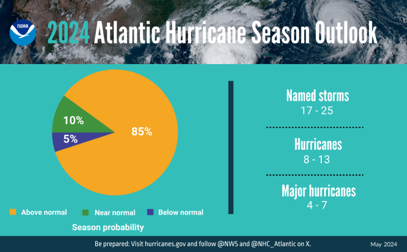
NOAA is still projecting an active Hurricane season for the Atlantic basin, so while things are quiet, now is the time for you to prepare!
There are a couple of reasons why Meteorologists are projecting a robust year for Hurricanes, so let’s take a look at some of them…
Warm Sea Surface Temperatures
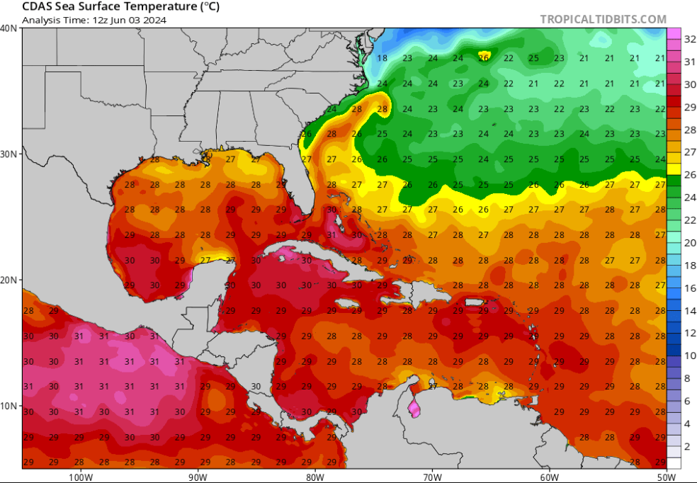
Sea surface temperatures from the Atlantic Ocean to the Gulf of Mexico are way ahead of schedule. Typically, you need ocean water temperatures to be at least 80 degrees Fahrenheit (27 degrees Celsius) and we’ve clearly got that across most of the basin. The longer we go without storms in this area, the more time that water has to heat up even more!
Moisture
This is one of the main ingredients we’re still waiting on, especially in the Main Development Region (MDR). The MDR of the Atlantic Ocean runs from the west coast of Africa to the Caribbean Islands and is the area where most of our tropical systems form. Currently, a lot of dry air is in place across this part of the Atlantic Ocean due to Saharan dust coming off of Africa.
Thunderstorm development can be difficult with dry air in place and limit the formation of a tropical system. Forecasts suggest that the dry air will be less of an issue in the coming weeks/months, so expect to see an increase in activity off the coast of Africa as we get closer to late July and early August.
Wind Shear
This is what can really determine if a tropical system is about to rapidly intensify or dissapate. Vertical wind shear looks at the change in wind speed or direction with a change in altitude.
Think of it like a bathtub draining and all of a sudden you took your foot and splashed the water around. A similar concept applies to a Hurricane. When there is a low amount of wind shear, the storm can “breathe” easier and grow in size. However, when strong winds are above, the storm begins to lose its symmetry and weakens. We are transitioning into a La Nina pattern which usually decreases wind shear near the MDR.
When is the peak of Hurricane season?
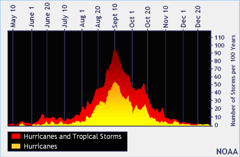
Even though tropical storms and Hurricanes are possible over the next two months, the most active time for the Atlantic Hurricane Season is typically between August and October, the peak being on September 10th. During these months, all of the factors that we looked at earlier are favorable for tropical systems, especially intense ones. The worst United States Hurricane landfalls usually happen during this time.
The past couple of years, the United States has been affected by the “I” named storm. This is due to the letter being used near peak season and the right atmospheric patterns were in place to have a United States landfall. The “I” named storm for the 2024 Atlantic Hurricane Season is Isaac.


