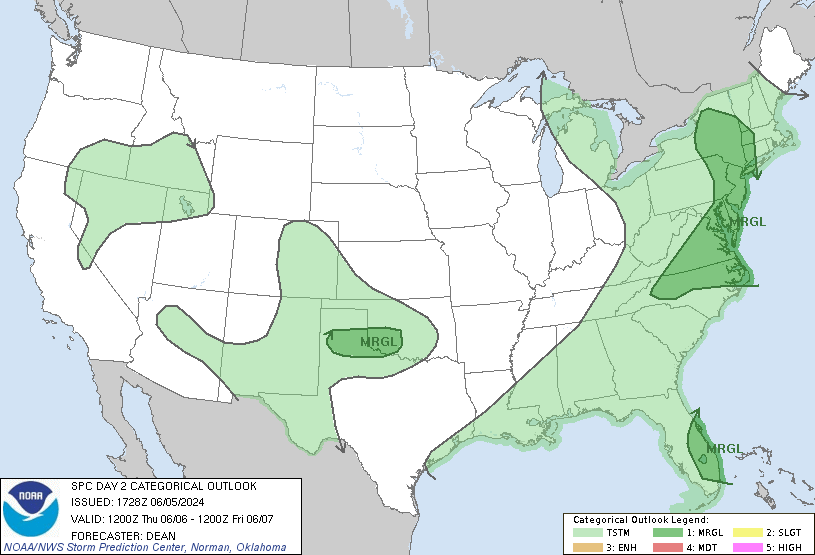
Happy Wednesday everyone! We have some synoptic (upper-levels) systems churning, which is causing the rain chances with cooler temps out East and the extreme heat out West. The SPC has released the outlook for Thursday, with parts of the Northeast and along the east coast in a Marginal Risk. So the chance for severe weather is low, but not impossible. Shifting to the West, the excessive heat continues with highs between 100 and 110 towards the southwest like Arizona and New Mexico.
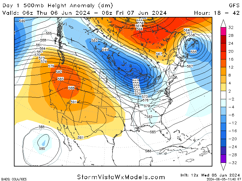
Focusing on what is happening synoptically, there is a trough in the Great Lakes region that is responsible for the cooler temperatures as well as the persistent rain chances. Troughs are associated with low pressure systems and tend to bring in cooler temperatures with more chances for severe weather, and with this trough staying in the eastern US it is safe to say that a latent severe weather risk will be with us in the short term. Moving out West, there is a strong ridge that is keeping the record-breaking heat in place. Ridges are associated with high pressure systems and usually produce stable, clear conditions which is aiding the heat in the desert southwest.
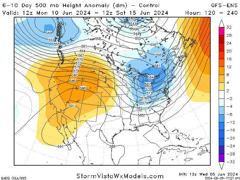
For the next five days, the models are very consistent with the ridge and trough staying in roughly the same area. However, the models for ten days out have some inconsistencies but suggest the trough sinking more towards the southeast and bring some slightly cooler air into the region. The ridge is expected to stay in the same general area, keeping the heat in the area for a little bit longer.
SPC Severe Weather Outlook:
Looking more at the threats for the nation Thursday, The SPC has issued a Marginal Risk for sever weather in parts of the Central and South Florida, the Texas Panhandle and Southwest Oklahoma, and the Mid-Atlantic and Northeast. The timing of this risk will be in the afternoon/evening hours with the main concerns being damaging winds and small chance for hail.
For central/eastern New York and surrounding areas, there is a chance for an organized cluster of storms with a few supercells to form thanks to greater amounts of shear. To the south of this area, there is expected to be less wind shear but stronger daytime heating, which may trigger a few intense storm clusters. Overall, while severe weather is not expected to be widespread, residents in these areas should stay alert and be prepared for sudden changes in weather conditions.
Extreme Heat out West Continues:
Lastly, the extreme heat in the southwest desert region is expected to continue well into next week with highs into the upper 100s with little rain chance. These temperatures are well above average for this time of year, resulting in multiple records being broken. This is also the first of many heat waves that usually impact the area. The ridge in the upper levels is keeping the heat in place for the next several days, with some places peaking above 115 degrees. The heat will steadily move from the middle of California to the southeast into parts of Arizona and New Mexico.
Specific areas like the middle and southern parts of California, the southern tip of Nevada, along with the western and southern parts of Arizona are all under an Excessive Heat Warning (indicated by the hot pink) . The orange in parts of California, Nevada, and Utah indicate a Heat Advisory. It is very import to be aware of this heat and try to stay hydrated and limit the time working in the sun as it will only get worse as the summer progresses.


