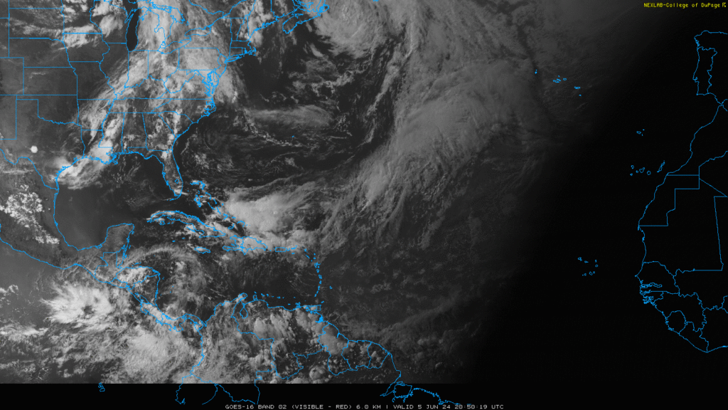
Everything is still looking calm out in both the Atlantic and East Pacific at the start of this Hurricane Season. An upper-level weather system in the western Caribbean Sea will continue to bring significant rain and thunderstorms through Friday, but signs of tropical development have not been identified and are not expected to for the next 7 days.
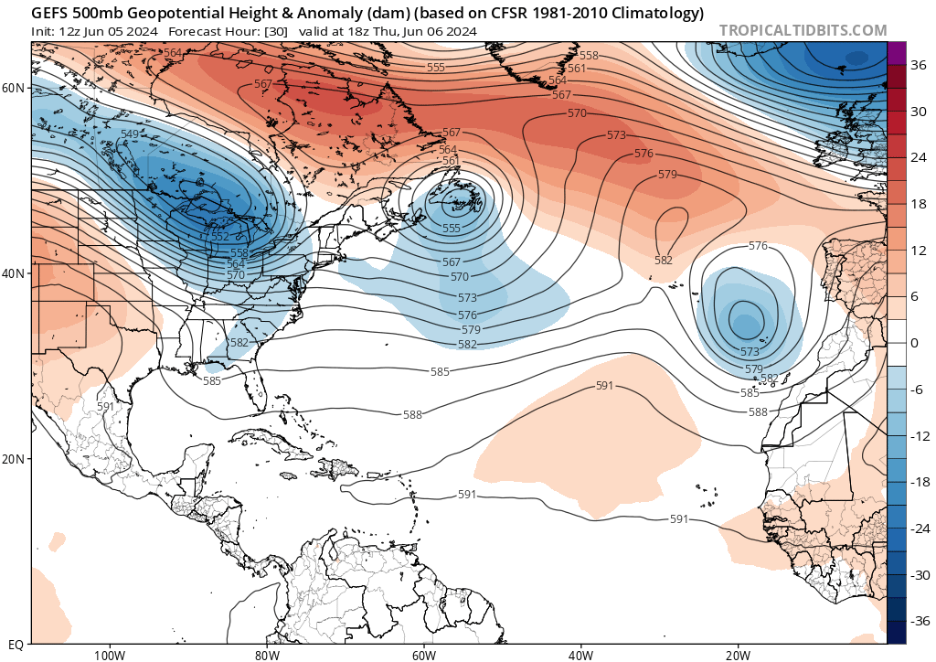
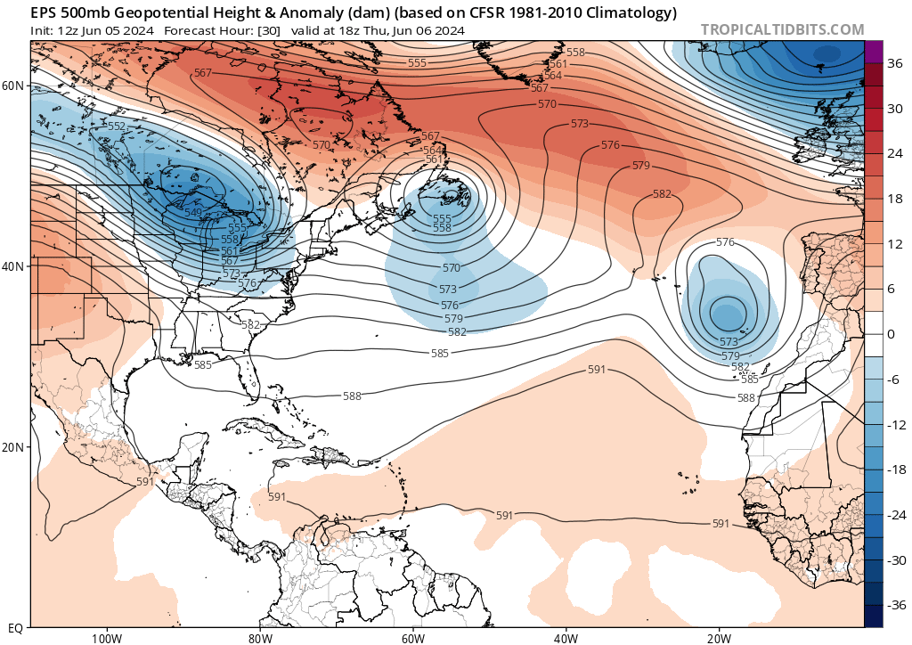
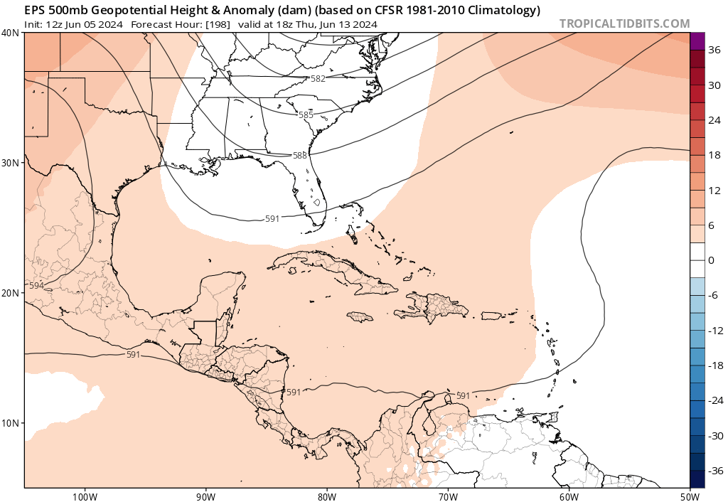
Using the GFS and EPS models to look at the upper levels of the atmosphere (reference the two maps below), both maps are in agreeance of the locations of troughs and ridges through tomorrow. There is an area of low pressure near Newfoundland, which is creating a trough in the northern Atlantic. There is also a ridge more in the central Atlantic indicating an area of high pressure.
These systems are helping to circulate the weather systems in the Caribbean through the Atlantic with the high pushing it out combined with the low pulling it out as well and keeping any tropical activity from occurring through the weekend
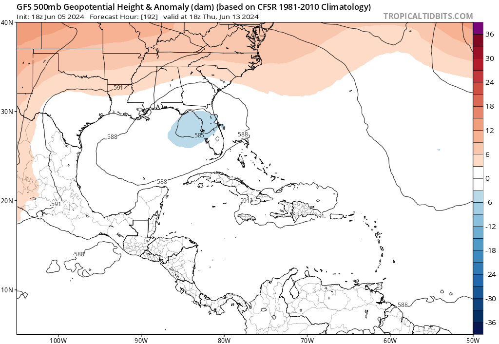
Talking about a week from now, there are some models indicating that there will be some activity in the Gulf of Mexico with a tropical wave in the northern Caribbean sea. potentially causing some development.
Looking at the same models used above, the GFS is showing an area of low pressure off the coast of Florida that moved up from the Caribbean, but the EPS does not correlate. With it still being a week out, the National Hurricane Center has yet to release any information and is still saying that tropical activity is not expected for the next week
While it is important to be prepared for what could come, there is still plenty of time for things to shift in the atmosphere and change the whole forecast. More forecasts will continue to come throughout the next week, so stay aware and up to date!


