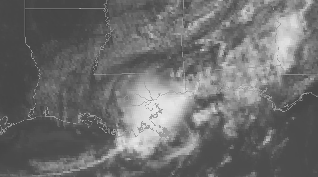
Hello, everyone. I hope that your week has been great so far. Looking at our local weather, the region can generally expect a hot and dry period through the weekend. Today (June 6th) is the only day that I am expecting cloud cover and rainfall in the region, with mostly sunny and dry conditions forecasted through the weekend. Temperatures are expected to be above average for this time of year, with little to no rainfall expected from this afternoon through this weekend. Later in this post, I will explain why temperatures are expected to run above average, so let’s get into it.
A Hot End to the Week
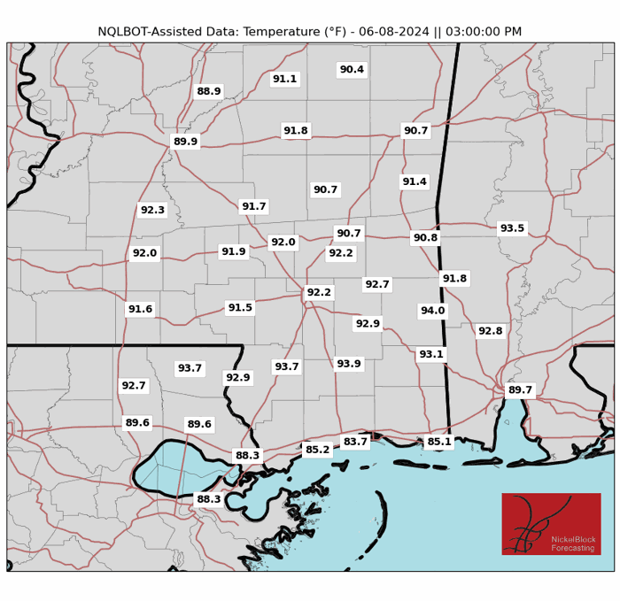
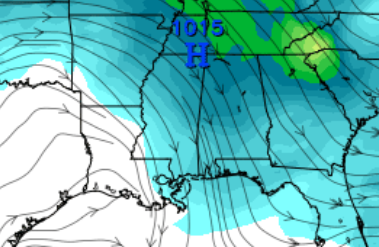
From today through this weekend, high temperatures are expected to remain above average for this time of year. Today is expected to be the coldest day, with high temperatures expected to be around the mid-to-upper 80s. Areas along the coastline can expect the coolest temperatures due to the moderating effect of the Gulf of Mexico. Looking ahead to Friday and the weekend, air temperatures are expected to climb into the low-to mid-90s. The high relative humidity typical of this time of year will push the heat index values to well over 100 degrees by the weekend. Areas south of Interstate 10 should see cooler temperatures than areas inland. These high temperatures are being caused be a passing ridge of high pressure to the north, allowing warm tropical air to make its way into the region. If you plan to be outside this weekend, make sure to drink plenty of water and try to find as much shade as possible.
Little to no Rainfall Expected
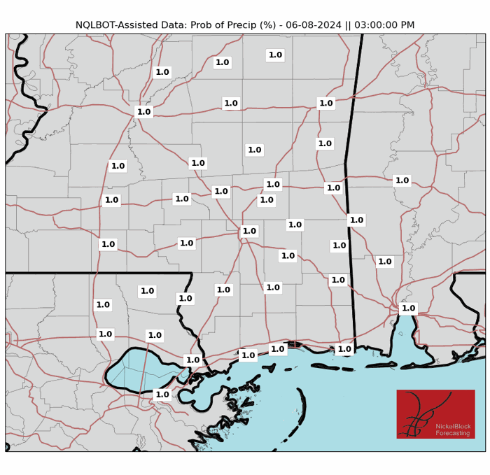
Due to the ridge of high pressure affecting the region, little to no rainfall is forecast from this afternoon through the weekend. Not only will there be little to no rain, but predominantly sunny skies are anticipated through the weekend. Our next chances of seeing rainfall won’t come until Monday, when a cold front associated with an upper-level low moves into the region. This will bring scattered thunderstorms and a slight relief from the heat of this weekend. Due to the high temperatures and little rainfall, going to the beach would be a great way to beat the heat this weekend.
Regional Day-to-Day Forecast
Today: Scattered showers in the morning, then sunny by the afternoon. Highs around 90. North winds around 5 MPH. Tonight: Mostly clear, with lows in the mid-70s. North winds around 5 mph, becoming calm.
Friday: Sunny skies, with highs in the mid-90s. North winds around 5 mph. Friday night: Mostly clear, with lows in the mid-60s inland and mid-70s on the coast. Northeast winds around 5 mph.
Saturday: Sunny skies, with highs in the mid-90s. East-southeast winds around 5 mph. Saturday night: Mostly clear with lows in the low-70s inland and mid-70s on the coast. Winds will be light and variable.
Sunday: Sunny skies, with highs in the mid-90s. Northwest winds around 5 mph. Sunday night: Mostly clear with lows in the low-70s inland and mid-70s on the coast. Winds will be light and variable.
Monday: Sunny skies in the morning, then scattered showers and thunderstorms in the afternoon. Highs around 90 degrees. North winds around 5 mph. There is a 50% chance of rain. Monday night: Showers and thunderstorms before midnight. Lows in the mid-60s inland and mid-70s on the coast. Southwest winds around 5 mph, changing to the northeast. There is a 30% chance of rain before midnight.
Tuesday: Mostly sunny with isolated showers and thunderstorms in the afternoon. Highs in the upper- 80s. East winds between 5 and 10 mph. There is a 25% chance of rain. Tuesday night: Isolated thunderstorms before midnight, then mostly clear. Lows in the upper-60s inland and mid-70s on the coast. Southeast winds around 5 mph. There is a 20% chance of rain before midnight.


