Both the Tropical Atlantic and Eastern Pacific basins are still relatively quiet for the time being. Little to none of the necessary ingredients for tropical development are currently present in both basins. Looking at the models, both the Atlantic and Pacific oceans show a slight chance of tropical development in the near future, which is typical of this time of year.
The Atlantic Basin
Looking at the Atlantic Ocean, there is not much to talk about since almost none of the needed ingredients are in place for tropical development. Two of the most essential ingredients needed for tropical development are low wind shear and a moist environment. Unfortunately or fortunately (depending on how you view hurricanes), these ingredients are missing. The two maps below show both high winds shear and dry air in the Gulf of Mexico. These two factors are a significant reason why little tropical development is expected in the near future in the Atlanic.
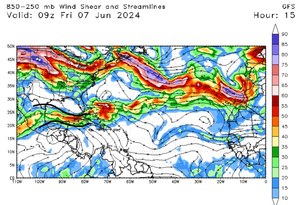
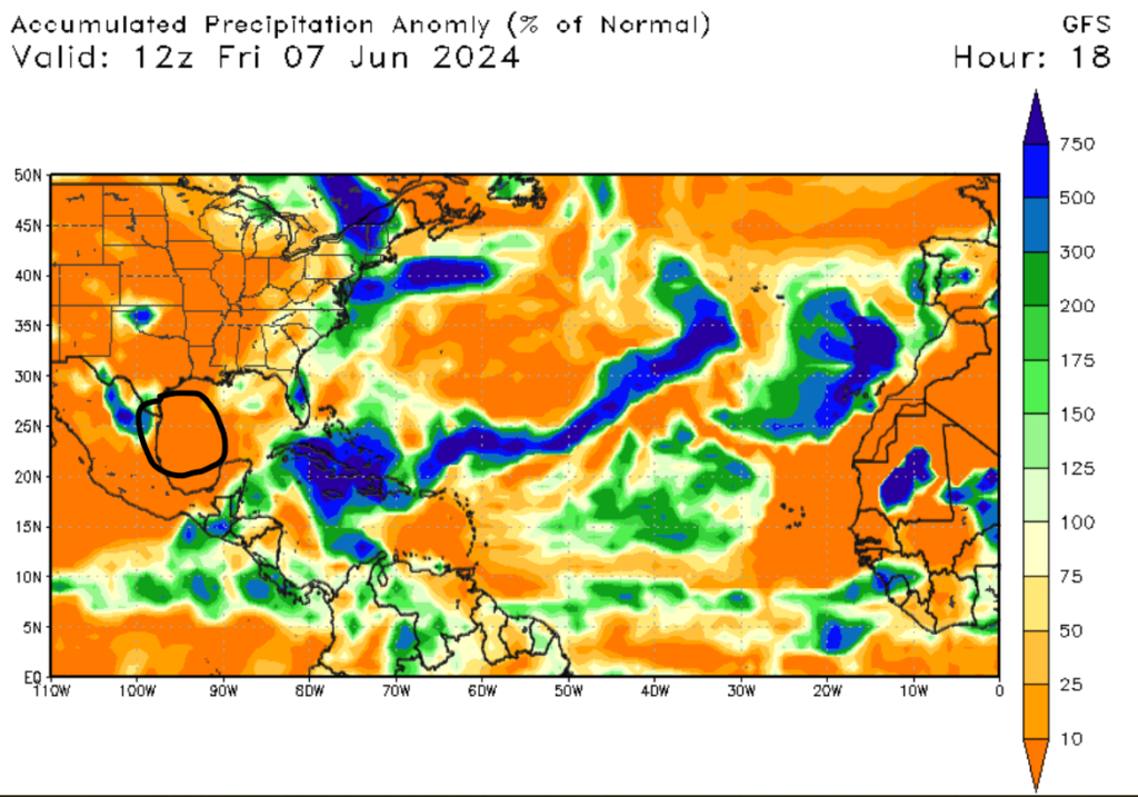
If you look closely at the images above, you will notice the black lines, which show the winds shear in the upper atmosphere and the accumulated precipitation anomaly in the Gulf of Mexico and off the coast of Africa. Hurricanes primarily develop in these two regions in the Atlantic. If these regions have high wind shear and dry air aloft, it’s much more difficult for hurricanes to develop, but it’s not impossible, and any of these ingredients can be present at any time.
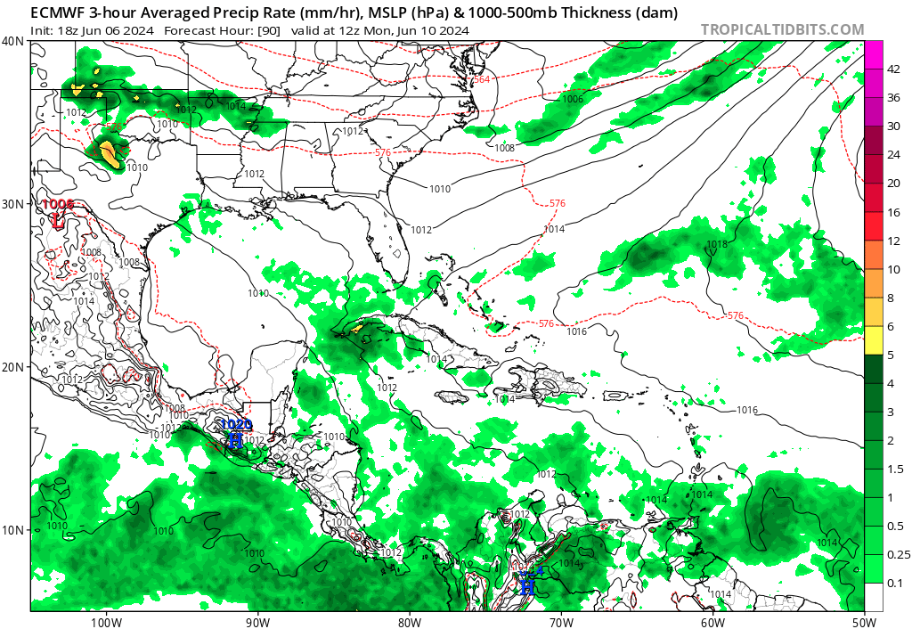
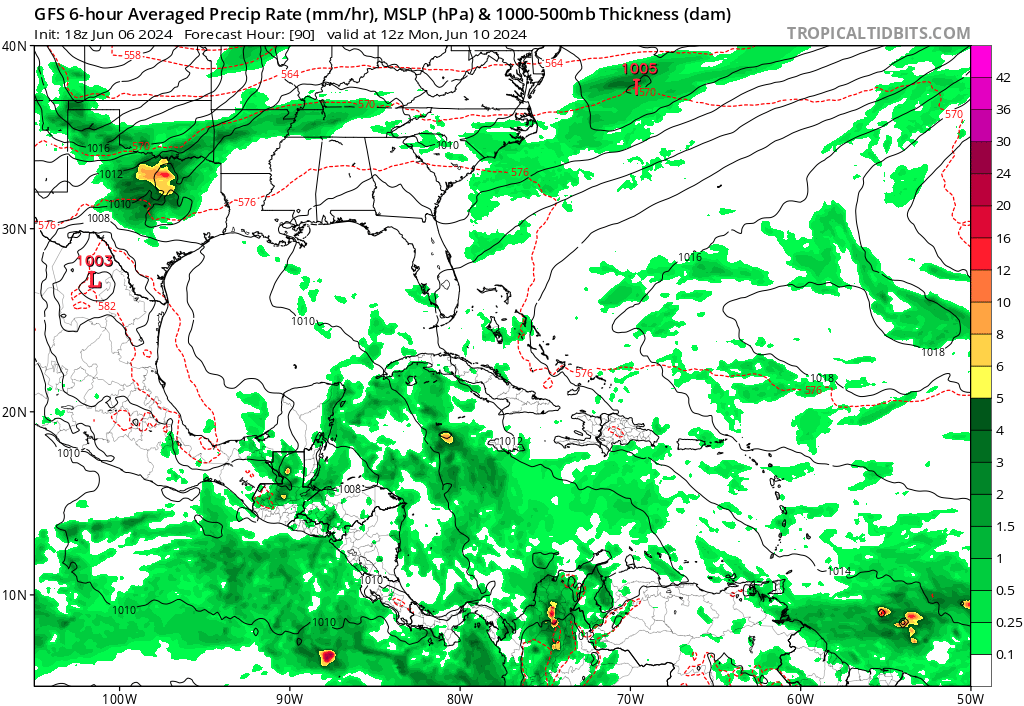
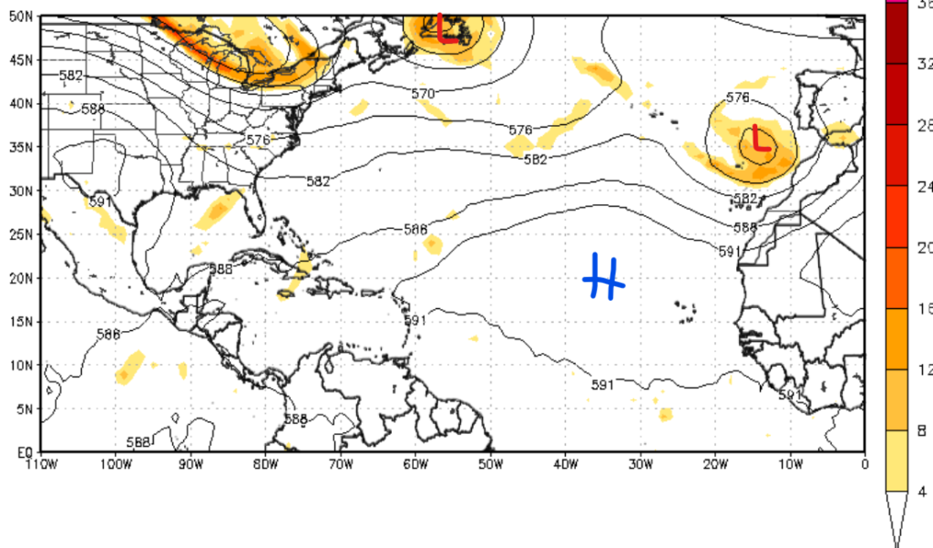
Looking at the images above, the moisture content associated with a center of low in the Caribbean region of the Atlantic has increased. Both the European and North American models agree that more moisture is expected in the Caribbean next week. This does not mean that tropical development is expected; instead, it means that one of the ingredients is now present, and it’s important to stay up-to-date.
The Pacific Basin
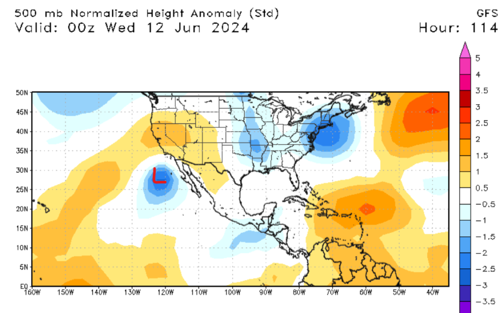
It is a similar story in the Pacific Basin, with little to no activity expected in the next few days. Looking into next week, some of the models are showing slight development, with a center of low possibly forming off the coast of Baja California. I don’t think that this center of low-pressure will develop because of the lack of moist air and too much wind shear.
Although both basins are showing little tropical activity, there is still a lot of time for hurricane development, as hurricane season has only just started. The big thing to remember is to check the tropical weather forecast daily to stay up to date on the latest hurricane news.


