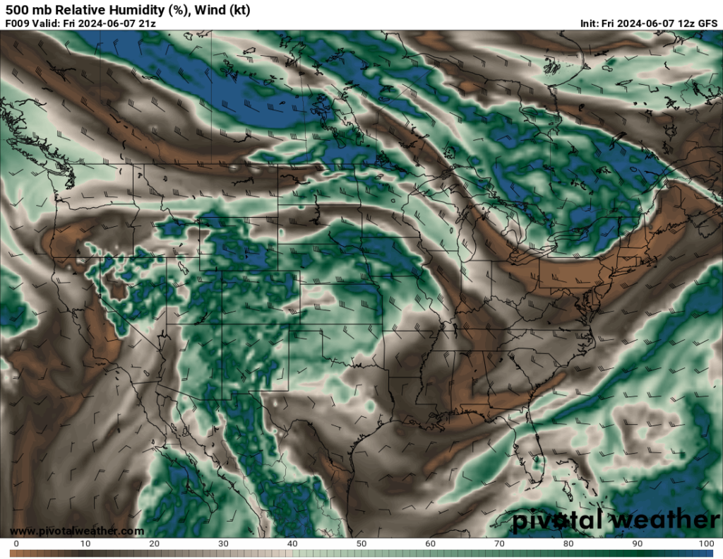
Hello, everyone. I hope that you had a great first week of June. This national forecast has much to cover, so let’s get into it. The two primary aspects that will be discussed are the heat in the southwestern U.S. and the potential for severe weather in the Central Plains. The heat wave in the southwest is expected to continue for the next couple of days as a ridge of high pressure is expected to dominate the region. Because of the dome of high pressure to the west, enough energy and low-level moisture (as shown in the 500mb relative humidity map) is being ejected into the central pains, allowing for severe weather to develop in this region.
The Heat is on in The Southwest
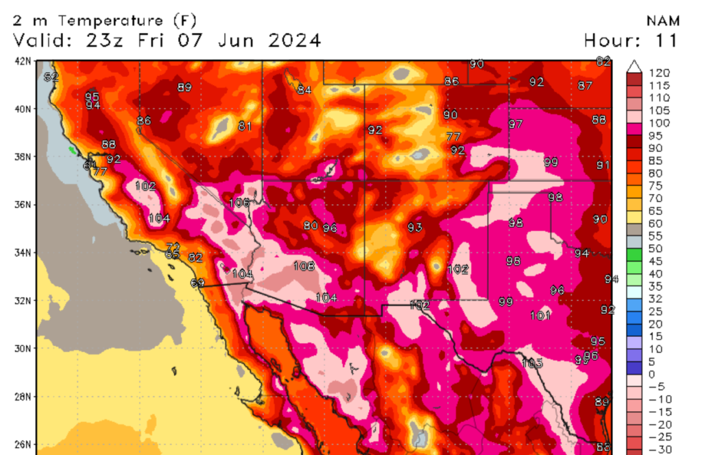
The first significant heat wave of the summer is here, and the Southwest U.S. is the primary target. A large ridge of high pressure centered in the Western U.S. (depicted on the map to the right) is causing abnormally high temperatures in this region. Afternoon highs are expected to reach over 100 degrees Fahrenheit, with some low desert regions expecting temperatures of 110 degrees Fahrenheit or higher. These dangerous temperatures can pose a severe threat to a person’s health. Remember to drink plenty of water, stay inside between 10 AM and 5 PM, wear light and breathable clothing, and apply sunscreen.
Risk of Severe Weather in the Central Plains
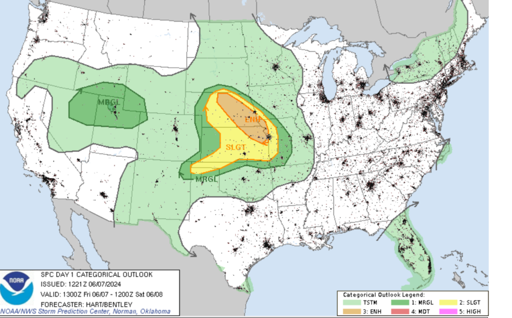
Looking further east, a large swath of the American Heartland can expect to see severe weather this afternoon through the overnight hours. Areas of Eastern Nebraska and Northeastern Kansas are under a level 3 or enhanced risk of severe weather, while most of the rest of Kansas and Nebraska are under a level 2 or slight risk of severe weather. Cities such as Kansas City, Lincoln, Omaha, and Wichita are expected to be affected by the severe weather today. The ridge of high pressure to the west, sunny skies in the morning, and low-level moisture are the primary factors in today’s severe weather outbreak. The high pressure and morning sun provide the needed energy, and the low-level winds provide the moisture. This will yield cape (convective available potential energy) values of 1500-2500 j/kg by the afternoon.
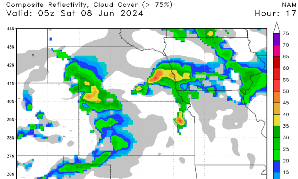
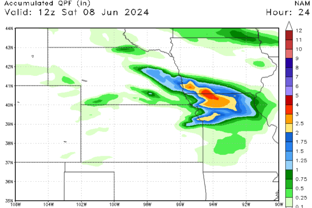
Storma will start firing by mid-afternoon in Central Nebraska and move southeast. Heavy rain, large hail, and damaging winds will be the primary threats from these storms this afternoon through tonight. The tornado threat will be low, but an isolated tornado or two can’t be ruled out this evening. Flooding from heavy rain associated with the supercells is possible in Eastern Nebraska and Northern Missouri, with 1 to 3 inches expected. Persons in the paths of these storms should take standard severe weather protocols this afternoon and stay up to date.
Overall, the weather in the United States today is quite varied, from heat waves in the Southwest to severe weather in the Central Plains. It is crucial to stay up-to-date on the latest weather information, so checking NickelBlock Forecasting is a great way to do so.


