Happy Saturday, everyone. I hope that you have a great first week of June 2024. If you did not know, we are officially one week into hurricane season in the Atlantic basin, so it’s important to remind yourself about hurricane safety. As for the current outlook for hurricanes, the Atlantic and Pacific Basins are showing little activity for the next few days. I am keeping an eye on a low-pressure system that is forecasted to form in the Gulf of Mexico next week. As for the Eastern Pacific, little to no activity is expected for the foreseeable future.
The Atlantic Basin
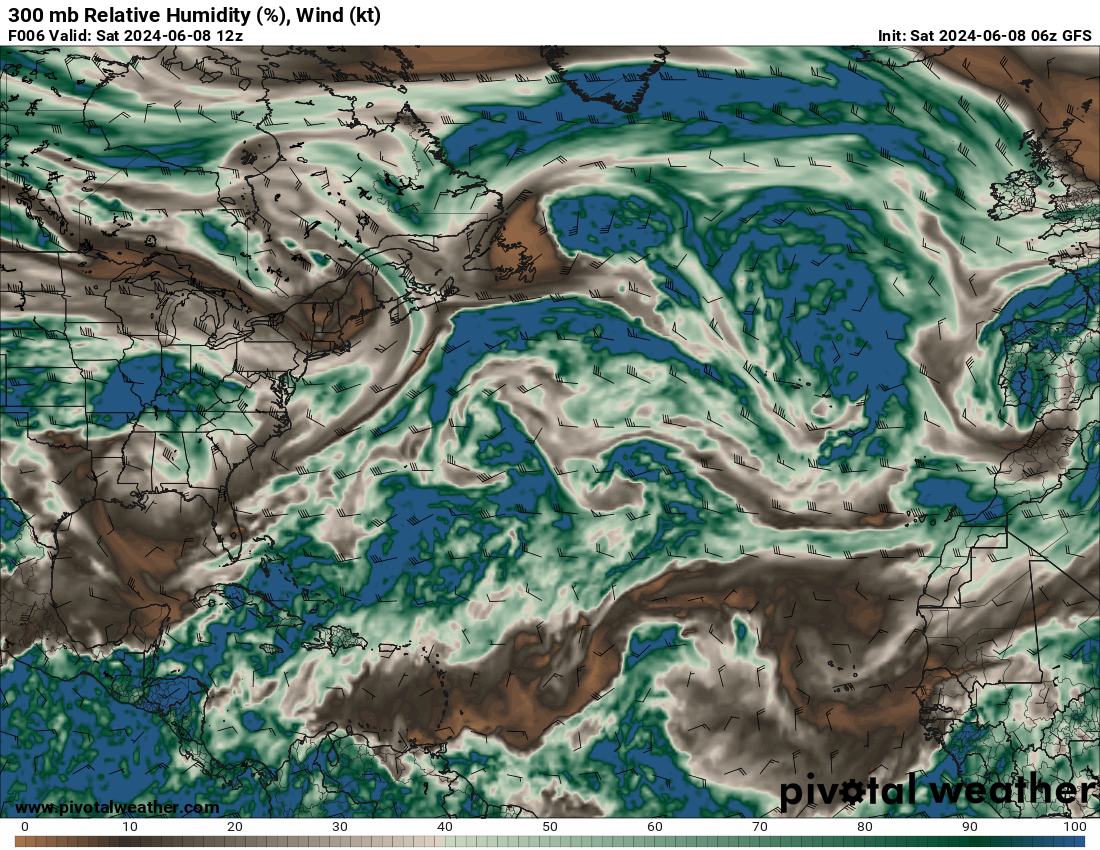
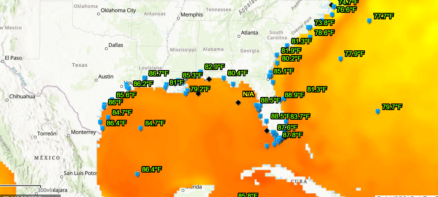
Looking at the Atlantic region (specifically the Gulf of Mexico), two critical ingredients for a hurricane are no wind shear and moisture aloft. If you look at the map to the left, the Southeastern U.S. is relatively dry afloat. Other areas in the tropical Atlantic are showing some tropical wave development, but little activity is expected in the next few days. Although little activity is expected for the next few days, sea surface temperatures are incredibly supportive of tropical development, especially in the Gulf of Mexico.
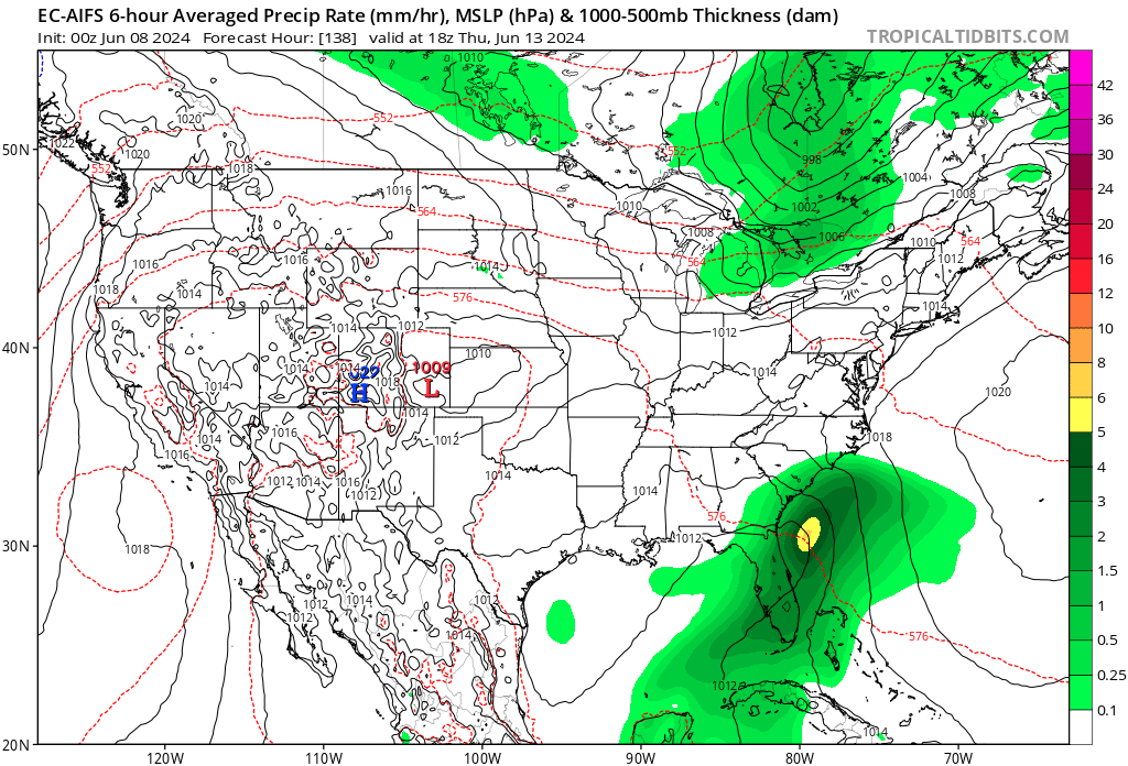
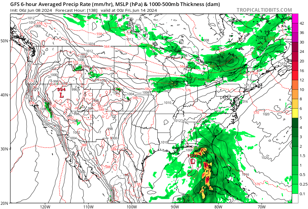
Looking into next week, there are more signs of a tropical wave possibly impacting the Gulf Coast Region. The map to the left is the European Centers for Medium-Range Weather Forecasting model, and to the right is the Global Forecasting Model. The Euro model is unique because it uses AI and machine learning to predict medium-range weather forecasts. Although there is plenty of moisture, wind shear, a ridge of high pressure, and lack of instability will hinder development. For now, this center of low looks like only a rainmaker for the region. Please make sure to stay up to date on the latest information on this system.
The Pacific Basin
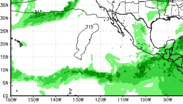
It’s a similar story in the Eastern Pacific, with little to no activity expected for the next several days. Although there is plentiful moisture in the intertropical convergence zone (ITCZ) and some isolated areas of convection, high pressure continues to dominate the region, hindering development. This area of high pressure is expected to dominate the region for the next several days. Overall, it has been a quiet start to the hurricane season in both the Atlantic and Pacific regions; however, we are anticipating a very active season this year, so please check for the latest hurricane news and information.


