Happy Wednesday, everyone! Plenty of things to talk about today, but here are the three main topics I will be focusing on. First, heavy rain has been impacting the Florida peninsula this week and will continue to do so over the next couple of days. Second, severe weather is likely Thursday afternoon for Missouri, Iowa, and Illinois. Finally, summer-like temperatures are likely for the central United States this weekend.
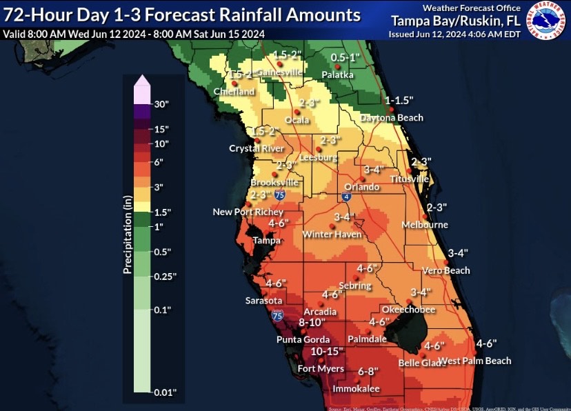
Tropical Rain for Florida

Invest 90L has moved onshore across the Florida peninsula and has been quite the rainmaker so far. Many locations including Sarasota have seen over 10 inches of rain so far!
Heavy rain will continue to fall in southwest Florida, with potential rainfall totals of 8-12 inches over the next 24 hours due to the advection of Gulf moisture and a jet streak over the northern Gulf of Mexico. Flood Watches have been issued for much of SW Florida, so avoid driving on flooded roadways and listen to your local station for more updates.
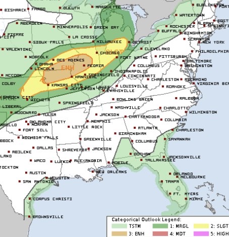
Upcoming Severe Weather Chances

Severe weather is likely Thursday afternoon and evening as very large hail, destructive wind gusts, and a couple of tornadoes are possible. An “Enhanced Risk” (a “3” on the 1-to-5 scale where “5” is the highest risk for the most significant severe weather) has been issued by the Storm Prediction Center.
A fast upper-level jet streak is forecasted to move over the Upper Midwest and Great Lakes on Thursday, with a surface low situated near the U.S.-Canada border. Associated with the low, a cold front will trail to the southwest from southern Wisconsin to northern Kansas.
Uncertainty still lies regarding exactly where storms will form along the front, but the best chance of seeing intense thunderstorms will be from northeast Kansas to northern Illinois. The main hazards Thursday afternoon and evening are large hail and damaging winds, then the severe weather threat should decrease after dusk.
Severe weather is possible on Friday for the Great Plains as well as the Northeast. Continue to check the website for more updates on this threat.
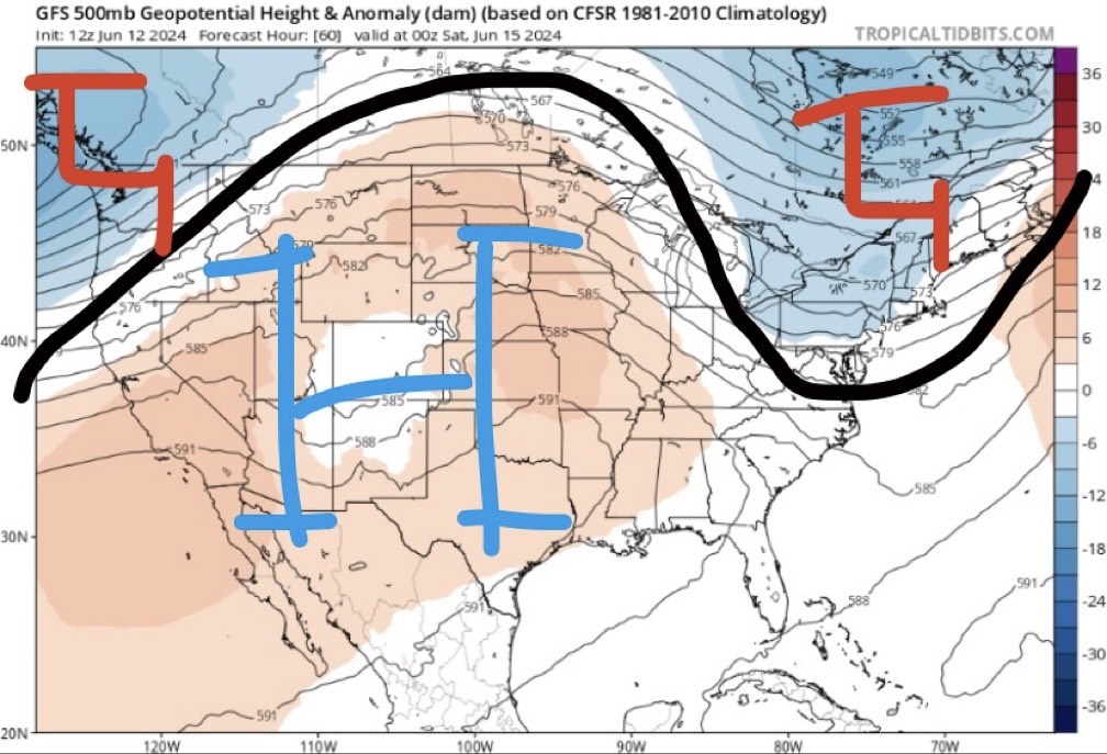
Summertime Heat This Weekend

An omega-block pattern will begin to take place late this week and into the weekend. With this, ridging is forecasted to dominate the central part of the country, resulting in above average temperatures.
This will be the first taste of summer for many across the central United States as temperatures will likely climb into the 90s with heat indices possibly reaching the century mark. Be sure to drink plenty of water and wear lots of sunscreen if you plan on being outside!

