Hello, everyone. I hope that you have had a great week so far. Looking at the next couple of days, a ridge of high pressure is expected to dominate the region through the weekend. This will result in hot and humid conditions throughout the weekend. Rain chances are expected to increase this weekend, with scattered thunderstorms expected, especially near the coast, as the ridge of high pressure starts to move out of the region.
Heat to Continue Through the Weekend
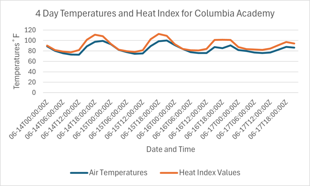
I am sure that you have been sweating it out for the past few days, and unfortunately, the heat is expected to continue through the weekend. This is thanks to a ridge of high pressure that has centered itself to the north of the region. The consequence of this ridge of high pressure is hot and humid temperatures. Afternoon high temperatures tomorrow are expected to be in the low to mid-90s, with heat index values expected to be well over 100 degrees.


Temperatures will be the highest in inland areas such as Hattiesburg, MS, with a high temperature of 95 degrees Fahrenheit. Areas along the coast should see the coolest temperatures and heat index values, such as Gulfport, MS, with a high temperature of 87 degrees Fahrenheit.
These temperatures are dangerously high and can result in heat-related illness within an hour of being outside. Please make sure to take heat-related precautions tomorrow and this weekend, such as drinking water, staying inside during peak daylight hours and wearing loose-fitting clothing.
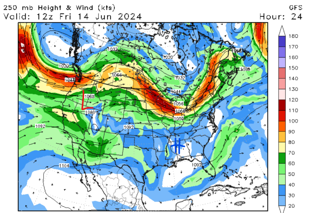
The heat is only expected to continue through the weekend, with daily high temperatures expected to be in the mid-to-high 90s by Saturday, with some regions potentially reaching 100 degrees Fahrenheit. The ridge of high pressure is expected to become an omega block, which is when a center of high pressure centers itself to the north. This causes the jet stream to move to the north and create an omega-looking shape, as seen in the map below.
Slight Chance of Thunderstorms
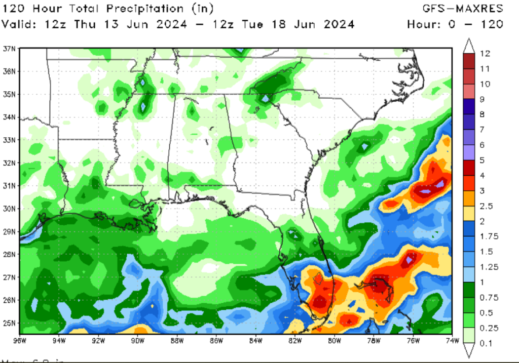
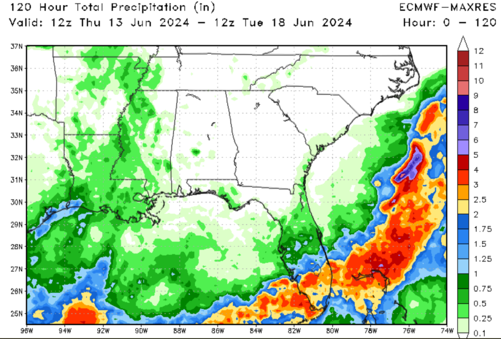
Unlike Florida, which has been drenched with rain for the last few days, our region has seen little rainfall. That trend is expected to continue for the next couple of days as the ridge of high pressure continues to dominate the weather pattern. Rainfall chances won’t get above 20% from today through Saturday. Rain chances are expected to increase on Sunday as the center of high begins to move, bringing a higher chance of thunderstorms.
Quick Look at the Tropics

Looking at the tropics, we currently have two disturbances in the Western Atlantic. The disturbance off the coast of the Carolinas is expected to move offshore and cause little impact. The other area of disturbance could possibly form as an area of low pressure is expected to form in the Gulf in the next few days.
If the system develops, it is expected to move in a north/northwest direction and could cause possible impacts to the region. This is why it is crucial to keep an eye on this potential system. For more tropical information on tropical weather, please look at our tropical posts on the website.
In conclusion, hot and dry weather is expected to dominate the region from now through Saturday evening. Once Sunday approaches, the high-pressure system responsible for the abnormally high temperatures is expected to move to the east, bringing a higher chance for thunderstorms and a slight relief from the heat. A great way to beat the heat this weekend is going to the beach: just make sure to wear sunscreen, stay hydrated, and find shade if you need it.


