There has been some upgrades to our tropical activity regarding the new area in the southwestern Gulf of Mexico as well as Invest 90L that has brought abundant rainfall to the Florida Peninsula in the past couple of days.
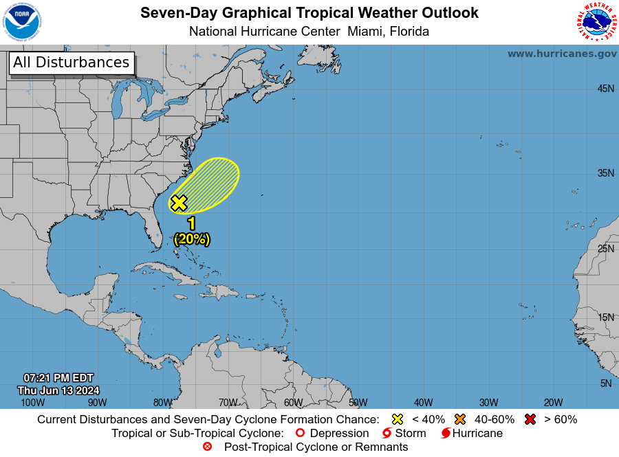
INVEST 90L
After bashing Florida with rain over the past couple of days and causing flooding concerns, Invest 90L looks to be moving out of the U.S. within the next few days. While the upper atmosphere conditions are only somewhat favorable for development, there is a chance for this system to slowly develop once it moves offshore. Florida will experience heavy rainfall over the next few days regardless of further development.
As it moves offshore, Invest 90L has a 20% chance of development as it is very unorganized. Cooler sea temperatures and upper-level wind shear will also aid in hindering further development. The main threat with this system is the rain that Florida has received and will continue to experience.
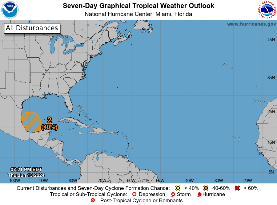
AREA IN GULF OF MEXICO
Looking to the Gulf of Mexico, a broad area of low pressure is expected to develop over the by late this weekend or early next week. The conditions in the area will likely support its gradual development, and it could become a tropical depression by early or mid-next week. The high pressure system that will move across the U.S. as shower move into the watch area. This high-pressure system will determine exactly what will happen to our area of interest.
While there is no sign of any formation in the next 2 days, there is a 40% of development within the next 7 days according to the NHC. It is still very early to tell exactly what will happen, but with the higher chance for development there is more confidence in this system to have ‘something’ happen. We will keep you updated as the system progresses.


