Hooray! The weekend is here, but so is the summer heat with forecasted highs well into the 90s. This is due to high pressure overhead, resulting in hot and humid conditions. However, by the time we get towards Monday, rain is likely, especially near the coast as the area of high pressure shifts east.
Above Average Temperatures This Weekend
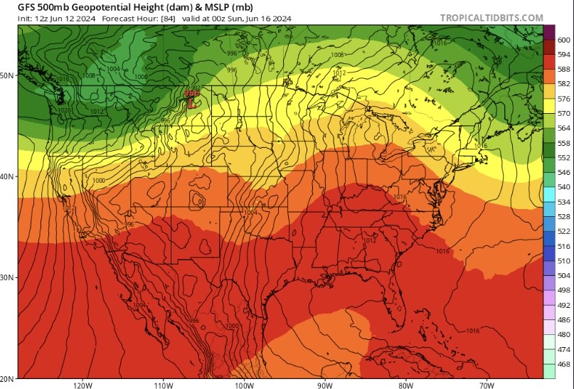
Ridging has influenced our warmer temperatures the past couple of days and will continue to do so throughout the weekend. This pattern results in lots of sunshine for the region which can quickly heat up the atmosphere.

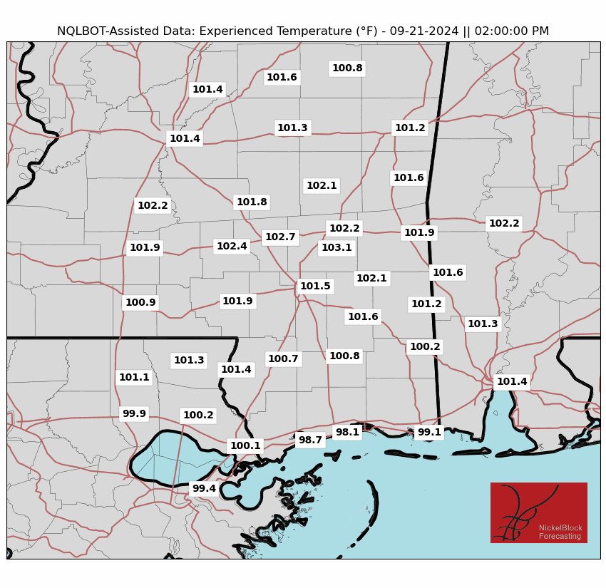
Tomorrow will be very similar to today with highs in the mid to upper 90s for most of the area with heat index values over 100 degrees! Unfortunately, light winds out of the south-southeast will not provide enough relief to the heat, so it’s going to feel HOT out there. On Saturday, it’ll feel closer to 110 degrees for cities like Hattiesburg, MS and Mobile, AL. For Sunday, the worst heat will be along I-20 from Jackson, MS to Meridian, MS.
Be sure to drink plenty of water and try to get your outdoor activities done either early in the morning or in the evening. Also, remember to be aware of children and pets during this dangerous heat as heat-related illnesses can occur quickly.
Rainy Start to Next Week
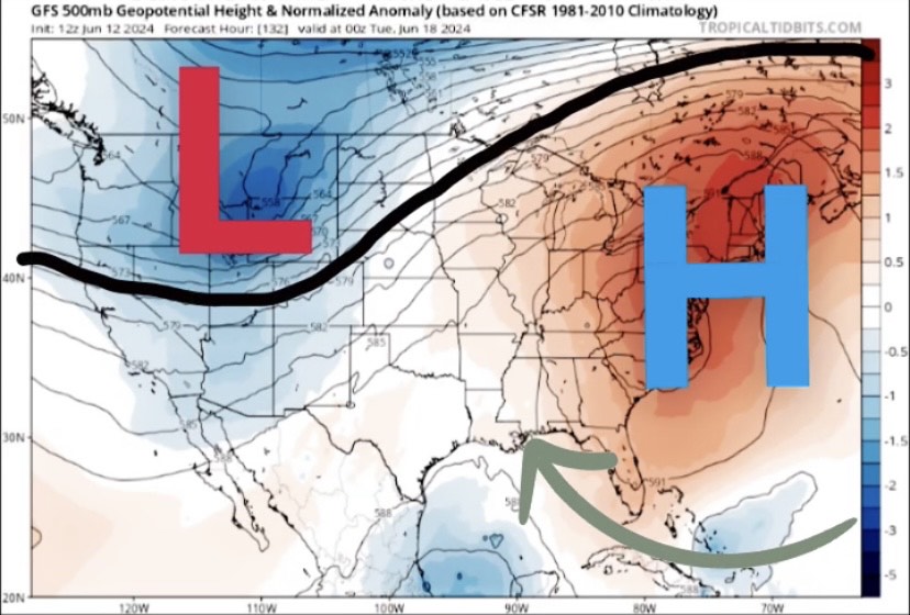
High pressure will begin to shift further east late this weekend and into early next week. This allows a return flow, or simply an increase in moisture advection depicted on the image on the right. Clockwise flow around the high will pump Gulf moisture into the region, resulting in better rain chances.
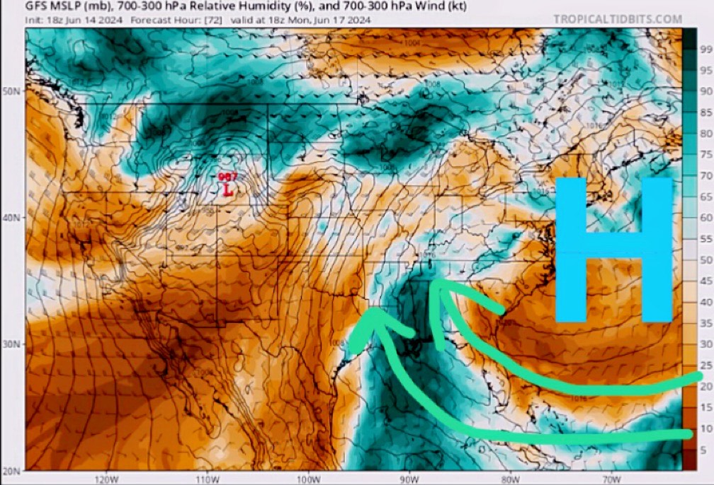
At the moment, models disagree where the heaviest rain may occur, but there is some confidence that greater rain chances will be closer to the coast. The best timing showers and thunderstorms is Monday afternoon and evening with slight chances of rain on Tuesday and Wednesday. Rainfall over an inch is likely for locations like New Orleans, LA and Gulfport, MS from Monday through Wednesday.
Area to Watch In the SW Gulf
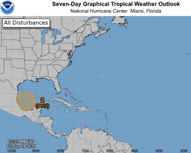
The main thing to watch over the next couple of days is a broad area of showers of thunderstorms across the Bay of Campeche. If this were to develop into a tropical depression or storm, steering would take it north-northwest towards Texas and Mexico.
At the moment, an increase in cloud cover and rainfall is likely, especially for Louisiana. Exact rainfall totals will be determined when we have more confidence in the track. Continue to check our page for future tropical outlooks regarding this system.


