The tropics are a mess and the model guidance isn’t helping. Some measure of unpredictability and messiness is typical for early season tropical activity. But this year, it seems to be amplified a bit by model guidance struggling to resolve tropical convection against the backdrop of a more active season.
And for those of us tasked with informing you, the public, with an accurate forecast, it creates a difficult task of not only understanding weather model biases and failure points, but also quelling your concerns after disingenuous purveyors of random weather maps share doomsday prognostications on social media.
For me, I feel a bit like Kramer, on Seinfeld, trying to get on a subway car, when tasked with correctly communicating the anticipated weather and actual risk.

Or, to borrow an aphorism, “I’m trying to swim upstream using one arm.”
WHAT’S BROKEN?
Honestly, the modeling.
I have my own hypothesis about this, but it comes with caveats. I am only an observer of these models I am not a modeler, I don’t have an advanced degree in atmospheric physics, nor am I an expert in the complex relationships present in these models. This hypothesis is untested and only has anecdotal evidence.
That said: I think the warm ocean waters fooling our computer model guidance into thinking there is more surface warmth than there actual is, and it is making the boundary layer mechanics in the modeling a bit screwy. And this problem gets amplified the further out you travel in time. So when the model is showing something for today or tomorrow, it is okay. But by the time a model is showing data for 8 days out, it is out to lunch.
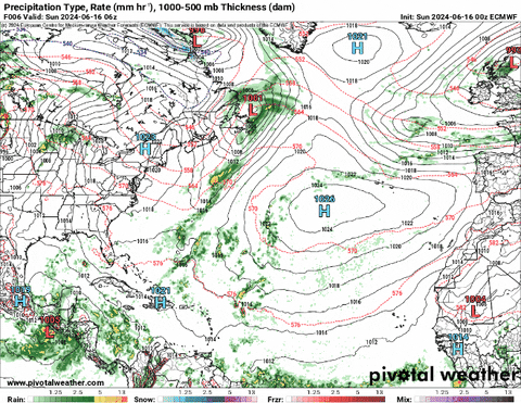
I’ll give you an example: Here is a look at the ECMWF operational model guidance in two images. On the left is the “precip type / rate” and on the right is the 850mb dewpoint. Same time.
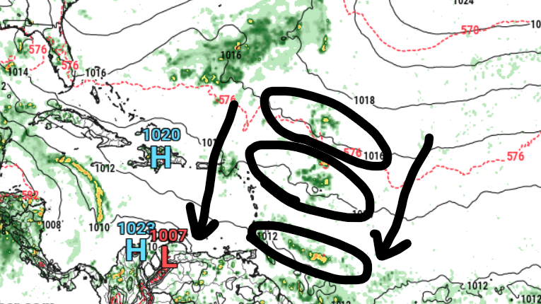
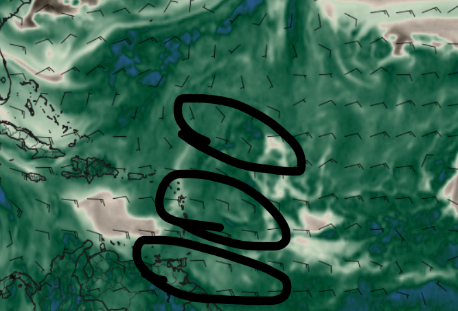
.
Both maps show three MCSs traveling from north-northeast to south-southwest across the open Atlantic. A few problems here: (1) that does not happen, (2) it leaves a wake of drier air pocketed behind each MCS, which isn’t real and (3) it consistently creates these features across the open ocean when any boundary is present.
This is an enormous impact – within the modeling – on the surrounding environments potential and capability to initiate convection. And thus tropical systems.
I would argue that the dry air in its wake can inhibit cyclones from developing within the models, leaving an under-forecasting of potential areas of tropical development at times and over-predicting them at other times when these MCSs run into other boundaries (like the CAG).
The GFS computer model is also bad, in a different way, for the same reason.
I think it sees any type of vorticity in the lower levels, assumes the warmer ocean waters mean higher surface temperatures, and translates that into more buoyancy and convection development, and spins up more storms.
Below is a look at the 850mb vorticity map. A very general way to look at this map is, “where it is red, there is motion in the atmosphere conducive for convection to develop”
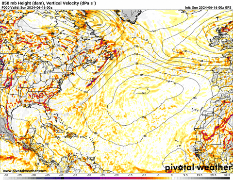
And I think it is taking this – very sound physical equation – and assuming there is much more heat and moisture than there actually is, and it rolls into a bit of a feedback loop over time. And that is why we always see scary “Category 19 Hurricanes” forming in the Gulf 13 days out. It can’t handle how warm the Gulf – or Atlantic – actually is.
WHAT ELSE IS BROKEN?
Honestly, some people
This is where social media comes into the fray: Anyone with a phone or keyboard can find this model data and share it with others – without context – to stir up clicks, shares and likes.
And that makes them money.
Things like this:
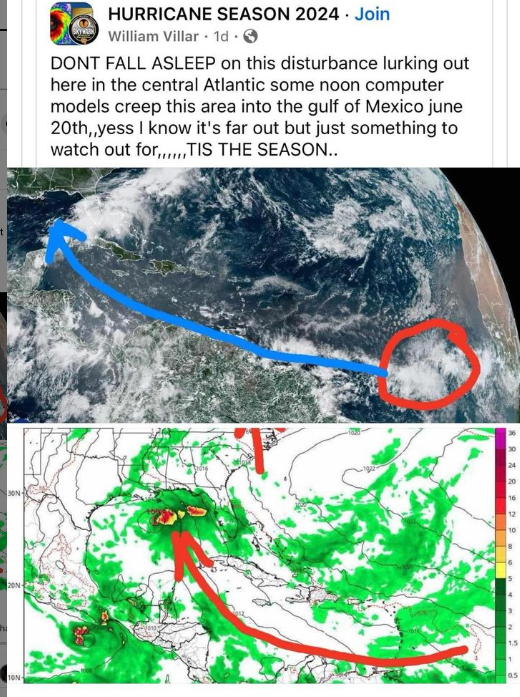
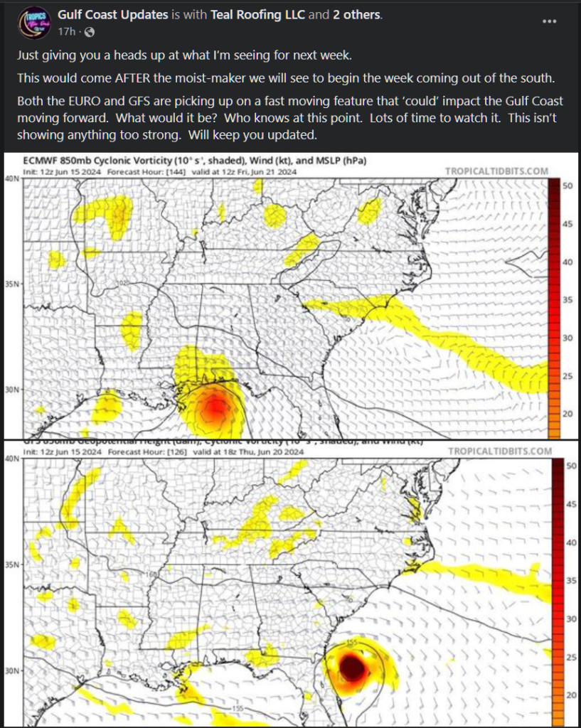
Both of these were sent to me from folks, worried, asking, “is this true?” during the past week.
Now, I don’t know who runs these pages. Maybe they are good people, maybe not. And I’m not here to get in the way of people making a living. But my support for people making money ends when it directly, and purposefully, causes other people pain and suffering. Even if the people posting those things hide behind the guise of, “just something to watch” or “Who knows what will happen.”
Because, if these people took the time to actually look at the modeling, they would recognize the faults and know that the modeling isn’t handling things correctly. In this case of these specific post, saying, “What would it be? Who knows at this point.” without any context to the situation is an immediate red flag to warn you that this person has no idea what they are talking about.
And full disclosure: I make money from facebook, too. A modest amount, but it is something. I’ll be fully transparent. Here is a look at my most recent statement.

If I chose to share outrageous model maps, use scary language, or hype up things, I could make a lot more money. Because, on facebook, I get paid by the interaction. The more my content gets shared, liked, and commented on, the more money I could make. On a post like the ones above, given the stats at the time of this writing, a post like those would’ve made me about 30 bucks (more than I’ve made this entire month, to date)
As an aside: That is why so many facebook pages (no matter who owns them) are now constantly asking for your opinion on posts and why they post an image or quick headline, with a link in the comments. Its all about making as much money as possible.
I was taught – by a superhero’s uncle – that “with great power, comes great responsibility.”
And having the power to reach a lot of people means I have the responsibility to inform them as best I can. But not everyone understands that. Or cares. And others ignore it, and exploit that power.
And that is a problem, when the model guidance – that is freely available – can be packaged and shared to make money.
HOW CAN WE BEAT THIS?
In the 80s we were taught: “Knowledge is power” and “knowing is half the battle.”
Now that you know, you have a better understanding about what these weather maps can’t do well. That means when you see the charlatans out there posting these maps without context, you can look at them with a skeptical eye.
Because the truth is, these models aren’t going to get better overnight. Both are run on complex interactions on supercomputers. It isn’t as easy as flipping a switch. It will be difficult to solve. But the models were built and are maintained by some of the smartest mathematical minds we have in atmospheric sciences, if anyone can figure it out, its them.
And the other truth is that these social media folks sharing this bad data aren’t going anywhere either. If there is one thing life has taught me, it is that anyone with a platform and any information – true or not – can cultivate a following through fear.
It comes down to individuals (you guys!) understanding the situation and making the right decision. And then informing others, too.


I use Tidbits quite a bit and, more times than not, it’s quite accurate. However, when it shows a Category 3 or 4 hurricane coming at us, I don’t just take one model run as truth … I wait until it shows the same (exactly same) scenario 4 or 5 model runs in a row before I even start to take it seriously. Also, I only trust a forecast, whether it’s from this site or the NWS, 3 days out. After that, only with a grain of salt. NO offense to you, Nick! I trust social media even less.
Thank you. I follow the Hurricane Season 2024. I’m going to unfollow them.
I want your take on that “error”in software on a certain site I’m sure we’re both familiar with