Well, we have our first “Potential Tropical Cyclone” of the season. For us, it will only have some indirect impacts.

With high pressure nudging back in from the east, we may be a bit drier today. As a result, expect fewer showers and storms this afternoon and evening. The sky will stay mostly cloudy, but you might catch a few glimpses of the sun.
It’ll be warm under the ridge for the next few days, too. Look for highs to hold at or above 90 degrees. Slightly above normal for this time of year. The chance for rain will hold around 10 to 20 percent through the weekend.
By the weekend, the ridge really flatten out. That means we may still see a few isolated storms in the afternoon, but it should be mostly dry. But when you flatten out ridges like that, it should eventually allow for a crack to form in the ridging near us by early next week, with another shot for some rain.
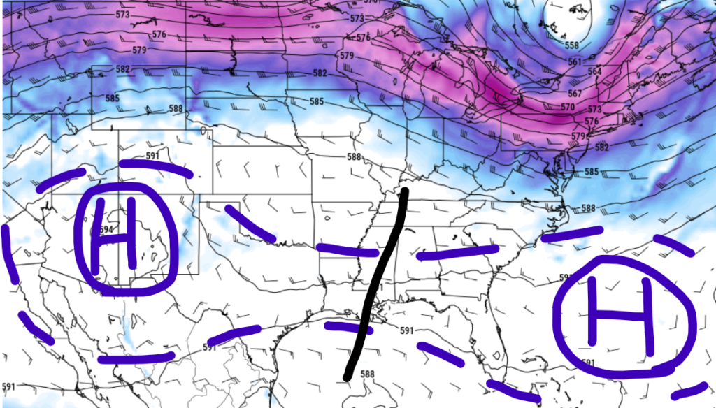
And once you crack it in half, it would open the door again for whatever tropical riff-raff may be in the Gulf to pay us a visit, too.
REGIONAL DAY TO DAY FORECAST
Today: Mostly cloudy. A slight chance of showers and thunderstorms this afternoon. Highs in the upper 80s. East winds 10 to 15 mph with gusts up to 25 mph. Chance of rain 20 percent.
Tonight: Mostly cloudy. Lows in the lower 70s. East winds 5 to 10 mph with gusts up to 20 mph.
Juneteenth: Partly sunny with a slight chance of showers and thunderstorms. Highs in the lower 90s. East winds 10 to 15 mph with gusts up to 25 mph. Chance of rain 20 percent.
Wednesday Night: Mostly cloudy in the evening, then becoming partly cloudy. Lows in the lower 70s. East winds 5 to 10 mph.
Thursday: Mostly sunny. A slight chance of showers and thunderstorms in the afternoon. Highs in the lower 90s. East winds 5 to 10 mph with gusts up to 20 mph. Chance of rain 20 percent.
Thursday Night: Partly cloudy in the evening, then clearing. Lows in the lower 70s.
Friday: Sunny. A slight chance of showers and thunderstorms in the afternoon. Highs in the mid 90s. Chance of rain 20 percent.
Friday Night: Clear. Lows around 70.
Saturday: Sunny. A slight chance of showers and thunderstorms in the afternoon. Highs in the upper 90s. Chance of rain 20 percent.
Saturday Night: Mostly clear. Lows in the lower 70s.
Sunday: Sunny. A chance of showers and thunderstorms in the afternoon. Highs in the upper 90s. Chance of rain 30 percent. Heat index values up to 105.
Sunday Night: Mostly clear with a slight chance of showers and thunderstorms. Lows in the mid 70s. Chance of rain 20 percent.
Monday: Mostly sunny. A chance of showers and thunderstorms in the morning, then showers and thunderstorms likely in the afternoon. Highs in the mid 90s. Chance of rain 40 percent. Heat index values up to 105.


