I hope everyone is having a great start to their week! It’s going to be a hot and mostly dry week for us with high temperatures in the 90s. This is due to an area of high pressure across the eastern United States. Unfortunately, even warmer temperatures are forecasted for the weekend with some of us nearing the century mark!
End of the Week Heat
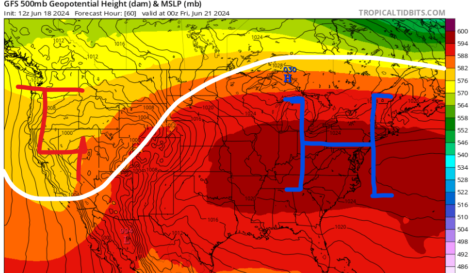
This week we will sit on the southern end of a large area of high pressure that is forecasted to bring dangerous heat to the Midwest and Northeast. The ridging pattern should help our area climb into the mid and upper 90s later this week and into the weekend. High pressure to the north will provide lots of sunshine for our area which can quickly heat up the atmosphere.
As far as rain chances, an isolated shower or thunderstorm can’t be ruled out for the rest of the week mostly along and south of the Highway 84 corridor, due to the intense afternoon heating.

Cloud cover over the next couple of days should help most of us stay near 90 degrees, however, by this weekend, more sunshine and lighter surface winds will be present due to the aforementioned high pressure. Temperatures are forecasted to be in the mid to upper 90s with heat index values over 100 degrees.
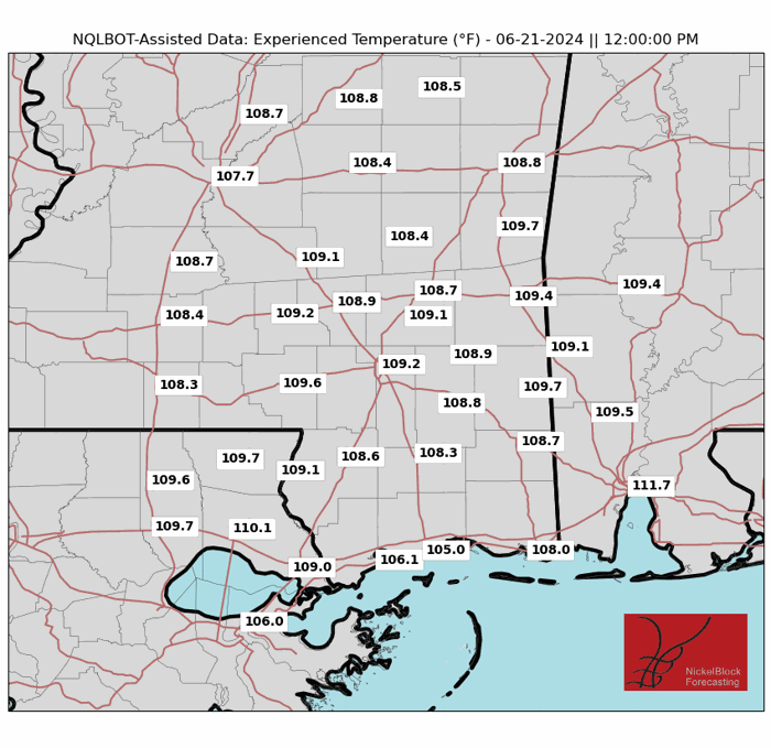
On Friday, it’ll feel closer to 110 degrees for cities like Hattiesburg, MS and Mobile, AL. For Saturday, the worst heat will be along I-20 from Jackson, MS to Meridian, MS.
Be sure to drink plenty of water and try to get your outdoor activities done either early in the morning or in the evening. Also, remember to be aware of children and pets during this dangerous heat as heat-related illnesses can occur quickly.
Quick Tropical Update
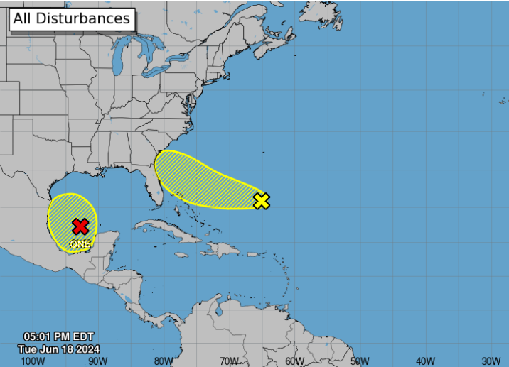
We have three areas we are closely monitoring in the tropics this week.
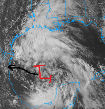
First, Potential Tropical Cyclone One has formed over the southwest Gulf of Mexico and is forecasted to slowly move off to the west-northwest before making landfall in Mexico late Wednesday evening. This system has brought cloud cover and a few showers across southern Louisiana. Heavy rainfall will be the main story with this as locations in south Texas could see up to 10″ of rain over the next couple of days.
Second, a disorganized area of showers and thunderstorms east of the Bahamas is forecasted to approach the southeast coast this weekend. Unfavorable dry air should limited the development of this, but an increase in cloud cover and rain is likely for the Georgia and Florida coastlines.
Finally, a new area of showers and thunderstorms is expected to move into the southwest Gulf of Mexico late this weekend. Slow development is possible as we head into next week, so there could be more rain on the way for areas like Texas.


