Our first system of the season is official! Tropical Storm Alberto brings plenty of heavy rain to Mexico and southwest Texas overnight and through the day tomorrow as it moves across Mexico. While all the attention is on Alberto, we need to keep an eye on our two new areas of interest north of The Bahamas and in the southwest Gulf of Mexico (same spot as Alberto) as we continue through the week.
TROPICAL STORM ALBERTO:
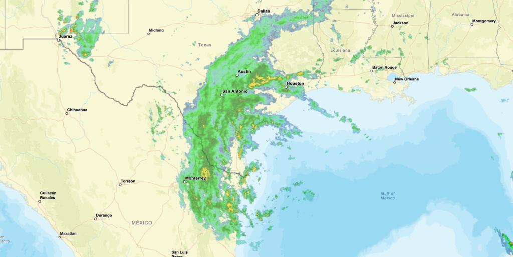
Alberto is expected to start moving west soon and continue before it reaches the Gulf coast of Mexico early Thursday. Alberto might get a bit stronger tonight before hitting land, but once moving inland it will weaken and likely break apart over Mexico by Thursday or Thursday night.
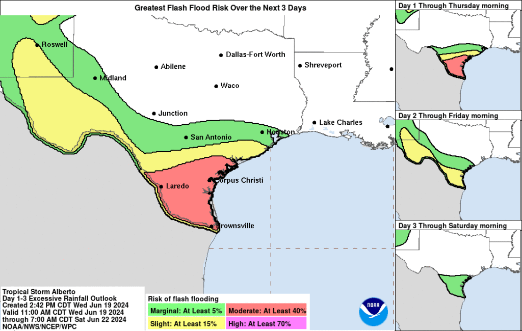
Alberto is expected to bring 5 to 10 inches of rain to northeast Mexico and South Texas, with up to 20 inches possible in the higher elevated areas in Mexico. This large amount of heavy rain will likely cause flash floods and river flooding in these areas subject to high precipitation amounts. Mudslides are also possible in the hilly areas of northeast Mexico.Coastal flooding is also a concern due to the storm surge combined with the higher tide. Water levels may rise 1 to 3 feet along the northeastern Mexican coast as winds push water ashore.
As Alberto pushes through, extreme caution should be taken with the flooding concern as well as storm surge in coastal areas.
AREAS OF INTEREST:
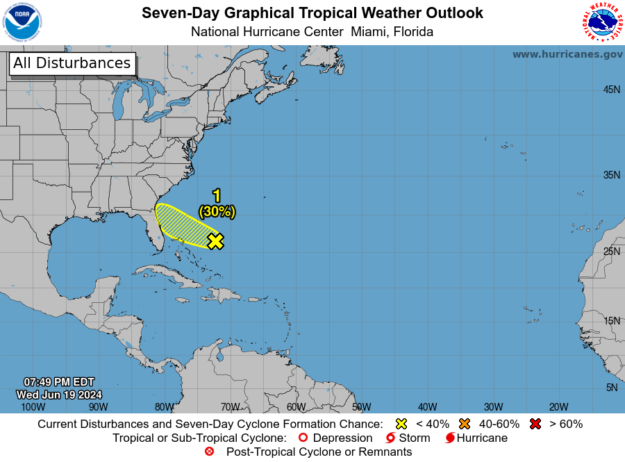
Up first, there is an area of low pressure to the north of The Bahamas with disorganized showers and storms. Further development is unlikely thanks to drier air in the area. However, there is a 30 percent chance of organizing as it moves towards north Florida/Georgia by Friday. Regardless of the system organizing, it will bring rain to the coast of Florida/Georgia over the weekend.
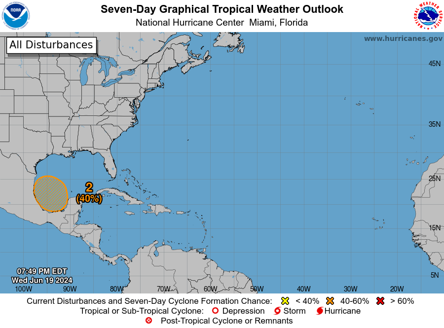
Next, there is a broad area of low pressure bringing more showers to the same area being impacted by Tropical Storm Alberto. Conditions are pointing to gradual development and organization with a 40 percent chance for development over the next seven days. It is still very early to tell, so we will keep an eye on this area.


