Happy Wednesday! Its been a hot start to the week, and its gonna stay that way through the remainder of the week and well into the weekend. We have a high-pressure ridge in the northeastern part of the country to thank for the constant heat this time around. Highs will be in the 90s, with a couple of areas nearing the triple digits soon. With the sun, humidity, and wind, the experienced temperatures will be well into the 100s.
MORE HEAT AND LESS RAIN:
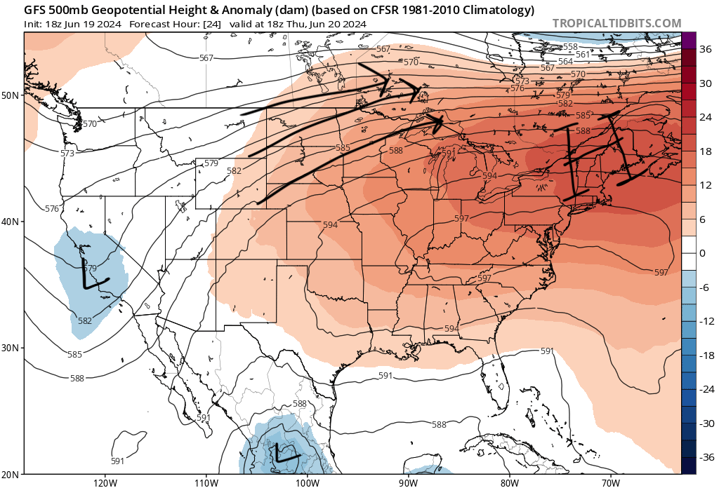
The high-pressure ridge up to the northeast is contributing to hotter, more humid, and generally drier conditions in our area. This stable weather pattern reduces the likelihood of widespread storms but does not completely eliminate the potential for isolated afternoon thunderstorms due to afternoon heating. The next few days are expected to be mostly/partly cloudy, which will keep the temperatures closer to 90, but the sunshine will be back this weekend.
Adding in factors like humidity, direct sunlight, and lack of wind, the experienced temperatures feel much worse then the actual temperature. Staying hydrated and out of the sun for too long is very important to consider as we head into the weekend.
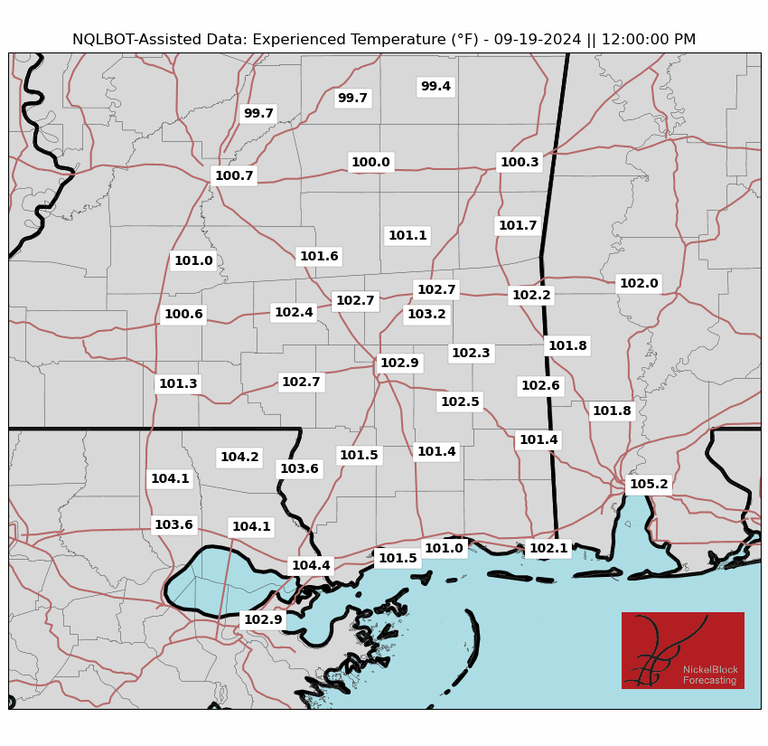


Below is a graph of the average high temperature for each location over the course of 9 days for Hattiesburg and smaller towns surrounding it. This shows how close to the 100s the temperatures are going to be though the weekend and into next week.

TROPICAL UPDATE:
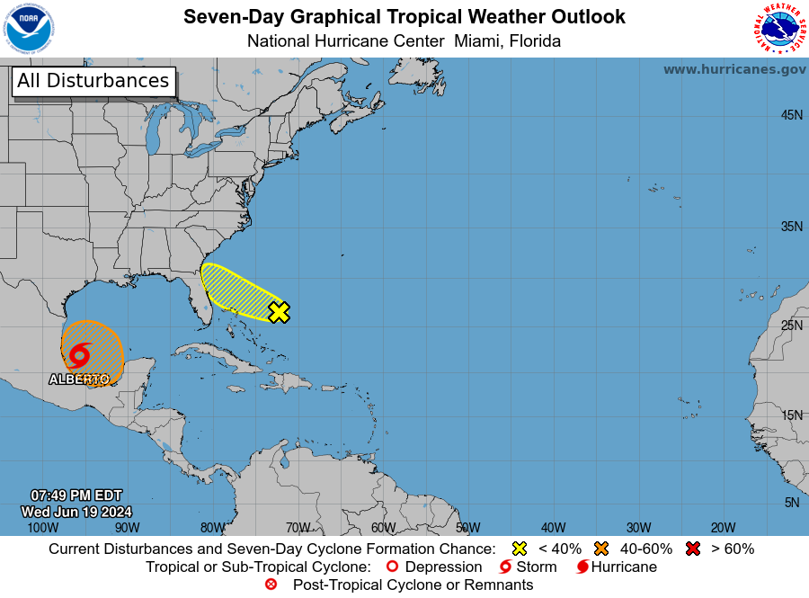
Tropical Storm Alberto is the main topic in the tropics currently as it was officially declared the first named storm of the 2024 Hurricane Season. It has brought plenty of rain to Mexico/Southern Texas throughout the day and will potentially strengthen overnight before making landfall and weakening again. Flash flooding is the main concern that Alberto brings.
There are two other areas of interest, one north of The Bahamas and the other in the same area that Alberto started out. The area in the Atlantic has a 30% chance of further development and will bring rain to the east coast along Florida, Georgia, and South Carolina. The Gulf area currently shows promise with its development, but it is still too early to determine what will happen.


