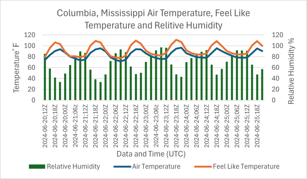
Hello, everyone; I hope that you had a great week and day off yesterday. Looking at our region for the next several days, most of the area should see average temperatures for this time of year. That means that forecasted high temperatures should be in the low 90s, and forecasted low temperatures should be in the mid-70s. Looking at rainfall chances, most of the region should be dry through the weekend, but an isolated thunderstorm or shower can’t be ruled out. Looking at the tropics, we are examining two potential systems that could form in the next several days.
Average temperatures are expected through the weekend, with a warm-up next week
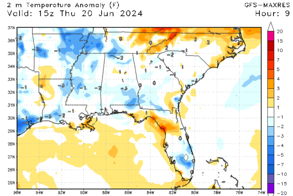
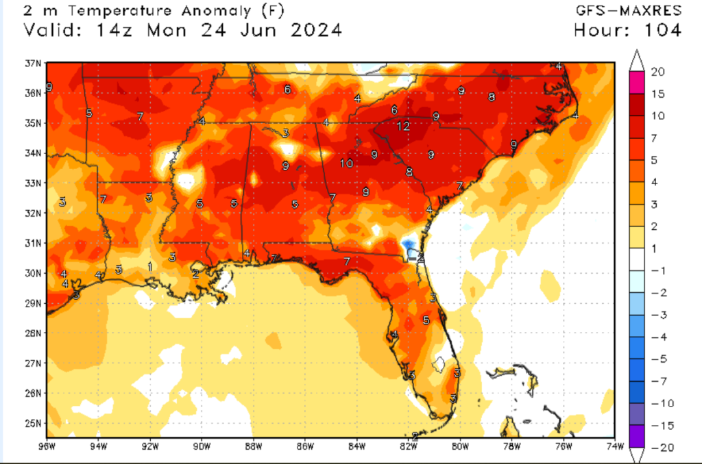
Looking at our region’s forecasted temperatures over the next few days, most of the area should see average highs and lows. The heat dome that is baking in the northeast is allowing our region to get some relief from the heat. Temperatures are expected to be in the low 90s for areas inland, with heat indexes in the mid-90s. Areas near the coasts should see highs in the mid to upper 80s today. Unfortenly, after this weekend, temperatures are expected to climb to above-average values. This is being caused by an area of high pressure that is forecasted to lock into our region by early next week. The spinning motion of this high pressure will draw in warm, moist air from the tropics. Temperatures could reach the mid to high 90s, with heat index values as high as 110 degrees in the afternoon. This center of high pressure is expected not only to push temperatures to above-average values but our rainfall chances are also expected to increase.


Little rain this weekend but a wet week next week
Looking at our rain chances for the next few days, we should see little to no chances of rainfall this weekend. Most of the moisture that the region typically sees is being drawn in by Tropical Storm Alberto, which is currently impacting Northeast Mexico. Because of this, our region should see partly cloudy skies and little to no expected rainfall. That being said, it is still summer, and I can’t rule out an isolated daytime convective shower or two, especially along the coastline. As the heat builds next week, look for more convective activity along the coastline. This will increase the chances of showers and thunderstorms, which could produce heavy rain in certain spots. If your area experiences heavy rainfall in a short time, remember that flash flooding could be an issue, so avoid flooded areas.
A quick look at the tropics

Looking at the tropics, I am keeping a close eye on two potential systems in the Atlantic. The system that is located off the coast of Florida should pose no threat to our region, as it’s expected to move northeast of the Gulf Coast. The system off the coast of Belize and Honduras could organize into a possible tropical system this weekend as it moves into the Gulf of Mexico. There is plenty of moisture in the region, and windshear values are expected to weaken through the weekend, increasing the likelihood of development. The question is whether this system moves to our area or not. Current models are trending in a northwest movement, but this could change at any time. If you want more information on the tropics, please read our tropical weather discussions on the website.
5-day outlook and conclusions
Overall, I am forecasting average temperature for the next 3 days. By Monday, a warm-up is expected for the next few days as high pressure is expected to dominate the region. Looking at our rain chances, this weekend should be pretty dry, with next week seeing a higher chance of rainfall, especially for coastal communities. I am keeping a close eye on this potential tropical system that could develop in the next few days. Thanks for reading, and have a great weekend.


