The gradient wind from the last 48 hours should relax a bit today, but we may still catch a couple of gusts up to 20mph. That wind should help to bring drier air into the area as a high-pressure system stretches from the mid-Atlantic states into the Mississippi Valley. This means limited chances for showers and storms, mostly confined to the coastal areas due to Tropical Storm Alberto moving west into Mexico.
High pressure and dry air will dominate the end of this week. Temperatures will gradually rise, reaching the upper 90s to near 100 by Sunday. Most areas will stay dry, but a few isolated showers or storms could pop up, especially closer to the coast.

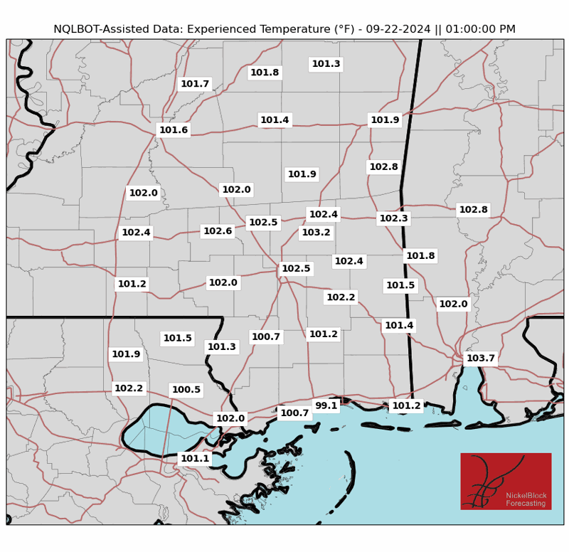
That said, by Sunday, winds will shift to come from the south, increasing humidity with dew points in the lower 70s. This may make it feel a bit hotter, though, I tend to think it will already be plenty hot. The Experienced Temperatures – which factor in sunlight, dewpoint, humidity, wind and temperature – for both Saturday and Sunday look to be around 110F.
Or, as our friend “Doge” might describe it:

As we move into next week, the high-pressure system will start to break down and shift westward, leading to a more unstable weather pattern. Moisture will increase, bringing more widespread showers and storms, especially in the afternoons. It will stay hot, though.
By Wednesday-Thursday, increased rain will start to affect high temperatures. There’s also a chance a cold front might bring some relief toward the end of the week with a brief period of drier air. We’re also keeping an eye on the tropics, as there’s potential for development in the southwestern Gulf of Mexico and off the Southeast US coast. However, none of this activity is expected to significantly impact our weather through the middle of next week.
REGIONAL DAY TO DAY FORECAST
Today: Sunny. A slight chance of showers and thunderstorms this afternoon. Highs in the lower 90s. East winds 5 to 10 mph with gusts up to 20 mph. Chance of rain 10 percent.
Tonight: Partly cloudy in the evening, then clearing. Lows in the lower 70s. East winds around 5 mph.
Friday: Sunny. Highs in the mid 90s. East winds 5 to 10 mph.
Friday Night: Mostly clear. Lows around 70. Southeast winds around 5 mph in the evening, becoming light and variable.
Saturday: Sunny. A slight chance of showers and thunderstorms in the afternoon. Highs in the mid 90s. Northeast winds around 5 mph, becoming southeast around 5 mph in the afternoon. Chance of rain 10 percent. Experienced Temperatures around 110F.
Saturday Night: Mostly clear. Lows in the mid 70s.
Sunday: Sunny. A chance of showers and thunderstorms in the afternoon. Highs in the mid 90s. Chance of rain 30 percent. Heat index values up to 105, Experienced Temperatures around 110F.
Sunday Night: Mostly clear. Lows in the mid 70s.
Monday: Mostly sunny. A chance of showers and thunderstorms in the afternoon. Highs in the upper 90s. Chance of rain 40 percent. Heat index values up to 110. Experienced Temperatures around 110F.
Monday Night: Partly cloudy in the evening, then clearing. A slight chance of showers and thunderstorms. Lows in the mid 70s. Chance of rain 20 percent.
Tuesday: Mostly sunny. A slight chance of showers and thunderstorms in the morning, then a chance of showers and thunderstorms in the afternoon. Highs in the upper 90s. Chance of rain 30 percent. Heat index values up to 110. Experienced Temperatures around 110F.
Tuesday Night: Partly cloudy with a chance of showers and thunderstorms. Lows in the mid 70s. Chance of rain 50 percent.
Wednesday: Mostly sunny. A chance of showers and thunderstorms in the morning, then showers and thunderstorms likely in the afternoon. Highs in the mid 90s. Chance of rain 40 percent. Heat index values up to 105. Experienced Temperatures around 110F.


