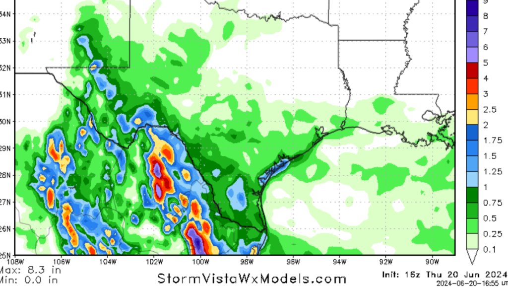
Hello there; I hope that you had a great week and day off yesterday. We have quite a lot of severe weather going on throughout the United States. Currently, the Northeast is going through a major heatwave, with temperatures well above average for this time of year. Looking at our first tropical cyclone this year, tropical storm Alberto has made landfall in Mexico and has dropped heavy rain in southern Texas. The heavy rain is expected to continue through today before letting up tomorrow. Looking at our severe weather threat for today, areas of the northern plains and parts of the interior Northeast are in the hot seat for severe weather.
The heat continues for the Northeast, but relief is sight.
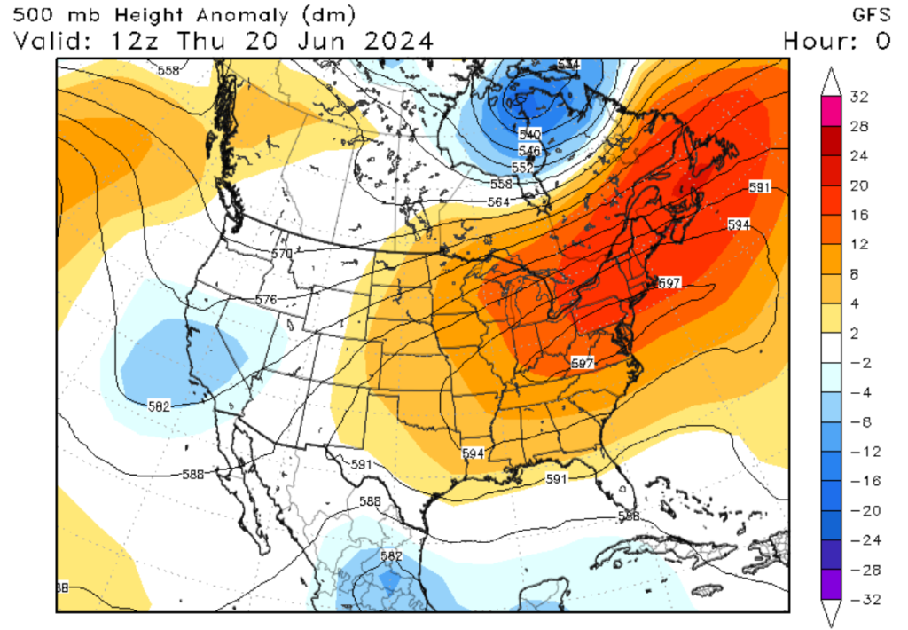
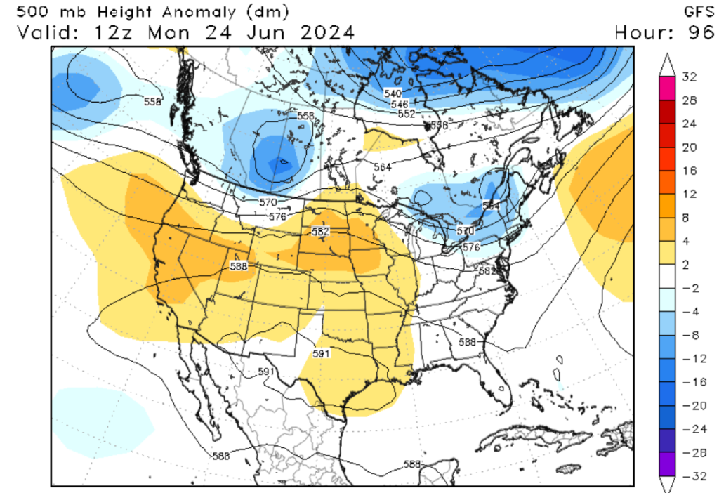
If you have been looking at temperatures for the last couple of days, you may have noticed that the Northeastern U.S. has been abnormally hot for this time of year. This is thanks to a prominent ridge of high pressure that has dominated the Eastern U.S. for the last few days. This ridge has caused the jet stream to move far to the north, allowing warm air from the tropics to settle into the Northeastern U.S. I’m sorry to say, but the heat is expected to continue today and tomorrow before finally starting to break this weekend, as a low-pressure system and cold front is expected to move through. High temperatures across the Northeast are expected to reach the mid-90s, with heat indexes expected to pass 100 degrees Fahrenheit. The areas that are expected to see the most significant impacts today are parts of Upper New England and Western Pennsylvania, as these regions typically don’t see temperatures this high. Please continue to take the necessary steps to keep cool today and tomorrow.
Alberto has made landfall.
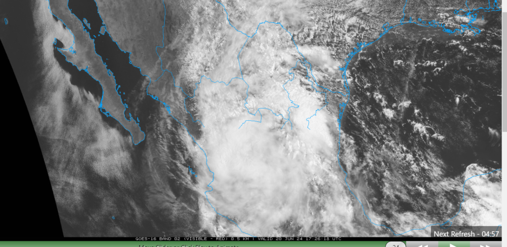
If you have paid attention to the tropics over the last couple of days, you may have seen that we have our first named storm of the season in the Atlantic basin. The storm (named Tropical Strom Alberto) has officially made landfall in Northeast Mexico. Although South Texas escaped a direct landfall, the effects are still being felt. As of 12 PM CDT, Alberto has weakened to a tropical depression as it continues into Mexico, but that does not mean that South Texas is out of the woods yet. Areas of Southern Texas could see an additional 2-4 inches of rainfall on top of the rain that has already fallen. Please remember to never drive through a flooded roadway and to be careful of storm surges if you live along the coastline. For more information on the tropics, feel free to read our tropical weather outlook.
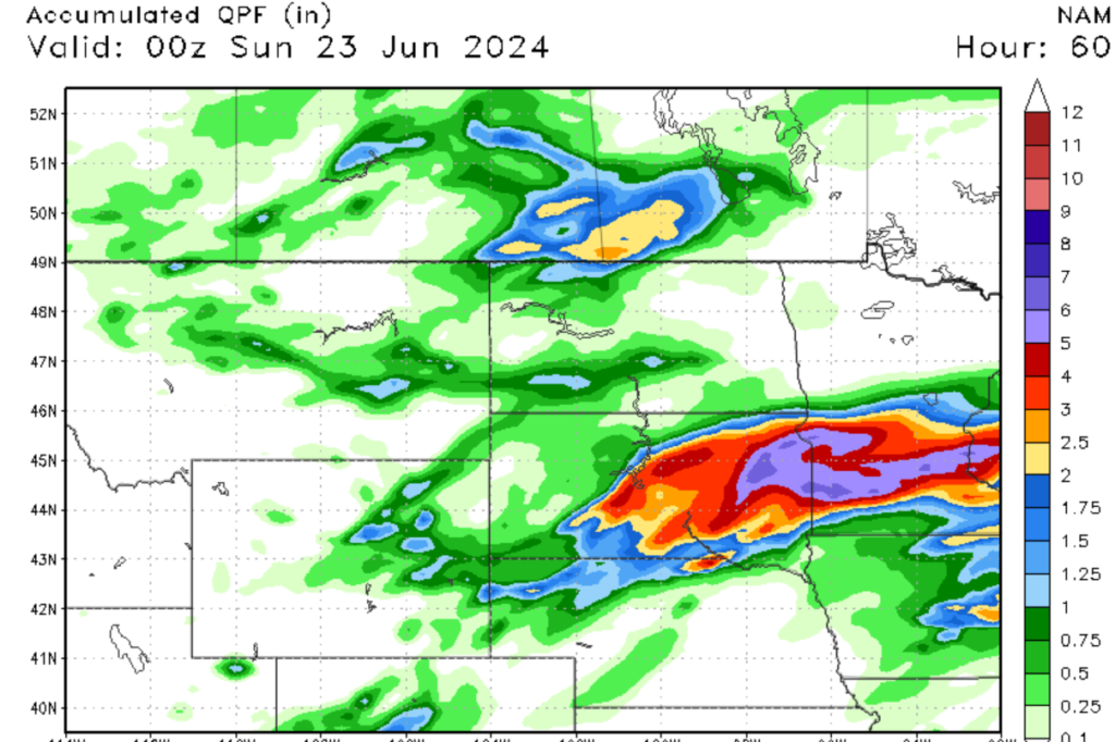
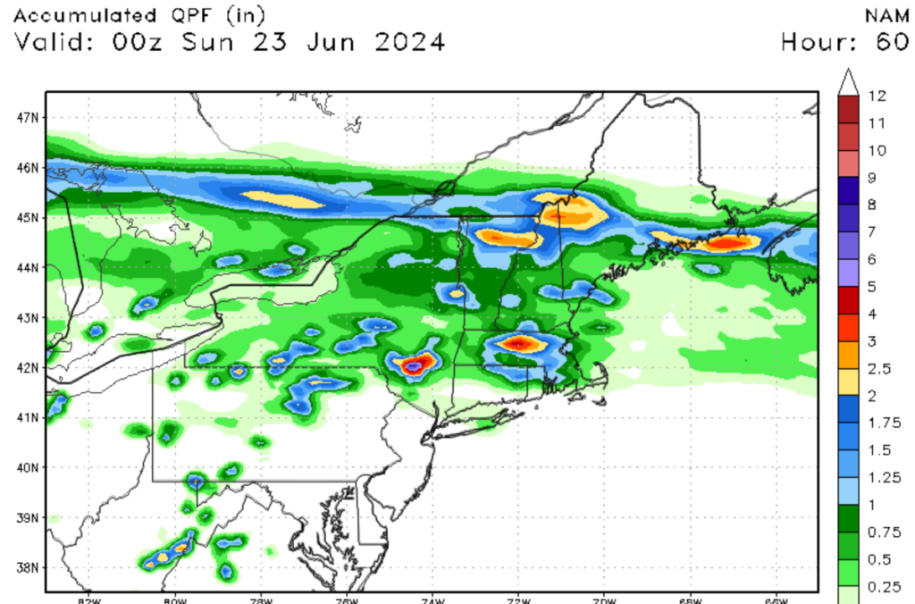
Severe weather and flooding expected across parts of the Northern U.S.
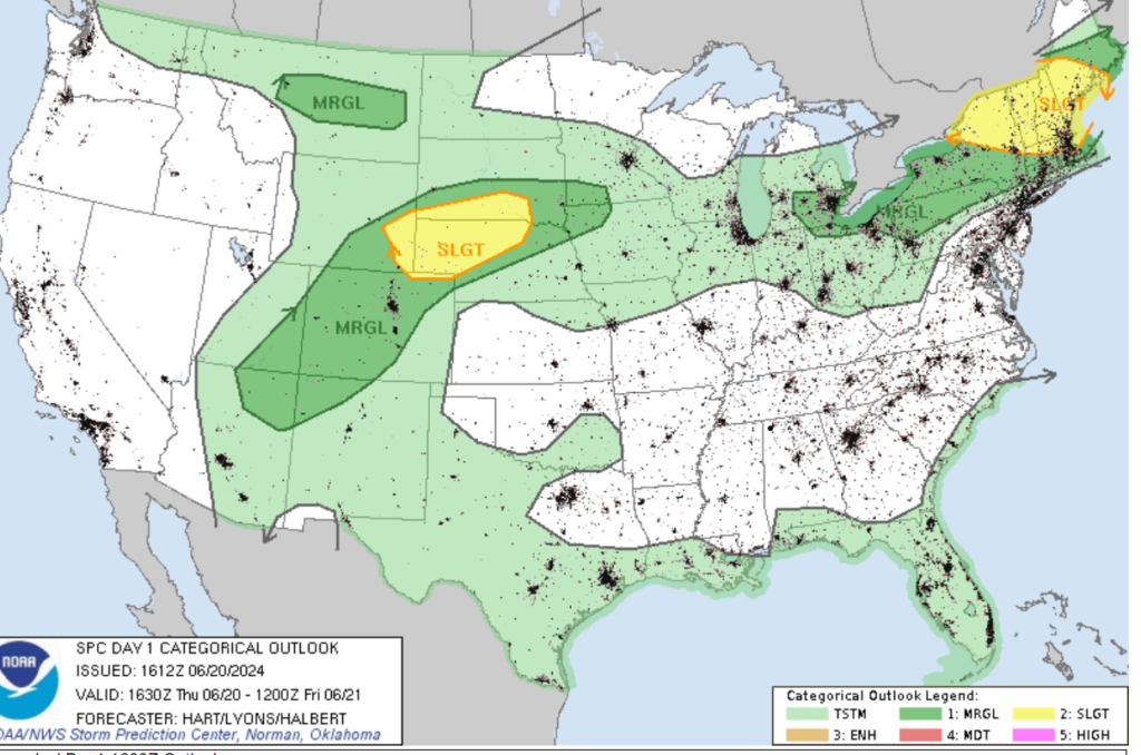
Looking at today’s severe weather threat, there are two areas I am keeping an eye on. Those are parts of Nebraska and interior New England, which are under a level 2 or slight risk of severe weather. Looking at the Northeast, the hot and humid conditions prevailing are causing instability in the upper atmosphere. CAPE values are over 2000 j/kg, and a well-defined MCS system is forecasted to interact with the unstable atmosphere. This will result in scattered severe storms throughout this afternoon and into this evening. The primary threat from these storms will be high winds and heavy rainfall, which could cause localized flash flooding. Looking back to Nebraska, southerly flow and strong windshear in the lower atmosphere will help maintain a moist and unstable atmosphere. This will allow for daytime convective heating to produce the lift needed for severe thunderstorms and supercell development. Not only will these scattered storms produce high winds and heavy rainfall, but the embedded supercells could also produce localized large hail and an isolated tornado or two. Localized flooding is also a concern with these storms, so please make sure to take the necessary flooding precautions. Speaking of flooding, areas of Eastern South Dekoda, Eastern Utah, and Western Minisoda can expect to see heavy rainfall associated with this southerly flow.
Overall, there is quite a lot of exciting and extreme weather in the Continental U.S. today. Please remember to always be weather-ready, stay safe, and check the website for the latest weather news and updates.


