Early this morning, a weather system is moving over the Gulf Coast while a high-pressure system is centered over central to southwestern Texas. High moisture levels are present, which will persist through the afternoon. Patchy dense fog is possible this morning due to calm winds and the recent rain, so please be careful if you’re out the door early.
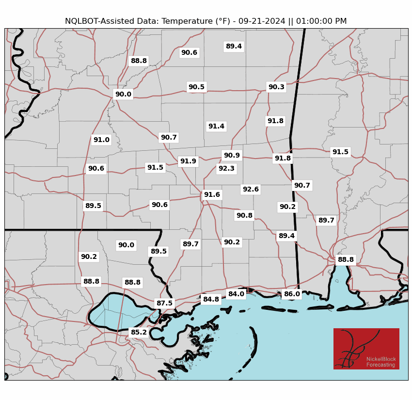
Highs today will top out between 90F to 95F again, with the ‘Experienced Temperature’ around 100F to 105F. It looks like the wind may be helping us out a bit to keep the ETs from tagging 110 like a few weeks back.
There is also a shot for some rain today. It isn’t a “great” shot, but it is there. Looking at the vertical motion map (below, left) and the RAP model seems to think we will have a good bit of vertical motion (orange and red shading) across the area. This would mean a good chance for showers and storms to develop. But the HRRR model’s radar estimate (below, right) shows only a handful of storms actually developing.
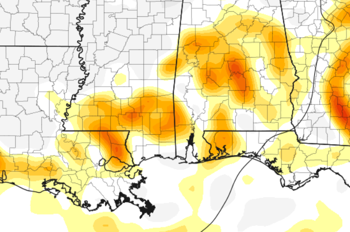
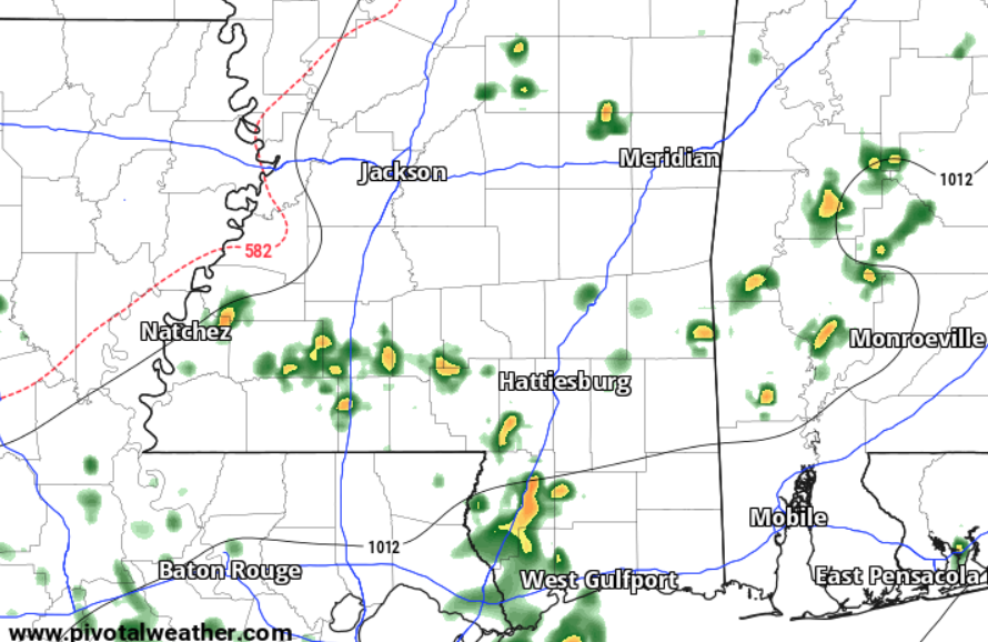
After looking at the Skew-Ts for both models, I’ve got to say that I bet we see more storms today than shown on the map from the HRRR. I’m going to hold the chance for rain for the area around 30 to 40 percent, but some folks I think may have a decent shot for rain – particularly along the HWY 98 corridor.
In short: 11a through 7p looks to be the best chance for rain across the entire area. But the better chance for rain will be further south.
Once we get through today, the heat will intensify a bit over the weekend as a high-pressure system strengthens over Texas and moves towards our area. I don’t know that the air temperature will be that much hotter, but we will have fewer showers and storms in teh area, the wind will die down and the humidity will poke up a bit.
The heat will continue into early next week, particularly along and south of the I-20 corridor even though a frontal boundary is expected to approach by Sunday afternoon and Monday. The weak front will offer an increased chance of showers and thunderstorms, but won’t break the grip of the heat.
REGIONAL DAY TO DAY FORECAST
Today: Mostly sunny. A slight chance of showers and thunderstorms this morning, then showers and thunderstorms likely this afternoon. Highs in the lower 90s. Southwest winds 5 to 10 mph. Chance of rain 40 percent. Heat index values up to 105.
Tonight: Partly cloudy with a chance of showers and thunderstorms. Humid with lows in the mid 70s. South winds 5 to 10 mph. Chance of rain 20 percent.
Saturday: Partly sunny. A chance of showers and thunderstorms in the morning, then showers and thunderstorms likely in the afternoon. Humid with highs in the lower 90s. South winds around 5 mph. Chance of rain 20 percent. Heat index values up to 105.
Saturday Night: Partly cloudy. A slight chance of showers and thunderstorms in the evening. Humid with lows in the mid 70s. South winds around 5 mph in the evening, becoming light and variable. Chance of rain 10 percent. Heat index values up to 105 early in the evening.
Sunday: Mostly sunny. A slight chance of showers and thunderstorms in the morning, then showers and thunderstorms likely in the afternoon. Humid with highs in the mid 90s. Northwest winds around 5 mph. Chance of rain 30 percent. Heat index values up to 105.
Sunday Night: Mostly cloudy with a chance of showers and thunderstorms in the evening, then partly cloudy after midnight. Lows in the mid 70s. Chance of rain 10 percent. Heat index values up to 105 early in the evening.
Monday: Mostly sunny. A slight chance of showers and thunderstorms in the morning, then a chance of showers and thunderstorms in the afternoon. Highs in the mid 90s. Chance of rain 30 percent. Heat index values up to 115.
Monday Night: Partly cloudy with a slight chance of showers and thunderstorms in the evening, then mostly clear after midnight. Lows in the mid 70s. Chance of rain 10 percent. Heat index values up to 110 early in the evening.
Tuesday: Mostly sunny. A slight chance of showers and thunderstorms in the morning, then a chance of showers and thunderstorms in the afternoon. Highs in the lower 90s. Chance of rain 30 percent. Heat index values up to 110.
Tuesday Night: Partly cloudy in the evening, then becoming mostly clear. Lows in the mid 70s. Heat index values up to 105 early in the evening.
Wednesday: Mostly sunny. A slight chance of showers and thunderstorms in the morning, then a chance of showers and thunderstorms in the afternoon. Highs in the mid 90s. Chance of rain 20 percent. Heat index values up to 110.
Wednesday Night: Mostly clear. Lows in the mid 70s. Heat index values up to 105 early in the evening.
Independence Day: Sunny. A chance of showers and thunderstorms in the afternoon. Highs in the mid 90s. Chance of rain 20 percent. Heat index values up to 110.


