Happy Friday! This weekend is expected to bring us some slightly cooler temperatures and some scattered thunderstorms thanks to a cold front making its way into the region. While we will be seeing some cooler temperatures, it is only temporary. As we start next week, a high-pressure ridge will once again dominate the country and bring back the above-average heat we love so much.
COLD FRONT BRINGS COOLER TEMPS AND SCATTERED STORMS:
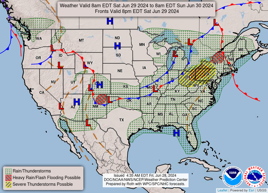
Looking at the images above, here is a cold front that will be making its way to our area Saturday indicated by the left image. This front is expected to bring plenty of scattered thunderstorms as well as some cooler temperature with highs peaking in the lower 90s. While the severe weather threat is low, some storms could be particularly strong and result in some damaging winds or hail.
Taking a look at some local areas, highs along the coast will stay closer to the high 80s or very low 90s while the temperatures slowly rise closer to the mid 90s the further inland you get. The chance for rain is the highest near the coast and to the south of HWY 98, but with storm development thanks to diurnal heating and high moisture levels from the gulf.


Saturday will see highs a little lower than usual, but still hot enough to require limited time outside in the heat. If the heat doesn’t keep you inside, then maybe the chance for some scattered storms will. These storms are expected to start in the afternoon hours and gradually make their way through the area.
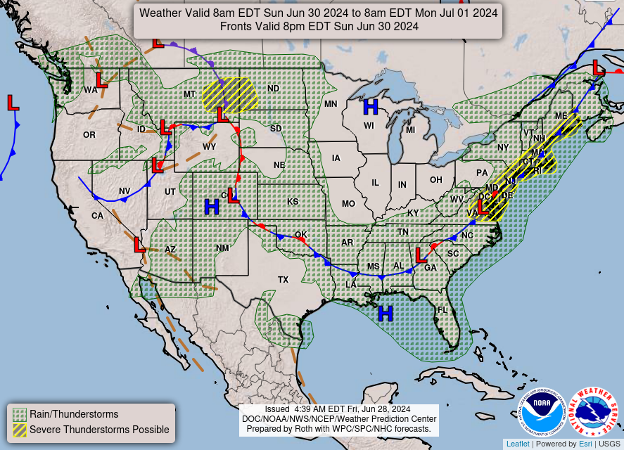
Sunday will be more or less the same setup, with temperatures slowly climbing again due to the high-pressure ridge building in the plains and scattered afternoon thunderstorms. As we start next week, however, temperatures will be back up as the high-pressure systems continues to dominate. This means another couple days of high temperatures and potential for pop-up storms.
LOOKING FURTHER OUT:
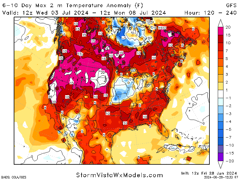
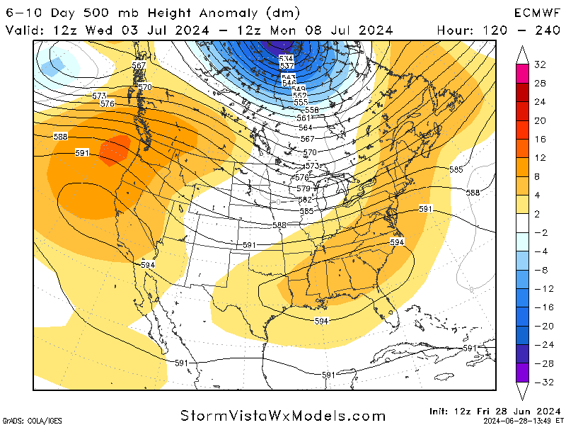
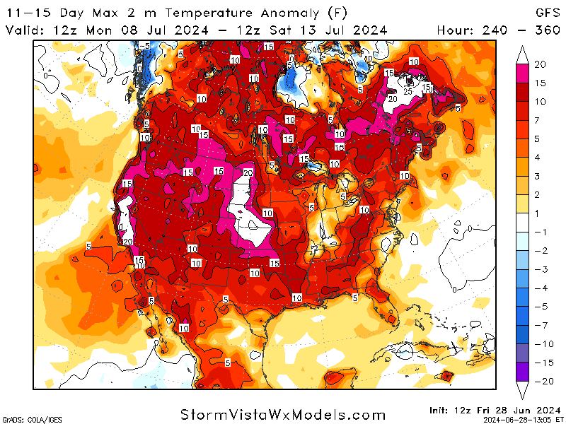
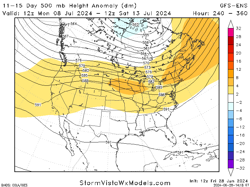
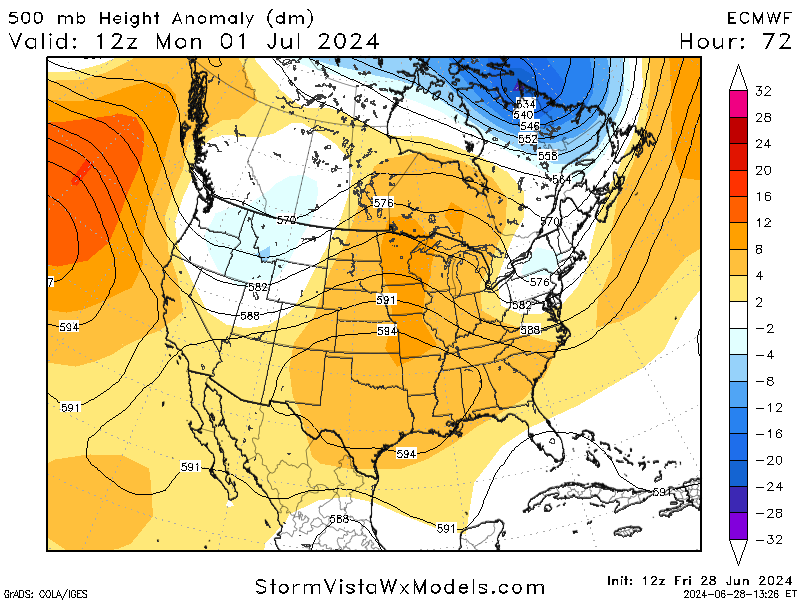
As we look further out past this next week, it is evident that we will be experienced more above-average heat as we continue through the summer. The addition of moisture from the gulf into our area also helps these temperatures stay high and humid. This prediction is supported by multiple models indicating yet another high-pressure ridge dominating the nation. Even though it still too far out to fully trust, it is safe to expect high temperatures for a decent while longer.
BRIEF TROPICAL UPDATE:
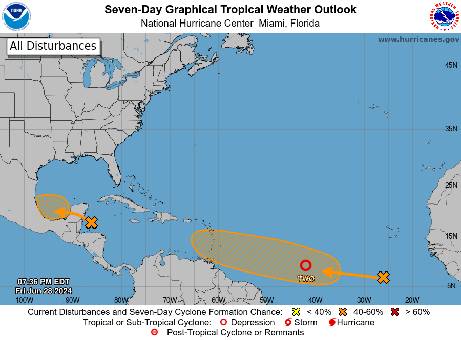
The tropical season continues to ramp up this season with 3 different disturbances that have either developed or are expected to within the next few days.
Invest 94L, which is over the northwest Caribbean Sea, has produced scattered showers and thunderstorms that are not well-organized. The system is not expected to develop into a more organized storm before it moves over the Yucatan Peninsula on Saturday. There is a chance that it could become a tropical depression before moving over Mexico early next week. Whether or not it develops further, the system will bring heavy rainfall to parts of Central America and Mexico.
The second area, which is located a few hundred miles south-southwest of the Cabo Verde Islands, is causing some disorganized showers and thunderstorms. The conditions in the area seem favorable for this system to develop further, and it might become a tropical depression by the middle of next week as it moves westward at 15 to 20 mph across the Atlantic. While there’s almost no chance of this system developing into a tropical storm in the next couple of days, there’s a 40% chance it could become a tropical depression within a week.
Lastly, Tropical Depression 2 is making majority of the headlines as the first potential hurricane of the season.It is expected to strengthen to hurricane status late Sunday night or early Monday morning. The Windward and Leeward Islands will be placed under Tropical Storm and Hurricane watches as the system continues towards the area. Models expect this system to move through the Caribbean, but uncertain where it will end up due to the synoptic systems at play. We will continue to monitor this storm and keep watch of the trends.


