Good evening, everyone! Here is the latest update on Hurricane Beryl and as of the 10 pm CDT update. Beryl is a category 4 hurricane with winds at 150 mph and a pressure of 947 mb. Even with the slight weakening trend, Beryl looks pretty impressive with some convection blowing up around the eyewall this evening.
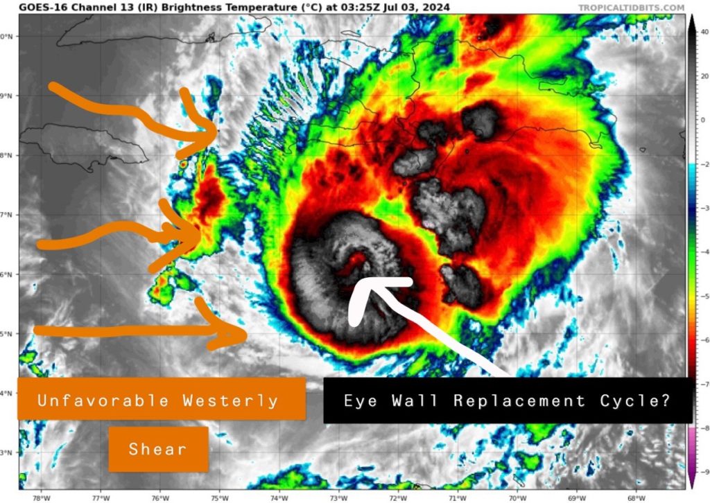
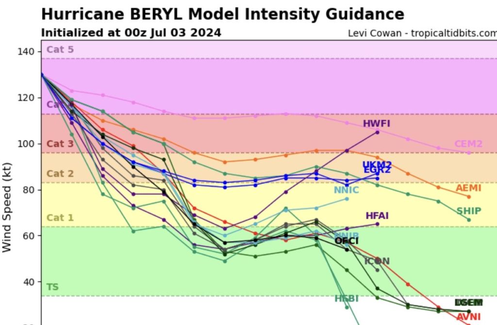
Wind shear off to the west has been the main reason for Beryl’s weakening trend and the intensity will gradually decrease over the next few days. Impacts will still be felt down the line, but the storm likely peaked in intensity last night.
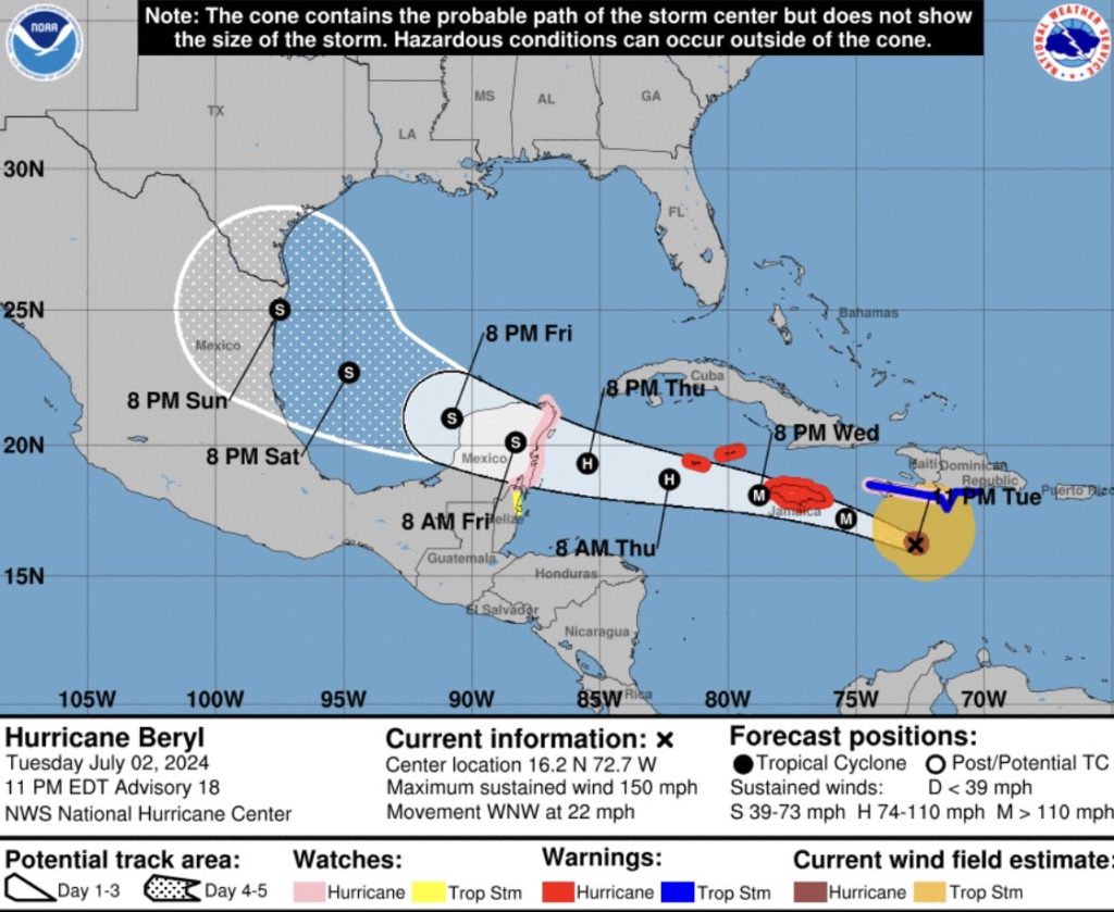
Beryl will continue to track off to the west-northwest and is forecasted to impact Jamaica on Wednesday. The island could very well take a direct hit from a major hurricane, so the National Hurricane Center (NHC) has issued a Hurricane Warning for Jamaica and the Cayman Islands. Conditions will rapidly deteriorate tonight with the worst impacts coming tomorrow afternoon and evening.
MODEL GUIDANCE BREAKDOWN
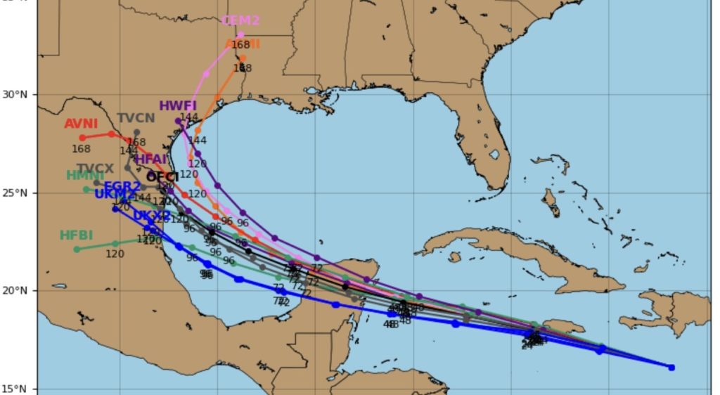
After that, the system is forecasted to move into the western Caribbean towards the Yucatan. This is where models have been disagreeing lately, so I’ve highlighted two possible scenarios:
Option 1: Beryl makes landfall further south of the Yucatan Peninsula which allows it to weaken substantially and leave a narrower window for U.S. impacts.
Option 2: Beryl makes landfall on the northern side of the peninsula which only allows it to weaken a little and has a greater chance to impact the U.S.
ANY U.S. IMPACTS?
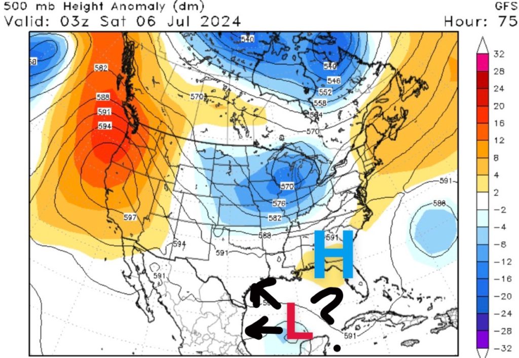
As of now, most of the models take Beryl into the SW Gulf this weekend and have landfall near Mexico or Texas early next week as a strong tropical storm or hurricane. If this were the case, rainfall chances would increase along the Texas coastline, especially on Sunday. Louisiana also needs to pay attention to the latest forecasts in case there is a more northern shift in the track.
In the end, steering patterns late this week into the weekend will be determined by the strength of an area of high pressure across the southeast United States. A weaker high could allow Beryl to pull further northward. A stronger high keeps it more west towards Mexico. It’s still too far out to tell, so continue to check the latest forecast posted here.


