With the progress that Hurricane Beryl has made, I’m sure everyone is curious as to what will happen and where it will go next. Beryl is currently a lower end Category 4 storm with a central pressure of 959mb and 140 mph winds. Jamaica is currently facing Beryl’s wrath as it’s storm eye brush by the south side of the island, bringing heavy rainfall, destructive winds, and significant storm surge that increases the threat of coastal flooding. Let’s jump into the details!
CURRENT CONDITIONS:
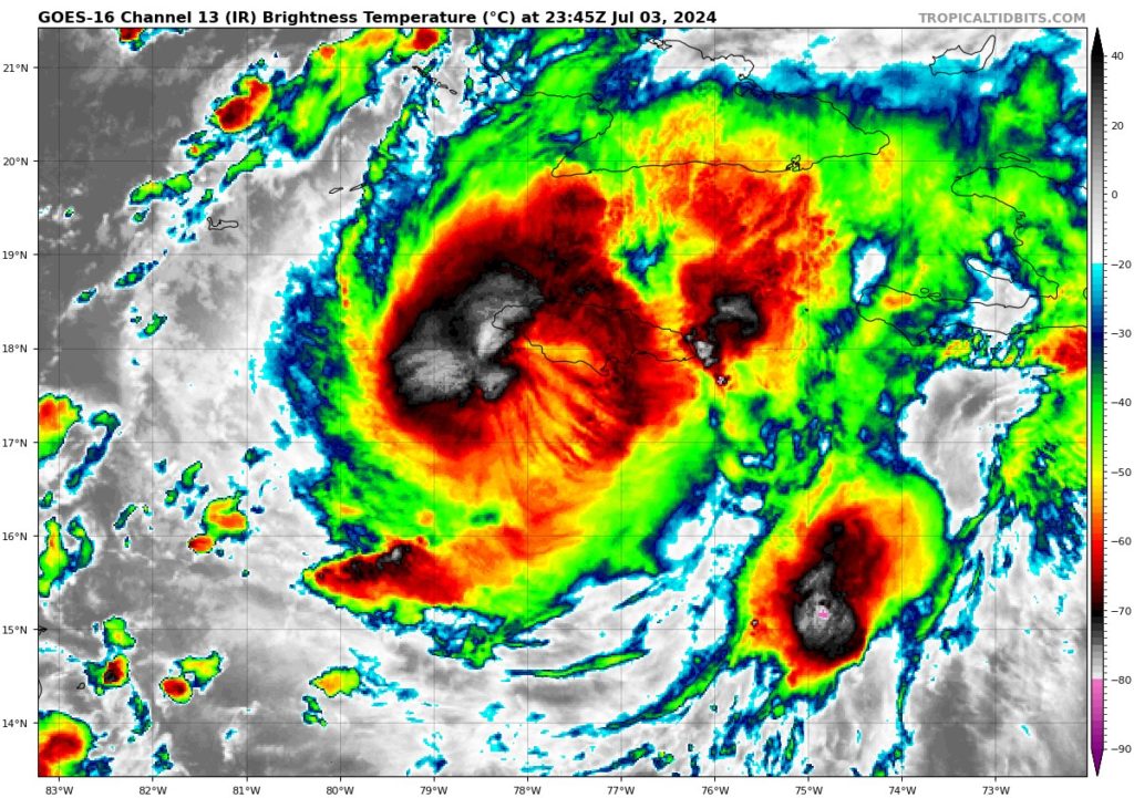
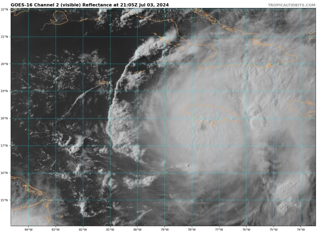
Although strong wind shear from the west is still affecting Hurricane Beryl, its central core has has shown signs of re-intensification this afternoon. The eye of the hurricane is now more visible on Cuban radar and satellite images. It’s not clear if the hurricane has gotten stronger, so the NHC is keeping its intensity at 120 knots (140 mph) until the next aircraft checks in with updates on intensity and position.
Even with these signs or strengthening, it is very unlikely that Beryl will return to Category 5 status. It is still expected to weaken below major hurricane status (Category 3 or higher) by Thursday afternoon according to the models and continue this trend as it moves over the Yucatan Peninsula, so we will be sure keep an eye on this and update if needed.
WHATS NEXT?
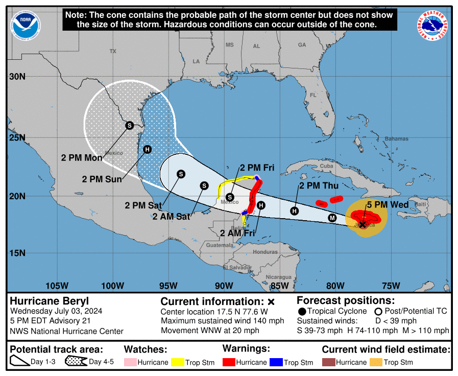
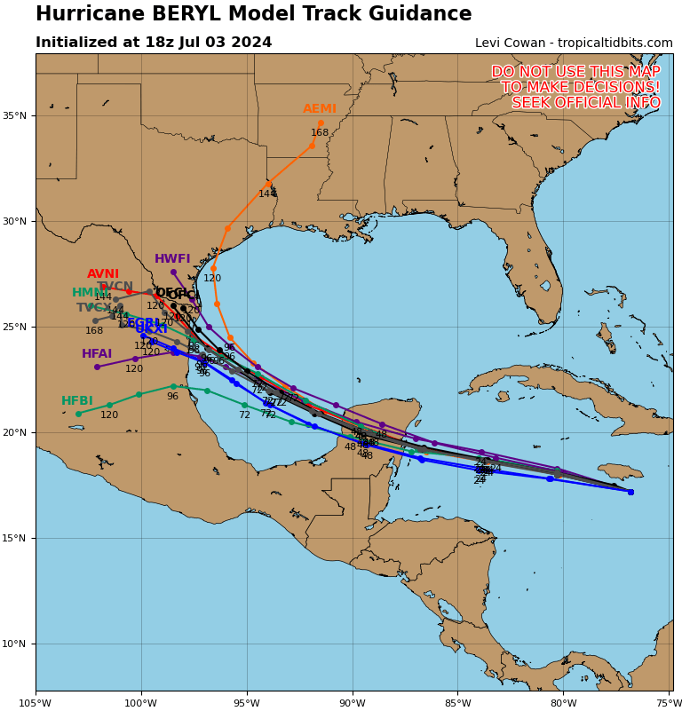
A strong weather system over the southeastern U.S. is expected to keep pushing Beryl west-northwest, but at a slower speed for the next few days. This should bring the center of the hurricane south of the Cayman Islands tonight. After that, Beryl is expected to reach the Yucatan Peninsula of Mexico early Friday morning and move into the southwestern Gulf of Mexico by late Friday night/early Saturday morning. Once over the Gulf, Beryl should head northwest toward a gap in a high-pressure area caused by a large low-pressure system over the central U.S. The different weather models are now in better agreement, so the forecast path has been adjusted slightly southwest. However, there’s still uncertainty, and a landfall in Texas can’t be ruled out.
Beryl will likely face some strong winds from the west for the next 24 hours, and moderate winds are expected until it reaches the Yucatan. This should weaken the hurricane as it moves across the peninsula. The forecast predicts Beryl will become a tropical storm while crossing Yucatan. There’s less confidence that Beryl will get much stronger again over the Gulf of Mexico, but the upper-level winds look favorable, so the forecast still expects Beryl to regain hurricane strength once it’s over the Gulf.
WHAT ELSE IS HAPPENING?
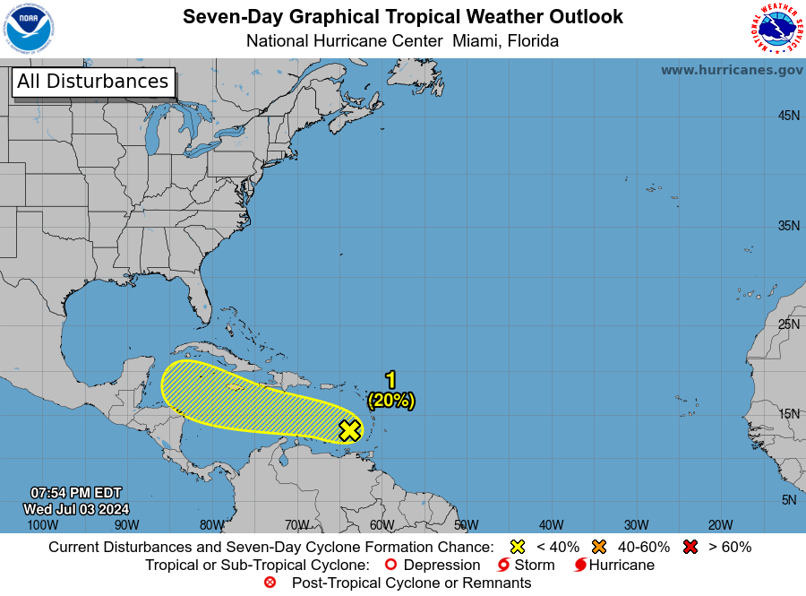
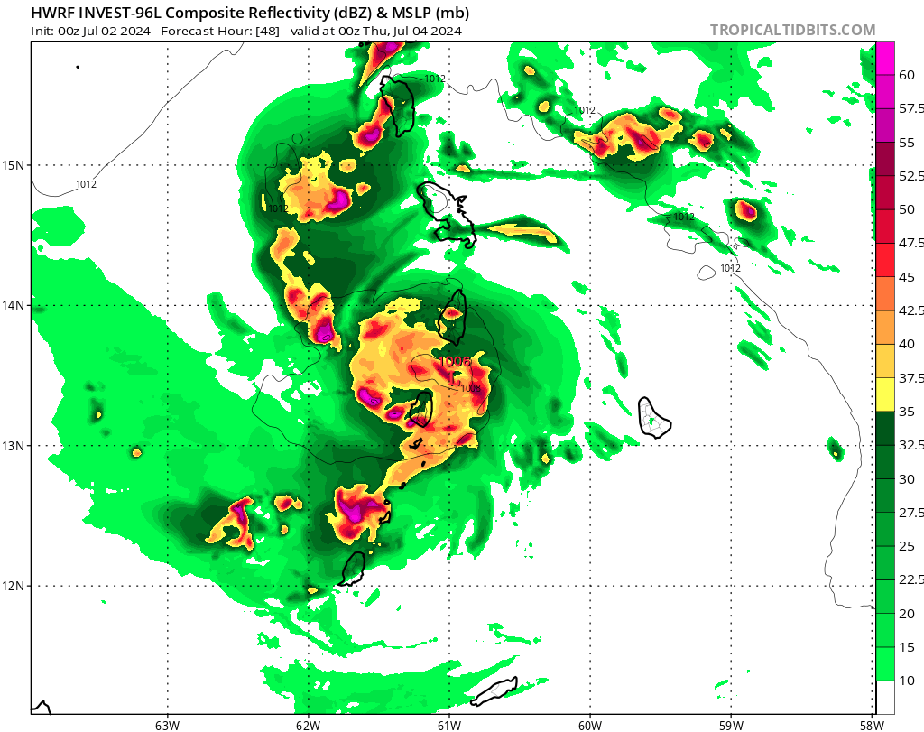
Invest 96L currently has a 20 percent chance of formation in the next 7 days. It is currently located in the southeastern Caribbean Sea is causing some scattered showers and thunderstorms. It’s moving quickly west to west-northwest at 20 to 25 mph. It’s unlikely to develop much in the next few days, but it could still bring gusty winds and heavy rain to the area.
As the tropical season continues to turn heads early in the season, we will be here to keep you updated on each storm we see form.


