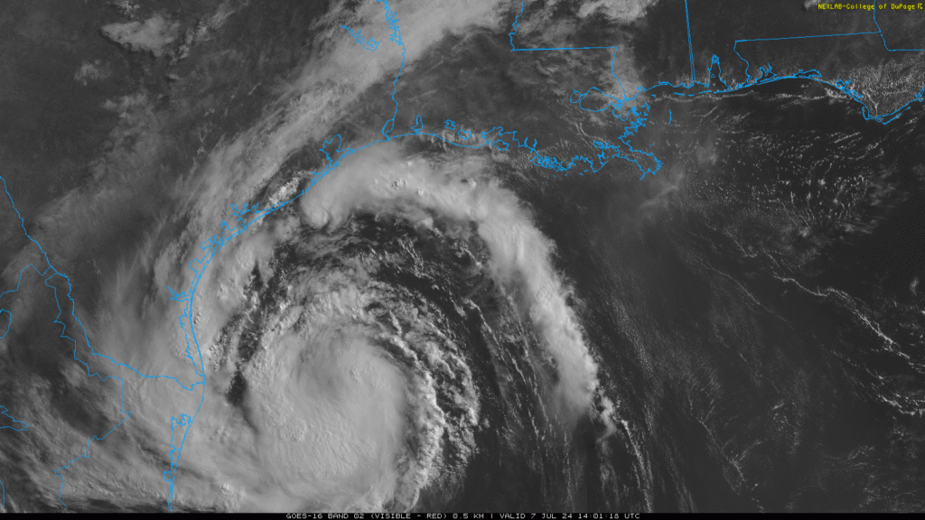
Let’s get into this forecast, as Beryl is expected to impact the Texas Coast in the next 24 hours. Before I get into the forecast, I wanted to give the current information regarding Beryl. As of the 7 AM CDT observations, the center of Beryl is located at Lattitude 25.2 North, Longitude 94.9 West, and is moving northwest at 12 mph. The minimum central pressure last observed was 992mb, and the maximum sustained winds were 60 mph. The system is expected to strengthen back into a hurricane as it continues to move northwest. Hurricane warnings have been issued for areas of the Texas Coast, including Corpus Christi, Rockport, Victoria, and Bay City. Tropical Storm warnings have been issued for other areas of the Coast, including the Houston Metro Area. As shown in the image above, the first outer bands of the storm are already starting to impact the Texas Coast.
What to expect over the next 48 hours

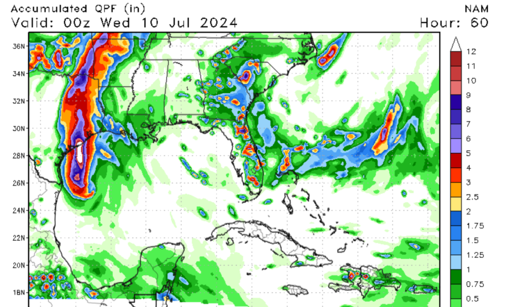
Beryl is expected to strengthen back into a hurricane before it makes landfall on the Texas Coast. Landfall is expected this evening through early Monday Morning; however, impacts from this storm are expected as early as this morning. Bays along the coast, such as Galveston Bay and Corpus Christi Bay, should expect life-threatening storm surges, so listen to local authorities for evacuation procedures. High winds of >72 MPH are expected late tonight into early tomorrow morning for portions of the Texas Coast. Heavy rainfall of over 6 inches is expected along the Texas coastline, possibly resulting in significant flooding in low-lying areas and areas with poor drainage. Any preparation for this Hurricane should be completed by this afternoon.
Tornado threat with Beryl
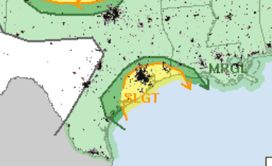
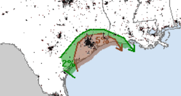
Not only will we be seeing typical hurricane-related threats associated with Beryl, but I am also tracking a possible tornado threat associated with Beryl’s landfall. The primary timing of tornadoes will be this afternoon, as the outer bands of Beryl approach the coastline. Areas that are impacted by the right front quadrant, i.e., the northeast part of the storm, could see embedded supercells as low-level windshear is expected to increase in this region. The tornado threat is likely to spread to other areas of the Texas Coastline as more rainbands spread through this evening. Besides the tornado threat, high winds associated with the outer bands of Beryl are expected as early as this afternoon. Please ensure that you are keeping a close eye on local radar as the outer bands of Beryl make landfall.
Other impacts that Beryl could have
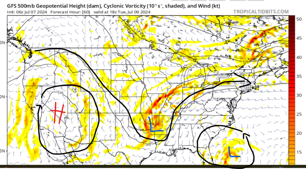
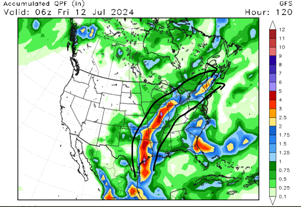
Not only will Beryl impact the Texas coastline, but its remains are also expected to impact other parts of the country. After landfall, Beryl is expected to lose hurricane status as it transitions to a remnant low-pressure system. A ridge of high pressure shown in the image above is forecasted to move the remains of Beryl to the northeast, affecting portions of the southern plains and upper midwest. The primary threat with the remains of Beryl will be heavy rain, which could result in Flooding. Major cities that could see flooding are Dallas, Tulsa, St. Louis, and Chicago. These cities could see rainfall amounts of over 3 inches through this next week. Flash flooding in poorly drained areas is possible in these cities next week. Even if your city was not mentioned in this writing, most of the southern plains and upper midwest are expected to see heavy rain this week as Beryl makes its way northeast.
Overall, Tropical Storm Beryl is expected to cause significant impacts as it makes landfall on the Texas Coast. Please remember that even if your town or city is not in Beryl’s wind cone or direct path, significant impacts from this storm are expected along the entire Texas Coastal area and as far inland as the Houston Metro Area. After landfall, areas of the southern plains and upper midwest should expect heavy rainfall and flash flooding as the remains of Beryl make it’s way northeast.

