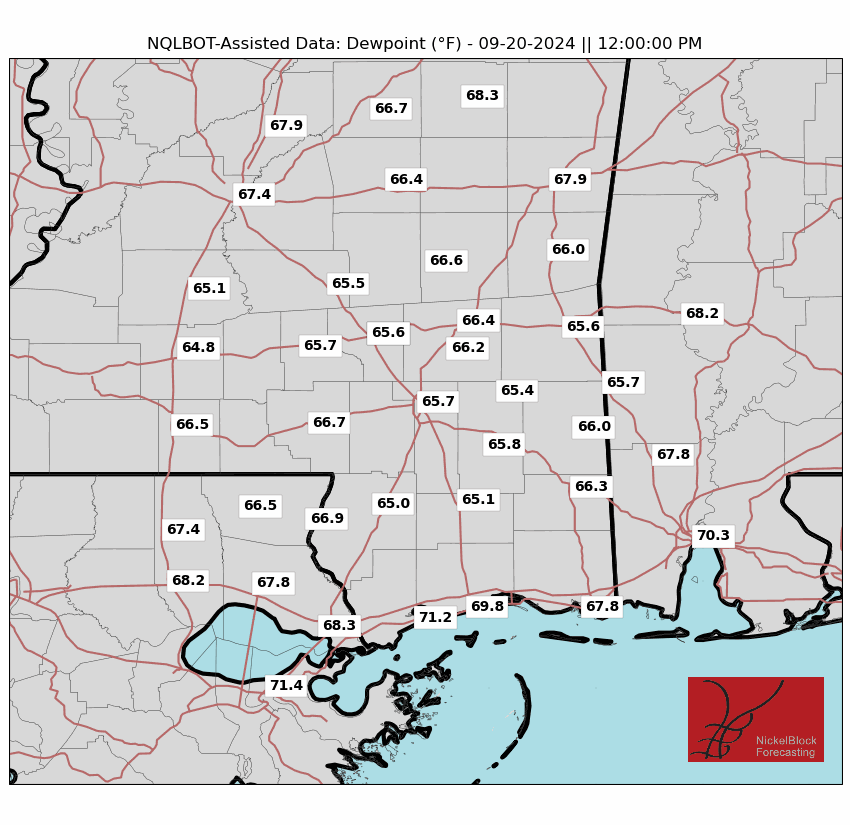
Happy Wednesday! We have seen some lower temperatures and dew points today, making it feel more bearable than usual outside. This trend should keep up through tomorrow and Friday, with highs in the lower 90s and dew points averaging in the low to mid 60s. The rain chances for the next two days are very limited, with areas along the coast having a higher chance for some scattered storms and areas more inland will remain dry. The chance for rain and more high temperatures returns this weekend as a high-pressure system makes its way back over the US. Let’s get into it!

HEADING INTO THE WEEKEND:
Looking at tomorrow, it will be mostly sunny with highs in the low to mid 90s and lower dew point temperatures than we are used to. This means that while it may still be hot, it won’t feel ‘as’ hot due to low humidity values. This may change for the coastal parts of our area that may see a shower or two thanks to a stalling front, which will cause the humidity to increase once again.
Friday will look very similar to Thursday, with highs in the mid 90s and lower dew points as well as a chance for rain on the coast. This pattern will start to shift as we head into the weekend, as the remnants of Beryl will be moving out of the country and allowing a mid-level ridge to settle in its place. This ridge will bring warmer temperatures along with higher rain chances for parts of our area as it interacts with moisture from the Gulf of Mexico.
Talking about the rain chances this weekend, scattered storms are expected to move through the area, with coastal MS and Louisiana having the highest chances. The further north, the chances are more limited, but that can always change thanks to the moisture from the Gulf and afternoon heating to produce some pop-up showers. Overall, the chance is there but the exact locations are hard to pinpoint.
LOOKING FURTHER OUT:
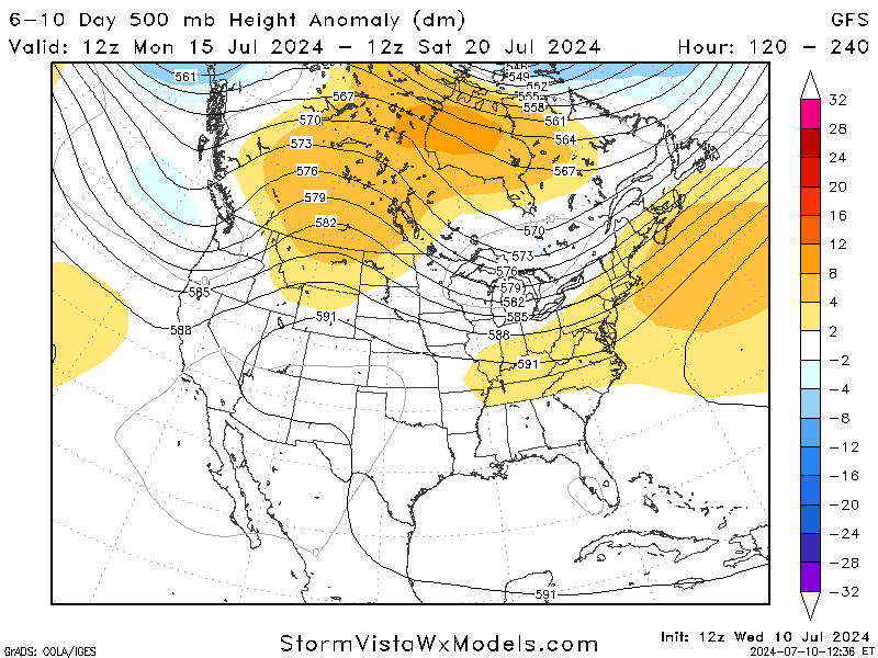
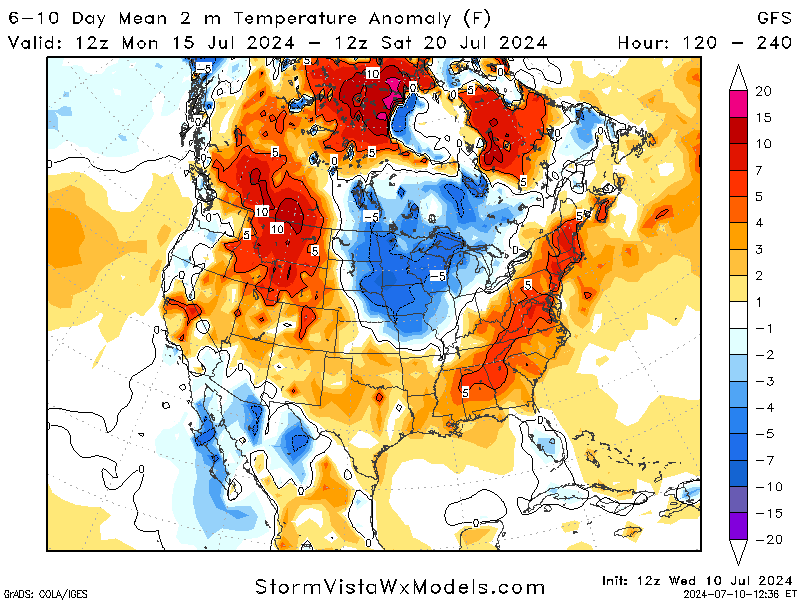
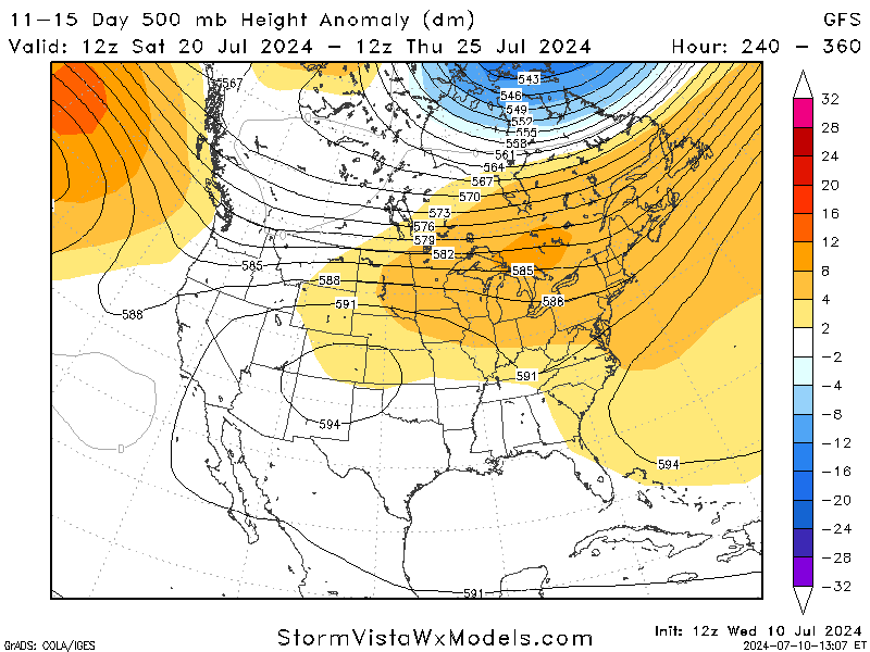
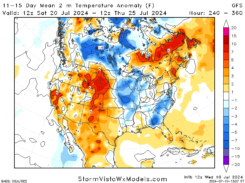
Taking a look into next week and beyond, the GFS model predicts that our area will still have some heat but has the ridge shifting away. It is always safe to assume we will still be dealing with the heat, but that will be determined as we get closer.
Looking even further to 2 weeks out, the models suggest some cooler air? Nothing to get too excited about, but just something to think about as we continue to move through this hot summer.
BRIEF TROPICAL UPDATE:
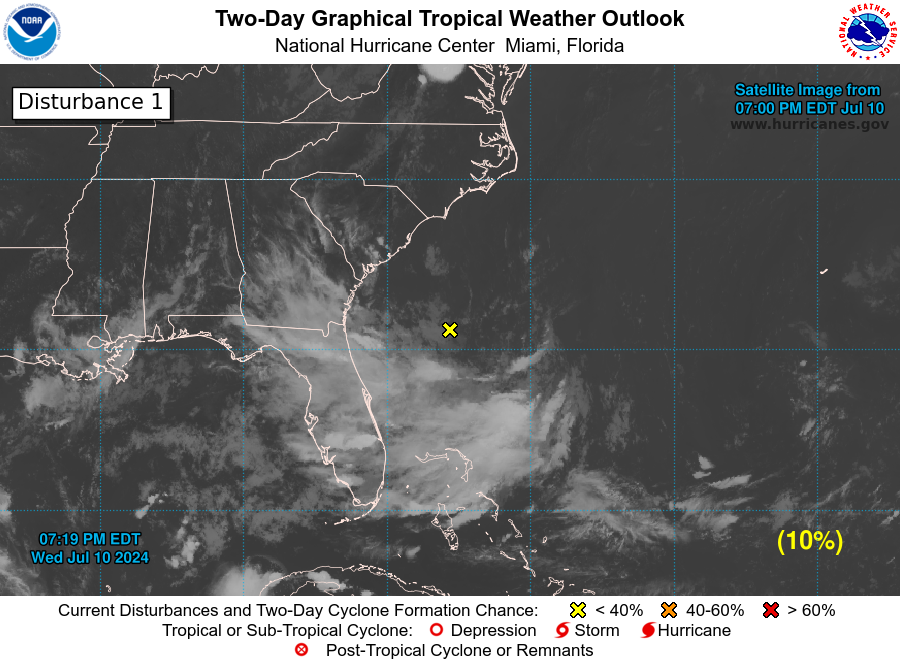
Now that Beryl has made its exit from the tropical screen, it’s time to be on the watch for our next storm. There is a large area of high pressure over the Atlantic right now, which is keeping things pretty quiet for the most part. However, we do have a little disturbance off the east coast from Georgia/South Carolina that has produced some disorganized showers/thunderstorms. It has a slight chance of additional development before moving inland by this weekend.
Other than that, we do not have any other tropical activity to discuss. With it being July, we still have a lot of hurricane season left to prep for, so continue to stay aware and ready for any weather we may experience.


