Happy Thursday! We do not have any exciting topics to discuss today. Just a repeat of high temperatures with chances for showers/thunderstorms in the afternoon through the weekend and into next week. Also looking into next week, an increase in humidity paired with temperatures in the mid to upper 90s will cause the heat indices to range between 105-110 for the majority of the area along with some higher rain chances. Let’s get into it!
FOR FRIDAY AND THE WEEKEND
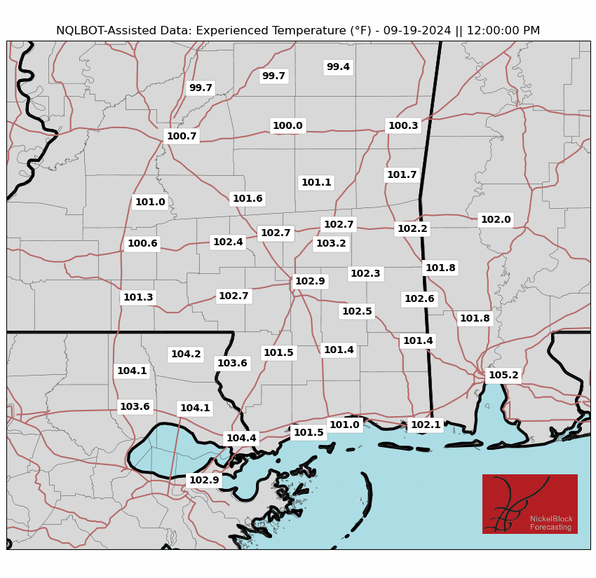
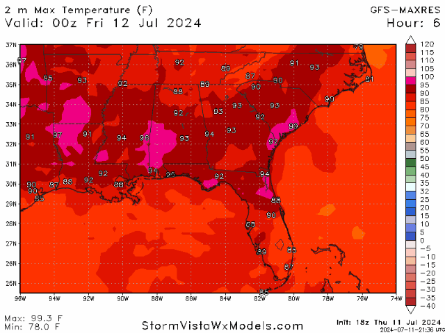

Looking at tomorrow and through the weekend, the same pattern is expected throughout our area: high temperatures combined with high humidity percentages and chances for scattered showers in the afternoon. Tomorrow, dew points will stay in the upper 60s to lower 70s, which will help keep the humidity levels down.
Moving into the weekend, a mid-level trough is bringing in moisture from the Gulf that will increase thunderstorm development in the afternoon/evening hours. This increase in moisture will also aid in higher heat indices and bring back extreme heat levels that may result in advisories being issued. Rain chances are expected to increase with each passing day, with the coast having the highest chance for this rain.
While the heat is returning over the weekend, these conditions are expected to stick around through the next week. Make sure to stay hydrated, take caution while working outside, and pay attention to your body.
LOOKING AHEAD?
While the heat will stick around through next week, we may see some more persistent rain towards the middle/end of next week. While it is still a question if we will see an organized system or more scattered storms, rain is expected for parts of our area.
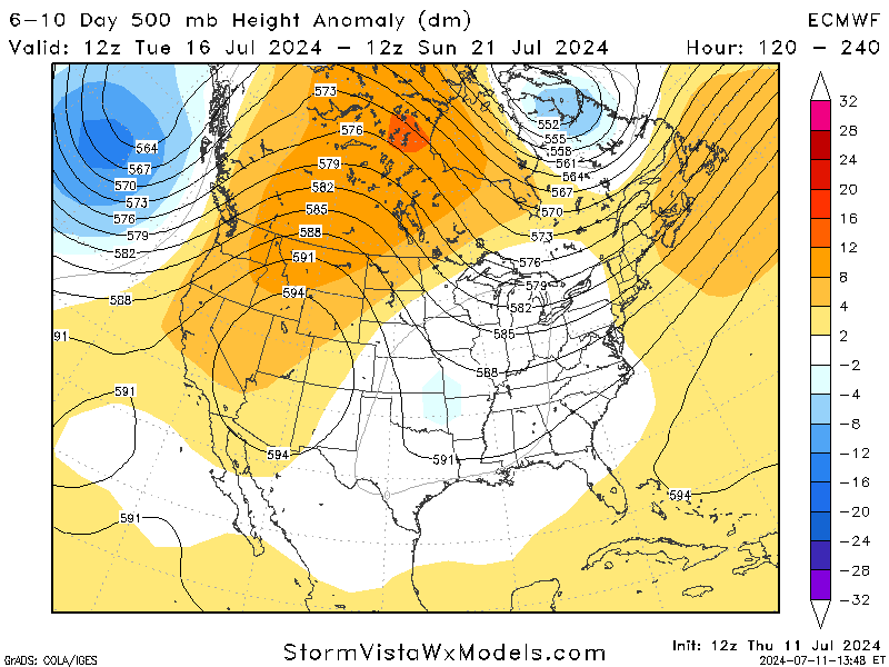
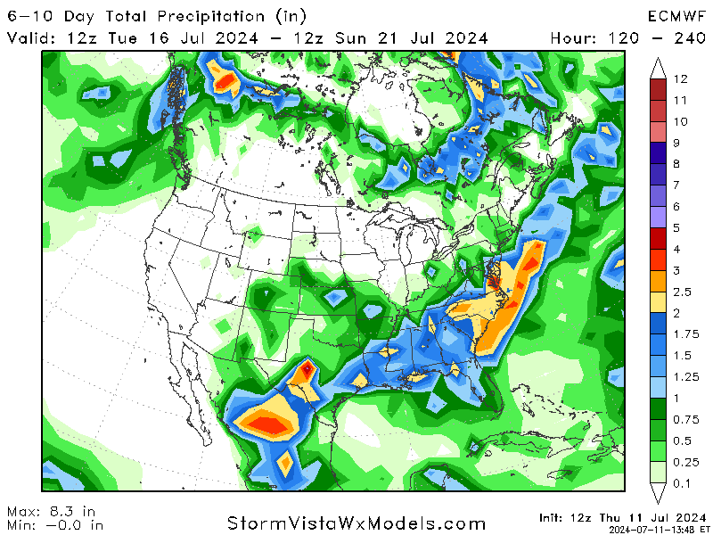
Looking at the mid-levels of the atmosphere for mid next week, models agree with a low-pressure trough coming into the region, which would line up with the potential rain chance around that time. We may also see some slightly cooler temperatures as a front may form and sweep the area. While this is still a week out, more certainty about these events will come out in the next few days.
BRIEF TROPICAL UPDATE:
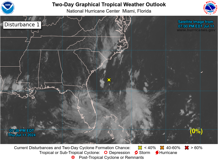
Taking a quick look at the tropics, there looks to be nothing major on our radar as of now following Beryl’s eventful timeline.
There is an area of low pressure off the coast of the Carolinas that is expect to bring plenty of rainfall to the area, but should not see any tropical development before moving inland. The main threats with this system will be heavy rains and flooding concerns with how slowly this system is moving.
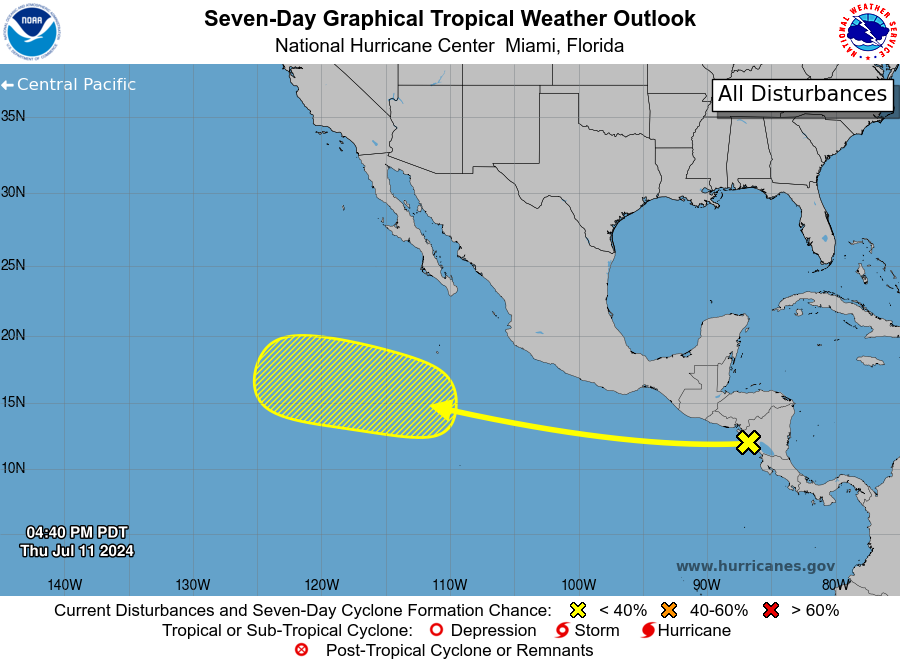
Shifting gears a little and looking to the Pacific, there is a tropical wave near Central America that is producing disorganized showers/thunderstorms. This system is expected to move to the west across the eastern Pacific, where conditions may be favorable for slow development as it continues to move further out into the Pacific.


