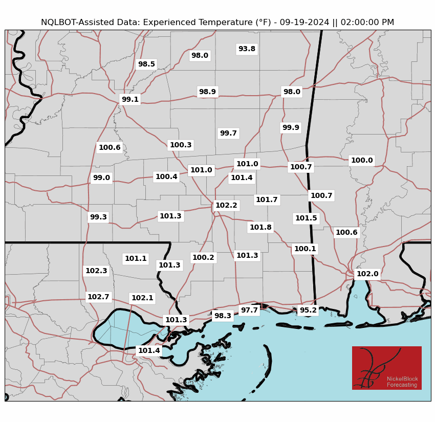
Good day to everyone; I hope that you had a great week. Looking at our forecast today, one thing concerns me: the high temperatures expected this afternoon. A heat advisory is in effect for southern Louisiana and Mississippi this afternoon. High temperatures are expected to reach the mid-90s, with heat index values expected to be as high as 110 degrees Fehernight. Looking at our rainfall chances, I suspect areas along and south of Interstate 20 will have the highest chance of seeing some rainfall this afternoon. Even so, these showers will be spotty in nature, so I would not count on seeing much rain today, even if you reside south of Interstate 20.
Heat advisory is in effect for this afternoon.
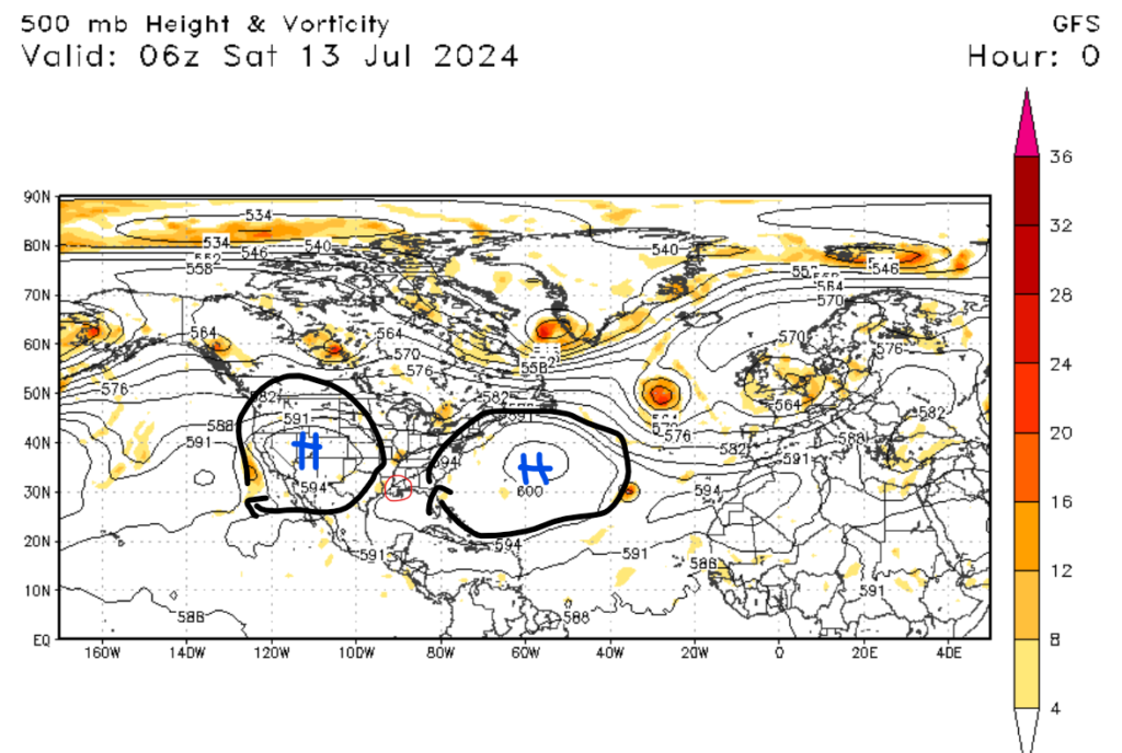
If you read my forecast yesterday, I mentioned that temperatures were expected to climb through this weekend. As expected, temperatures are expected to climb to above-average values by this afternoon. This is because of two prominent ridges of high pressure that we are right between. The first one is baking the Western U.S, while the other one is situated in the Atlantic Ocean. Because of the locations of these high-pressure systems, temperatures are expected to be above average through this weekend. I am forecasting heat index values of between 100 and 110 degrees Fahrenheit this afternoon. Little cloud cover is expected today, allowing heat index values to soar today. These are dangerous heat values, so please take proper heat-related precautions if you plan on spending time outside.

Spotty showers today
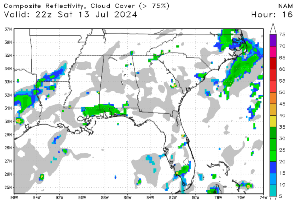
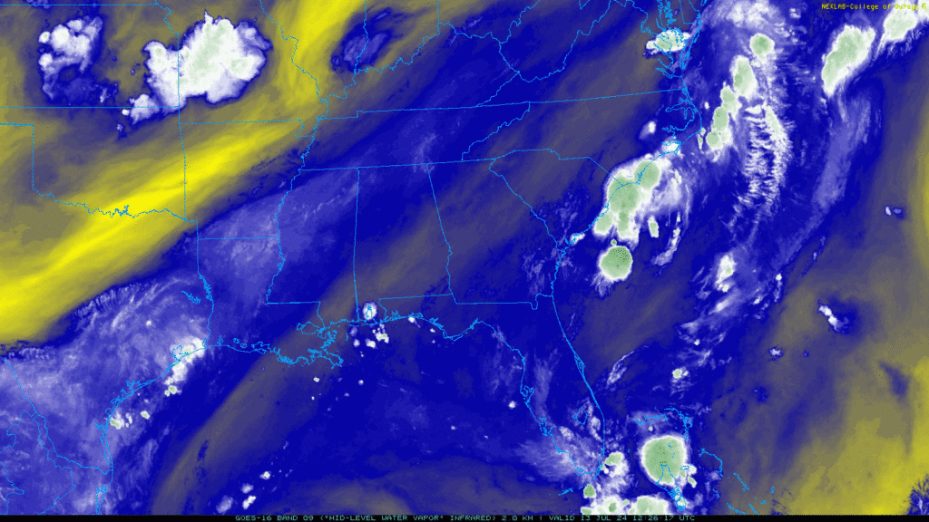
Switching gears here, most of the region should be dry today, especially if you are north of Interstate 20. These locations should stay dry for the most part, but I won’t rule out an isolated shower making its way north. Looking further south to the coast, I am expecting more shower activity. This is thanks to the area of moisture along the coastline that you can see on the water vapor satellite image above. I suspect that convective activity will begin this afternoon as temperatures continue to rise. Storm activity should stay around through this evening before drying out by midnight tonight. These storms will only be isolated in nature, so be presently surprised if you see rainfall this afternoon. A couple of these storms could produce brief heavy rainfall, providing some relief to the heat.
Looking into the future


Looking into the future, I am expecting that temperatures will cool off slightly by the middle of next week. This is great news if you are done with this heat. Now, this is still summertime, so these “cooler temperatures” will still be in the high 80s to low 90s, but it’s something at least. The bigger news is the increased rainfall potential. A cold front associated with a low-pressure system is expected to move through the Southeastern U.S. by the middle of next week. I expect numerous showers and thunderstorms by Wednesday as this cold front moves through the region. The rainfall and cold front will help keep our temperatures more moderate as next week progresses.
Looking at the tropics


Looking at the tropics, there is little to no activity expected in the next few days. There is little to no moisture in the Intertropical Convergence Zone, and high pressure is currently dominating the Western Atlantic, limiting storm activity. Because of these factors, no tropical development is expected in the next 7 days. Looking west to the Pacific, there are a couple of very disorganized areas of tropical waves off the coast of Mexico. As of this writing, these tropical waves are just an area of disorganized showers and thunderstorms. These areas of showers could combine as the system moves northwest, but tropical development is unlikely for the next several days.


