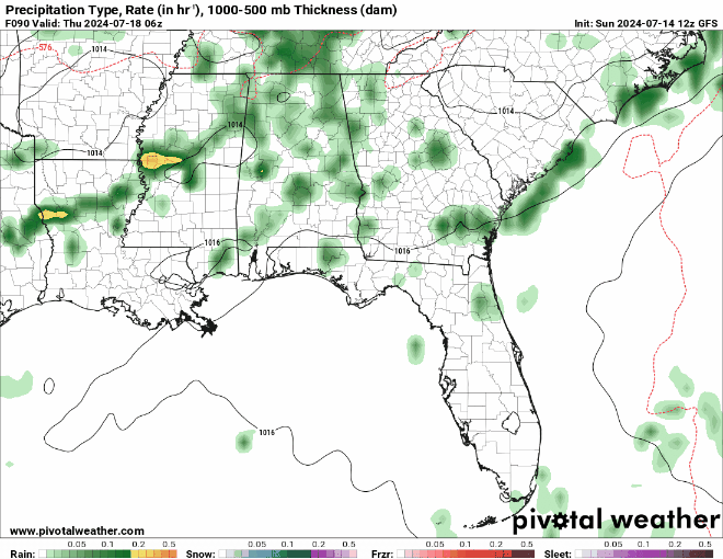
We’re in for another hot and muggy start to the week. A few storms are passing through in the eastern side of the state and will begin to dissipate as the afternoon goes on. A few more showers are possible closer to the coastline this evening with some northerly flow from the Gulf high having influence.
Looking at the synoptic level, the Continental US is between two large surface ridges; one in the western US, and one in the Atlantic. Over the week, a strong surface ridge will form over central Canada which will squeeze out a low pressure system moving south into our neck of the woods. Towards the end of the week, the cold front will stall as the ridge hangs over the Heartland and eventually move out by the end of the weekend.
Early Week Heat and Thunderstorms
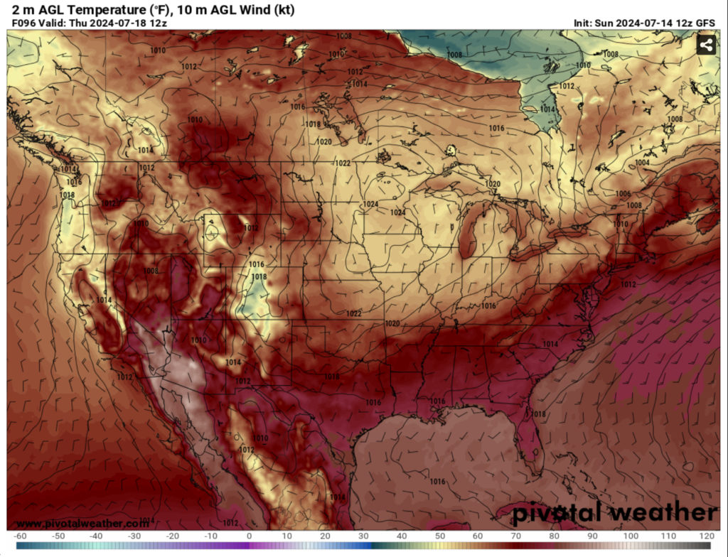
Tomorrow, temperatures will be in the mid 90s with the heat index climbing into the mid-100s in the afternoon. Another chance of scattered thunderstorms is possible across the southern and central parts of MS/AL in the evening. The heat index will climb up to 110 on Tuesday with temperatures in the mid 90s and rain staying around the Pinebelt and the coastline.
Wednesday will continue the trend with a line of scattered thunderstorms in the afternoon/evening and hot weather during the day. If you’re out during the day, be prepared to have plenty of water on hand and something to protect you from the water coming from the sky at the same time.
Late Week/Weekend Washout Potential
From Thursday into the weekend, the cold front I mentioned earlier will move in towards the mid-South and slow down to a crawl for several days. The good news is that this will likely reduce temperatures a bit into the mid and upper 80s, but the caveat during this time of year is that that usually means that rain is the reason.
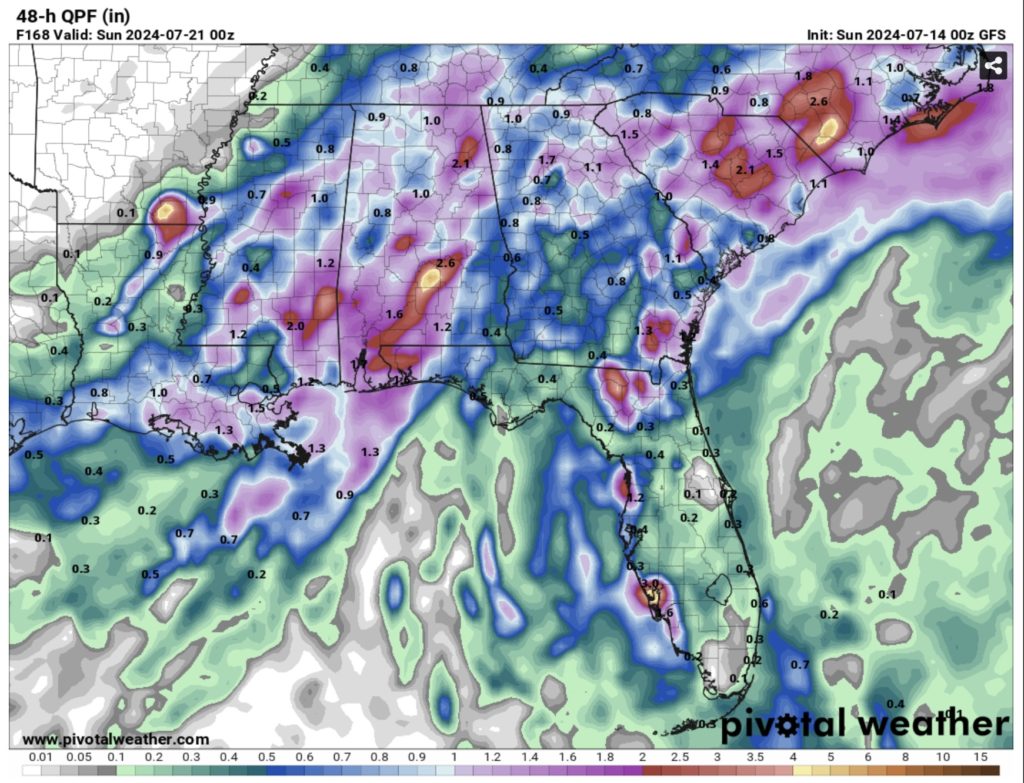
The rain looks to be fairly diurnal with most of it developing in the afternoon but lasting into the overnight hours especially Thursday into Saturday. Rainfall totals will range from 1” to 4” depending on the type of storm. Flash flooding is possible over those days, so please keep an eye on the roads and waterways as you traverse them. This system may last until the beginning of the next week, so the weekend and early week may be a wash-out.
Regional Day-to-Day Forecast
Tonight – Scattered showers and thunderstorms possible into the evening. Mostly cloudy, then gradually becoming mostly clear, with a low in the mid 70s. Calm wind.
Monday – A chance of showers and thunderstorms into the afternoon and evening. Patchy fog before 8am. Otherwise, mostly sunny, with a high in the low to mid 90s. Heat index values as high as 105. Calm wind becoming southwest around 5 mph. New rainfall amounts of less than a tenth of an inch, except higher amounts possible in thunderstorms.
Monday Night – A slight chance of showers and thunderstorms before sunset. Partly cloudy, with a low in the mid 70s. Calm wind.
Tuesday – Showers likely and possibly a thunderstorm in the afternoon. Patchy fog before 8am. Otherwise, mostly sunny, with a high in the mid 90s. Calm wind becoming southwest around 5 mph. New rainfall amounts of less than a tenth of an inch, except higher amounts possible in thunderstorms.
Tuesday Night – Mostly clear, with a low in the mid 70s. South wind around 5 mph becoming calm.
Wednesday – Showers likely and possibly a thunderstorm starting in the afternoon. Mostly sunny, with a high near 96. Calm wind becoming south southwest around 5 mph.
Wednesday Night – Showers and thunderstorms likely before sunset. Partly cloudy, with a low in the mid 70s. South southwest wind around 5 mph becoming calm.
Thursday – Showers and thunderstorms in the afternoon. High in the mid 90s. Calm wind becoming west southwest around 5 mph.
Thursday Night – A chance of showers and thunderstorms, mainly before midnight. Mostly cloudy, with a low in the low 70s.
Friday – Showers and thunderstorms. High in the upper 80s.
Friday Night – A chance of showers and thunderstorms. Mostly cloudy, with a low in the low 70s.
Saturday – Showers and thunderstorms. High in the upper 80s.
Saturday Night – A slight chance of showers and thunderstorms. Mostly cloudy, with a low in the low 70s.
Sunday – Showers and thunderstorms likely. Partly sunny, with a high near 90.


