We’ve made it to Friday! I hope everyone had a great work week. This weekend will feature many different weather patterns across the country including a rainy setup for the Southeast U.S., a continuing hot and dry period out West, and a slightly cooler temperature outlook across the Central CONUS.
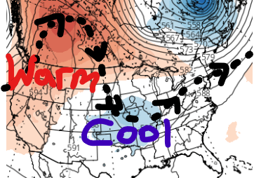
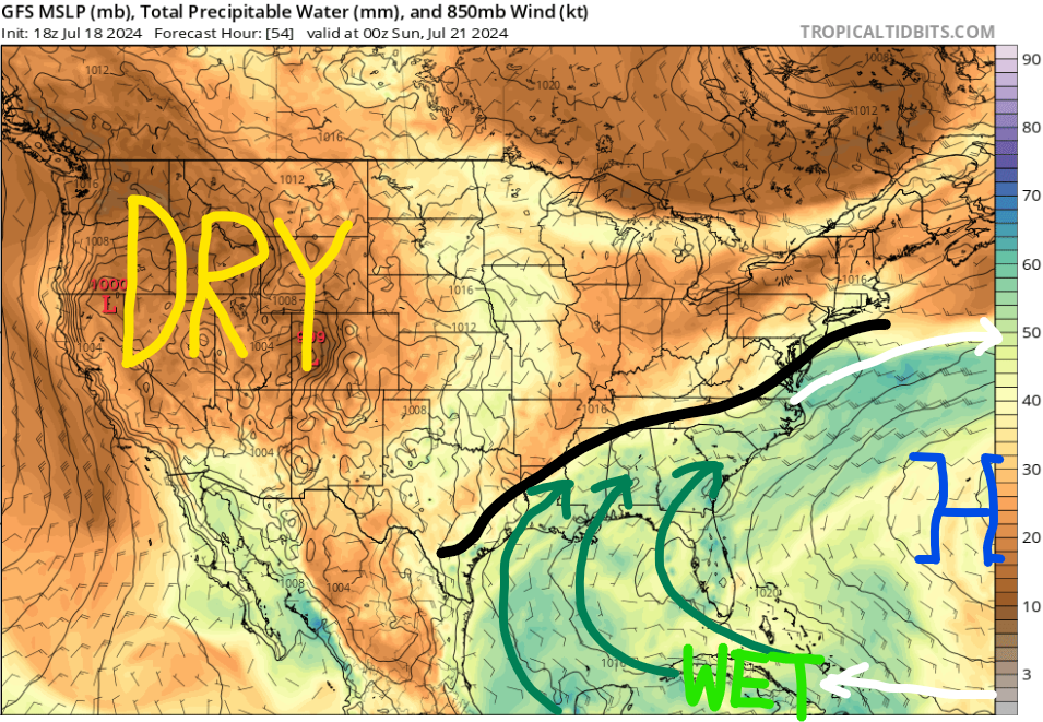
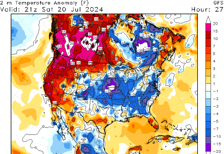
Here is the overall pattern for this weekend as we have a strong mid to upper-level ridge across the western United States, with high pressure dominating the region. With rising height lines and high pressure overhead, rainfall chances will only occur in places such as Arizona, New Mexico, and Colorado due to the monsoon. Lower humidity and plentiful sunshine will allow for a hot and dry pattern to continue out West.
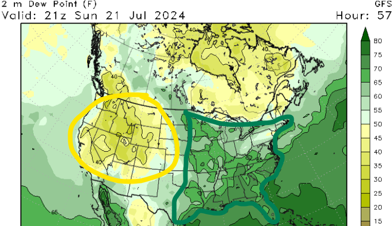
However, the eastern half of the U.S. is completely different with a weak mid-level trough digging across the Great Lakes, allowing for slightly below-average temperatures. In addition, high pressure in the central Atlantic is allowing for moisture to advect northward into much of the Southeast. Multiple rain chances are possible this weekend and confidence is high that the wet pattern will continue into next week.
WILDFIRE THREAT & HEAT
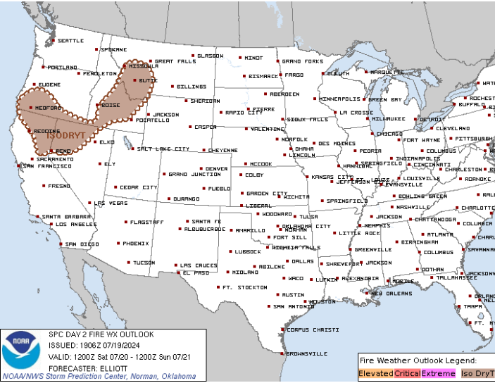
It has been dry across much of the western U.S. this week and as a result, we currently have around 54 large active wildfires that are being managed. With the monsoon moisture further south, the main states being affected are California, Oregon, Washington, Idaho, and Montana.
Red flag warnings are currently in place across eastern Oregon, meaning that critical fire weather conditions are occurring or will be shortly. Conditions that can enhance the severity of these wildfires include gusty winds, low relative humidity values, and hot outdoor temperatures. For Saturday, avoid outdoor burning in places like northern California and Nevada, southern Oregon, central Idaho, and western Montana.
Temperatures are going to continue to be above the century mark for high temperatures as excessive heat warnings stretch from Washington, Idaho, and Montana to California and Arizona. Remember to stay hydrated by drinking plenty of water and avoid going outside during the afternoon hours if you’re prone to heat illness.
SOUTHEAST RAIN & COOLDOWN
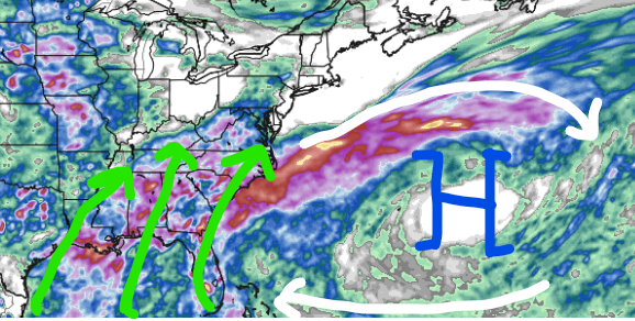
A cold front has stalled across the Southeast and has led to a pattern of moisture being advected northward out of the Gulf of Mexico. This trend will continue for the rest of the weekend and the start of next week as high pressure across the Atlantic is helping to provide clockwise flow and southerly flow across much of the Southeast.
Over the next few days, most areas will see between 1-3″ of rain, however, some locations could exceed this total if heavier rainbands go over the same area multiple times. If you live in a location prone to flooding, avoid driving or know which areas to avoid in case you do have to. Creeks and rivers will be high by the middle of next week, so be aware if you are driving near one or you’re taking the boat out.
Due to the front stalling, the lack of mid-level ridging, and the abundance of cloud cover, temperatures are going to be below average for much of the southern CONUS this weekend and the beginning of next week. Lots of 80s will be on the map and possibly a few 70s too if enough cloud cover and rainfall occurs. Be sure to go outside when it’s not raining as there will be breaks from time to time!


