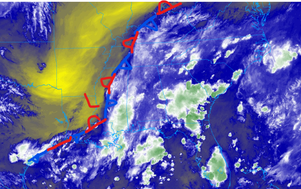
I hope that you don’t have any outdoor plans for this afternoon and this weekend because chances are it will rain out, or you will get wet. We expect a wet next couple of days as an area of disturbance associated with a stalled cold front is expected to cause unsettled weather for the next couple of days. The good news is that temperatures are expected to be cooler than what we have seen this summer. The bad news is that rainfall and thunderstorms are forecasted to inundate the region, which could lead to some flooding.
The good news: Cooler temperatures

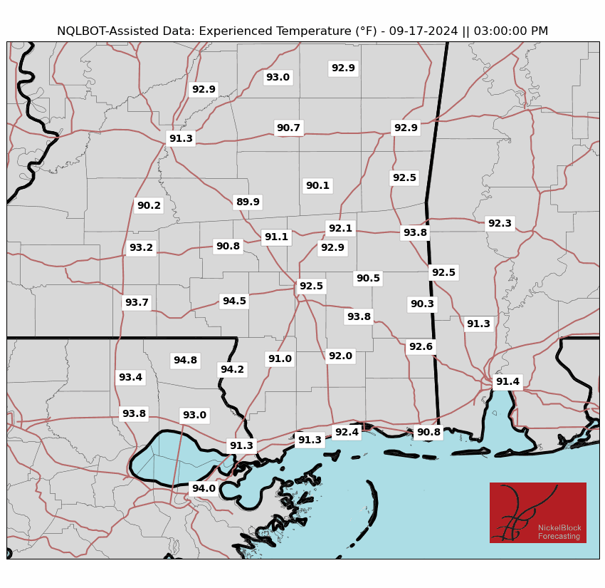
If you are done with extreme heat, you are in luck, as this front is causing our temperatures to fall below normal values for this time of year. High temperatures are only expected to climb into the mid-80s, with a few areas possibly seeing the high-80s. Typical high temperatures for this time of year are in the low to mid-90s, so this relief should be great for those who want a break from the sweltering heat.
Although temperatures are below average for this time of year, the increased moisture associated with the stationary front will cause our relative humidity (the amount of water vapor in the atmosphere) to skyrocket to near saturation (100%) values. This effect will be most apparent in the fell-like temperatures, which could climb into the mid to high 90s. Although this is not as high as earlier this month, you will still feel the summer heat, especially if the sun is out. Speaking of sunshine, don’t expect much as a consequence of a stationary front, primarily cloudy skies, especially since we are ahead of the frontal boundary.
The bad news: Rain, rain, and more rain
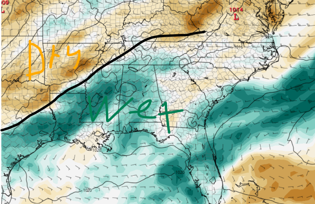

The bad news of this stationary front is the amount of rainfall expected over the next couple of days, especially for coastal communities. For the rest of today, the rain should let up in the next few hours, but I would expect a few isolated showers and possibly a rumble of thunder to continue into the overnight hours. Looking into tomorrow, I would not be surprised if we started to see rainfall in the mid-morning hours, as the low-pressure system associated with the stationary front draws in moisture from the Gulf. This is why I am confident that coastal communities will see the most rainfall. As the day progresses, scattered to numerous showers and thunderstorms will inundate the region. None of these storm are expected to be severe, but heavy rainfall is expected form some of these raincells.
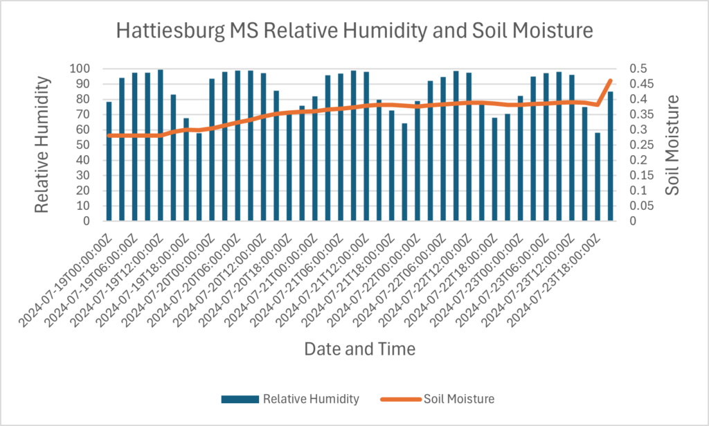
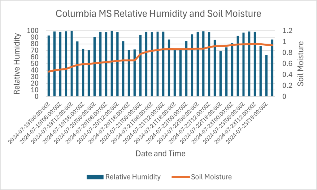
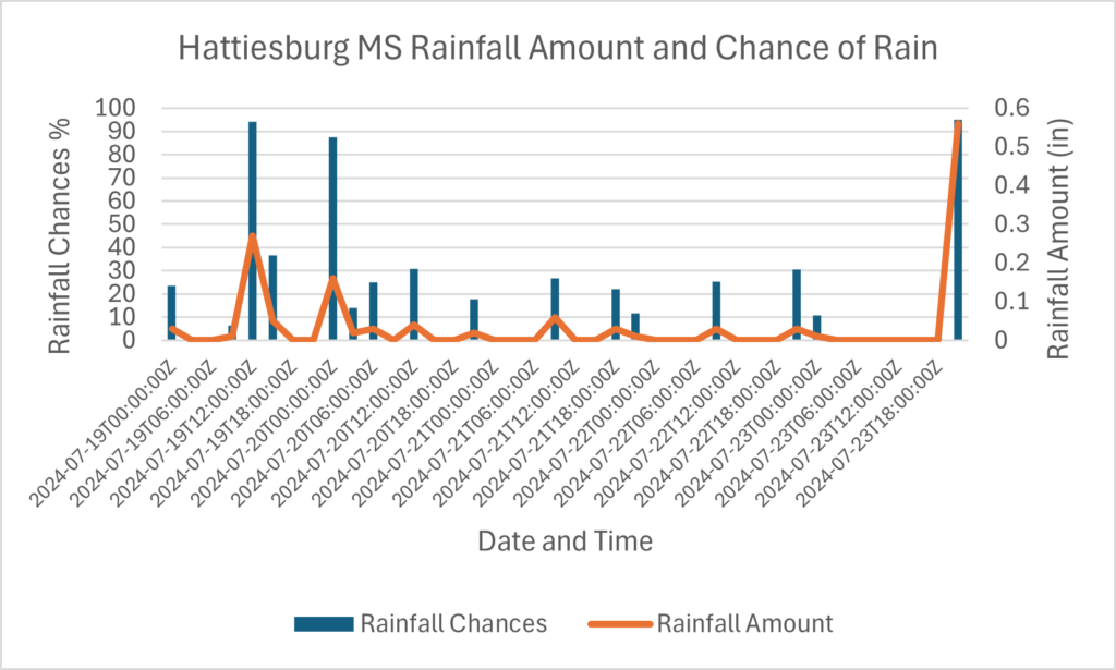
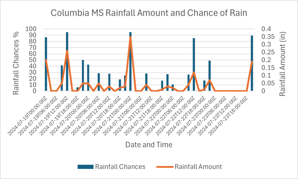
Regarding how much rainfall you could expect over the next couple of days, most of the region should expect between 1” and 2” of rainfall. Some isolated amounts of over 3” are possible, especially for coastal communities. Cities such as Jackson, MS, Columbia, MS, and Hattiesburg, MS are more likely to see that 1 to 2” rainfall. Coastal cities such as New Orleans, LA, and Gulf Port, MS, are expected to see higher amounts, possibly over 3” in local areas. As a result of all this rainfall, flooding is possible in lower-lying areas and poorly drained areas. If you reside in these areas, please make sure to prepare for flooding.
What’s ahead


Looking into the future, I expect this pattern to stick around into next week. The stationary front discussed earlier is likely to stick around the region. This is because of a prominent ridge of high pressure stuck in the middle of the Atlantic. The nice thing about the high pressure is that it keeps tropical activity in this part of the world at bay. The bad news is that the rainy pattern is forecasted to stick around the region through next week. This means daily showers, thunderstorms, lower temperatures, and predominantly cloudy skies for the next several days. I do not expect a change in the pattern until the latter half of next week, when higher pressure starts to build in.


