Hi everyone! Good news: we have no new areas to talk about in the Atlantic Basin. There is only one area we’re watching in the eastern Pacific with a low chance of development. Overall, conditions look unfavorable in both the Atlantic and eastern Pacific over the next couple of days.
Current Look At the Tropics
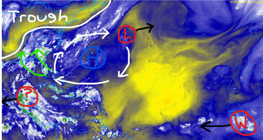
Looking at the big picture, we’ve got a broad area of low pressure across the northern Atlantic, with much of the convection away from the center of circulation. This will continue to weaken as it pushes further east.
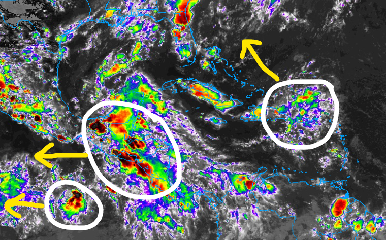
In the Caribbean, we have a disorganized area of showers and thunderstorms across Central America that’ll continue to slowly push off to the west, so flooding could be a concern. The area circled near Hispanola is fairly weak and will be a rainmaker for the eastern Caribbean before it enters an environment with hostile wind shear from the trough over the Southeast.
Looking into the future, we have two potential waves moving off the coast of Africa, according to the GFS model by the middle of next week. Both look fairly weak at the moment, but we’ll continue to monitor the latest trends.
Signs of An Active August
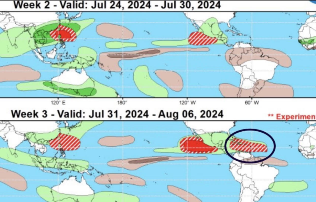
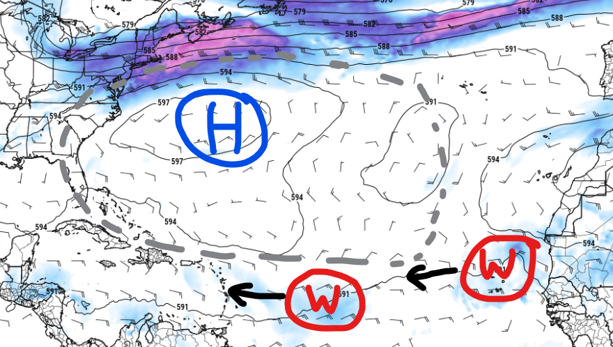
Models and other meteorological data are starting to hint at the idea for more tropical systems in the Atlantic Basin beginning in August.
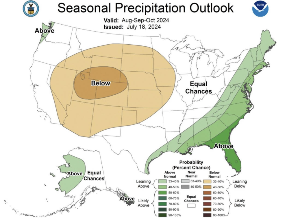
The map on the left shows above-average precipitation for the rest of hurricane season along the Gulf Coast and the East Coast. The figure on the right shows a more favorable atmosphere by the first week of August, hinting at the idea of more waves coming off the main development region (MDR).
If you have any vacation plans for August, I’d recommend staying up to date with the latest forecast in case you have to plan around a tropical system. You won’t be alone as I’m going to the Bahamas the first week of August, so I will be checking the forecast every day too.
In the Pacific
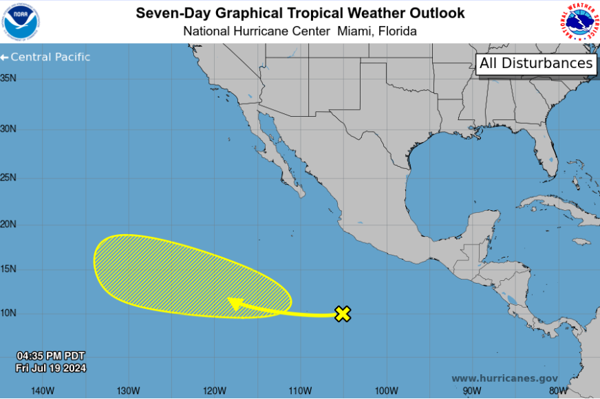
A broad area of showers and thunderstorms has been slowly moving off towards the west. Initial development is unlikely, however, by the middle of next week, conditions may become more favorable, so a tropical depression or storm could form. As of now, the NHC only gives this a 20% to form over the next seven days. This will not impact Mexico or any landmasses over the next week. The next name on the list is Bud.


