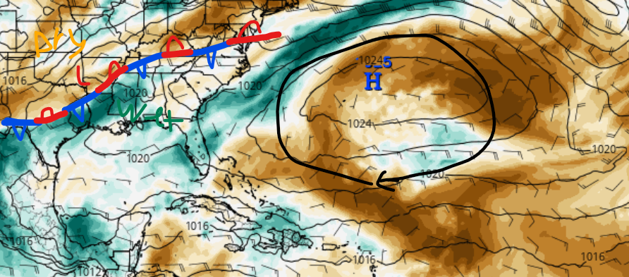
It’s been quite wet for the region for the last couple of days, and this trend is only supposed to continue for the next several days, thanks to a stationary front that has stalled to the northwest of our area. Although this front is keeping temperatures mild for summertime, this upper-level disturbance is packing a ton of moisture with it. Unfortunately, due to a large area of high pressure in the Atlantic Ocean, this area of disturbance is not expected to move for the next several days, bringing rounds and rounds of showers and thunderstorms. The good news of this high-pressure system is that it keeps tropical weather activity at bay.
More scattered showers for today but less rainfall
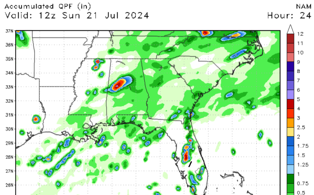
Over the last couple of days, these rounds and rounds of rain have caused disruptions to travel plans and have led to numerous flooding reports. Luckily for today, our rainfall chances will be less than in previous days. That’s not to say that you won’t see any rainfall today, but our chances should be lower for today. This will be especially true for our communities around Jackson, Mississippi, as drier air is expected in this region. Areas closer to the coast should expect higher rainfall chances as more moisture is expected to be in this region. Although rainfall chances should be lower across the region, areas along the coast could see brief heavy rainfall this afternoon. Rainfall across the region should diminish by this evening.
Heavy rain is to return by Sunday through this week
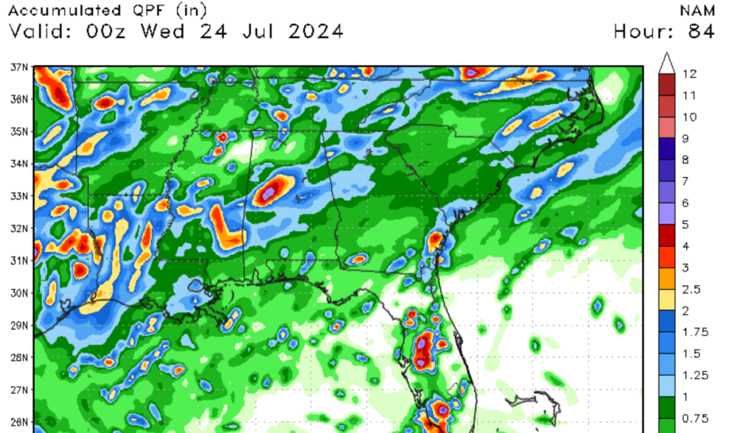
After today, our rainfall chances are only expected to increase as this upper-level disturbance refuses to leave. Since we are ahead of the front, we are expected to see continuous rounds of rain, especially in the afternoon, as the sun’s energy heats the environment, allowing for convective storm development. As we move into next week, more mosure associated with a low-pressure system in the Gulf is expected to bring in additional moisture to the region. These storms are not likely to be severe, but brief winds of 30-50 mph and lighting are possible with some of the stronger cells. The main concern is flooding, as the soil is extremely saturated, which could lead to flooding in low-lying areas. Please make sure to take the necessary steps in case of flooding.
When will the rain stop


Looking into the last 10 days of July, I don’t expect a significant pattern chance until at least next Friday, when the high-pressure system to our east should weaken somewhat. Our rainfall chances should lower to our more typical scattered afternoon showers and thunderstorms by the end of next week. Although our rainfall chances will be high this next week, temperatures should stay below average for the next few days.
A quick look at the tropics

Hurricane activity is all but nonexistent thanks to the semi-permanent area of high pressure in the Atlantic, which is also known as the Bermuda High. A large area of extremely dry air is moving off the coast of Africa, preventing tropical development. Instead of tropical development, the only thing that’s expected in the tropical is Saharan Dust. Not only does this limit the needed moisture for tropical development, but the strong winds moving off the coast increase wind shear, which hurricanes don’t like. I am not expecting any tropical development for the next 7 days.


