If you know who the man is below, you already know what I’m about to say…
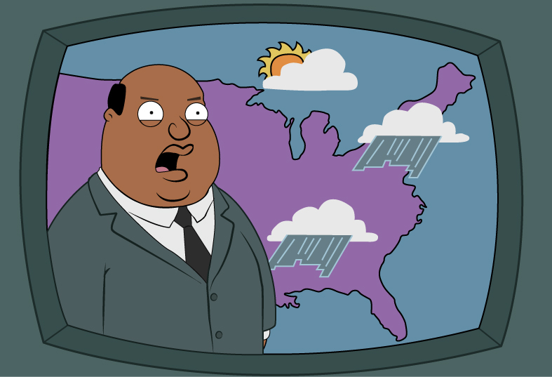
It’s Gonna Rain!
We’ll have several days of rain and thunderstorms ahead. The stalled front we’ve been talking about will remain over the mid-South with the Atlantic high keeping it at bay. Since this will enhance the amount of moisture that we’re receiving daily, there will be a chance of rain essentially every day during the week.
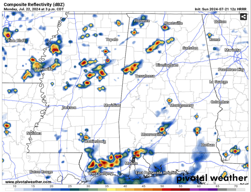
//Courtesy: Pivotal Weather
A few shortwaves will keep the rounds of storms coming, however the pattern looks fairly similar with storms coming out of the Gulf and squeezing out moisture, moving either from the south or southwest. With many of these storms, we’ll see gust fronts develop that will help form other storms ahead of them or collide with some storms and fade out.
Wednesday and Thursday look to be our heaviest chance of rain with the ridge expanding out and squeezing more moisture out of the stationary front. We’ll see our highest rainfall amounts from these two days. Overall, rainfall totals look to be around 1-2.5 inches by the end of the week. Afterwards, the Atlantic ridge looks to retreat with a low pressure system undermining it. From Friday, we’ll see an upper level ridge form in the Gulf of Mexico which may soften rain chances over the weekend, so this will be our first break from the rain.
Saturday and Sunday will still be fairly humid with temperatures reaching the upper 80s/low 90s during the day and heat indices reaching up to 100. To make it even more sticky, the dew points will remain in the mid-70s, so it’ll be cloudy and muggy during the day and only fall into the mid-70s at night.
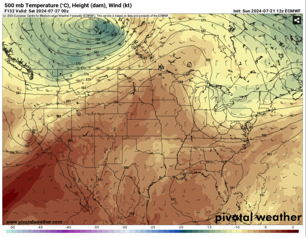
//Courtesy: Pivotal Weather
Expect some patchy fog the next couple of mornings with winds being calm and plenty of moisture on the ground. Temperatures will reach the mid-80s to upper 80s during the day for the next several days and in the low to mid 70s at night.
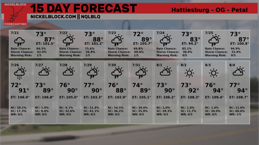
Looking at the 15 day forecast, once the weekend is over, we’ll return to a similar pattern as this week. A few more chances of rain and thunderstorms during the day until the ridge begins to retreat and we go back to our normal low/mid 90s and upper 100s heat index we all know and love during the Summer.
Regional Day-to-Day Forecast
This Afternoon – Showers and possibly a thunderstorm. High in the low 80s. Southwest wind around 5 mph. Chance of precipitation is 80%. New rainfall amounts between a quarter and half of an inch possible.
Tonight – Showers and thunderstorms before midnight, then a slight chance of showers before sunrise. Patchy fog after 4am. Low in the low 70s. South southwest wind around 5 mph becoming calm in the evening. Chance of precipitation is 80%. New precipitation amounts between a tenth and quarter of an inch, except higher amounts possible in thunderstorms.
Monday – A chance of showers and thunderstorms starting in the morning. Patchy fog before 7am. High in the upper 80s. Calm wind becoming southwest around 5 mph in the afternoon. Chance of precipitation is 90%. New rainfall amounts between a tenth and quarter of an inch, except higher amounts possible in thunderstorms.
Monday Night – Showers and possibly a thunderstorm before sunset and remaining into the overnight hours. Low in the low 70s. Calm wind. Chance of precipitation is 80%. New rainfall amounts of less than a tenth of an inch, except higher amounts possible in thunderstorms.
Tuesday – A chance of showers and thunderstorms in the afternoon. High in the upper 80s. Calm wind becoming southwest around 5 mph. Chance of precipitation is 90%. New rainfall amounts between a quarter and half of an inch possible.
Tuesday Night – A 50 percent chance of showers and thunderstorms. Mostly cloudy, with a low in the low 70s. Calm wind. New rainfall amounts of less than a tenth of an inch, except higher amounts possible in thunderstorms.
Wednesday – Showers and possibly a thunderstorm. High in the mid 80s. Calm wind becoming southeast around 5 mph. Chance of precipitation is 90%.
Wednesday Night – Showers and thunderstorms likely, mainly before midnight. Mostly cloudy, with a low in the low 70s. Calm wind. Chance of precipitation is 60%.
Thursday – Showers and thunderstorms. High in the upper 80s. Calm wind becoming southwest around 5 mph. Chance of precipitation is 90%.
Thursday Night – A 30 percent chance of showers and thunderstorms, mainly before midnight. Mostly cloudy, with a low in the low 70s.
Friday – Showers and thunderstorms likely. Mostly sunny, with a high near 90. Chance of precipitation is 70%.
Friday Night – A 20 percent chance of showers and thunderstorms. Mostly cloudy, with a low in the mid 70s.
Saturday – Showers and thunderstorms likely. Partly sunny, with a high near 91. Chance of precipitation is 50%.
Saturday Night – A 20 percent chance of showers and thunderstorms. Mostly cloudy, with a low around 73.
Sunday – Showers and thunderstorms likely. Mostly sunny, with a high near 92.


