Happy Monday! I hope everyone had a great weekend. Our week looks similar to this past weekend, with cooler temperatures and rain chances each day. Highs are expected to stay in the upper 80s to the lower 90s, with heat indices nearing the 105 mark, but few areas are expected to reach that heat. This trend will likely continue through the week and potentially into the weekend. Let’s get into it!

OVER THE NEXT COUPLE OF DAYS:
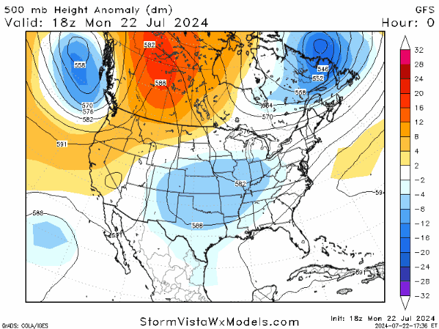
Looking at the upper levels, a low-pressure trough is situated over the central Great Plains and parts of the southeast. This system is aiding in the lower temperatures and increased rain chances that most of the region is experiencing. As we continue through the week, the intensity of this system will decrease but not fully disappear. This decrease will allow for a break in the rain this weekend but expect rain at some point each day until the weekend arrives.
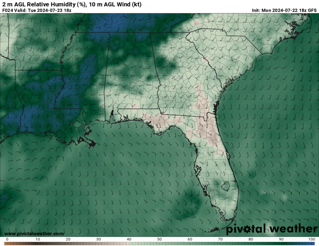
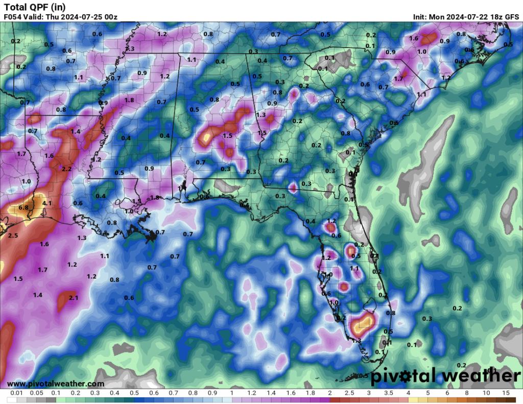
Plenty of moisture from the Gulf is helping the development of these showers/storms that will affect our area this week. High humidity and daytime heating will result in pop-up showers/storms that are more common in the afternoon. Areas to the south and along the coast are expected to see the most rain, with some places getting around 2 inches through Wednesday. The main threat will be localized flooding, focused in low-lying areas or areas that experience persistent rainfall. Be weather-aware and pay attention to your surroundings!
LOOKING AHEAD:
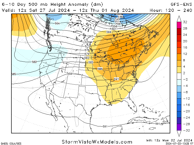
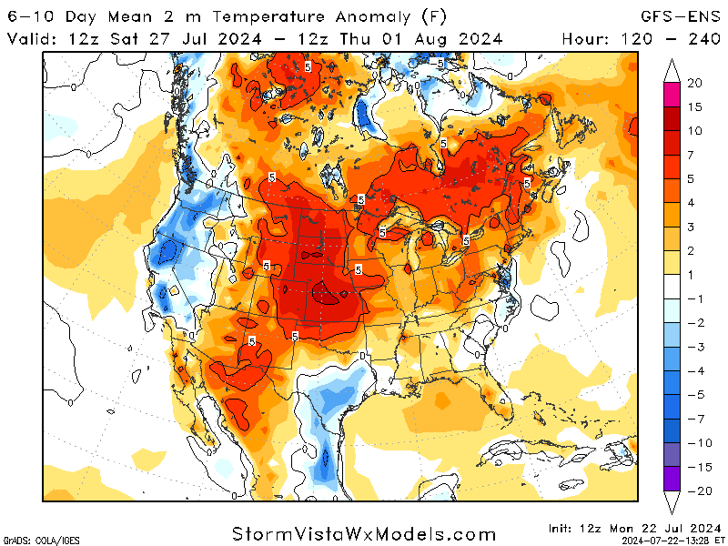
Jumping ahead, the last weekend of July is expected to see a slight rise in temperatures as a high-pressure system makes its way over the eastern half of the US. There is also a chance for a break from the showers/storms through this weekend, which will be a nice break for those tired of the constant rain chances.
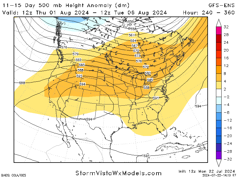
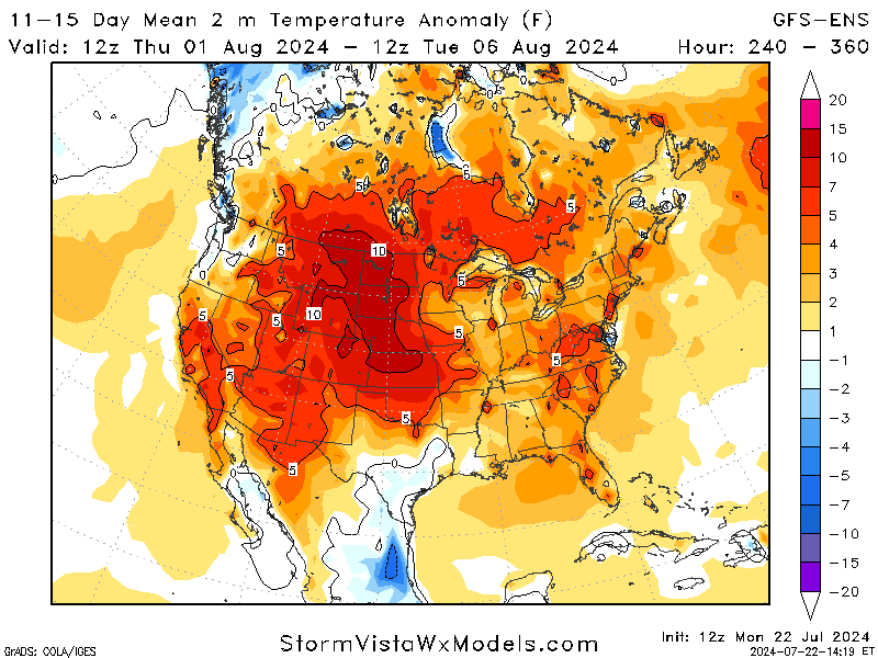
Jumping even further ahead, the first week of August looks hotter and calmer, with high pressure dominating the region. This will result in higher temperatures and a lower chance of rain. It’s still a way out, but it will give an idea to those trying to plan a last-minute vacation or get some outside work done.
BRIEF TROPICAL UPDATE:
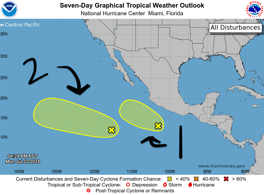
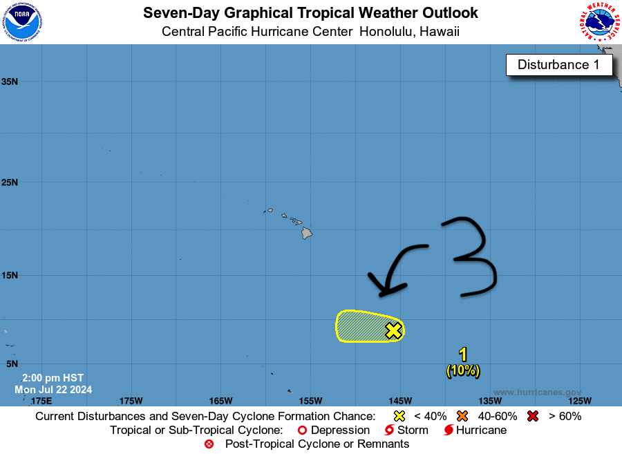
A quick look at the tropics shows that the Atlantic is still quiet and is expected to stay that way over the next seven days. However, the Pacific is quite busy with three areas of interest.
Area 1 is an area of showers and thunderstorms located a few hundred miles south-southeast of Manzanillo, Mexico is associated with a tropical wave. This system has become better organized today, and some further development is possible while it moves generally west-northwestward over the next couple of days, remaining offshore of southwestern Mexico. This system has a 20% chance of development over the next week.
Area 2, a tropical wave located several hundred miles south-southwest of the southern tip of the Baja California Peninsula, produces disorganized shower and thunderstorm activity. Environmental conditions could become a little more conducive to the gradual development of this system over the next several days while it moves westward to west-northwestward at 10 to 15 mph across the central and western portions of the basin. This system has a 10% chance of development over the next two days but a 30% chance over the next week.
Area 3 is a large area of disorganized showers and thunderstorms located over the far eastern portion of the central Pacific basin and is associated with a trough of low pressure. Environmental conditions appear conducive for some slow development during the next 24 hours. The disturbance will move westward at 10 to 15 mph. Strong shear will inhibit further development of this system by the middle of this week, hence the 10% chance for additional development.


