There is quite a bit to talk about regarding weather across the country today, with consistent rain in the east and West and wildfires in the northwest, along with some high temperatures. Showers in the West are expected to shift to the east heading into the weekend as the low-pressure trough pushes eastward. Rain in the east, however, is expected to stick around into the start of next week. Let’s get into it!
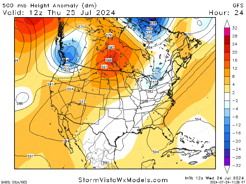

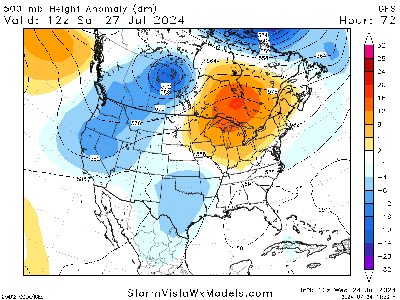
A ridge is making its way across the northern half of the country, kicking out the trough currently over the Great Lakes and bringing in another trough right behind it. The low pressure will help slightly cool temperatures and boost rain chances in both the eastern and western half of the country.
Moving into the West, the mid-level trough should bring relief for the extreme heat and may get some showers/storms to help keep the wildfires at bay. The trough moving out of the country’s eastern portion is expected to break off and leave an area of low pressure over the southern Great Plains, keeping the cooler temperatures and higher rain chances around for a little longer.
EASTERN SHOWERS/STORMS
Rain is expected to impact areas nationwide, with the most significant amounts focused in the eastern portion. While severe weather is not expected, some storms could produce strong winds and heavy rain.
There is a moderate risk (at least 40%) for excessive rain issued for portions of Louisiana and far southeast Texas tomorrow, with a slight risk (at least 15%) around the area and in the Carolinas. This outlook involves the risk of rainfall exceeding the area’s flash flood guidance.
HAZARDS ACROSS THE NATION
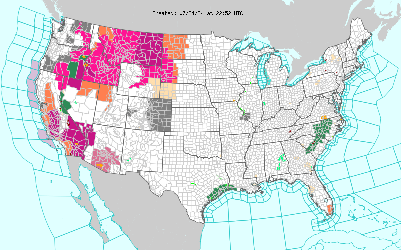
A wide variety of hazards are currently in effect across the nation, with the West being the most active region. The central Great Plains and Midwest are relatively quiet, with some scattered hazards throughout the regions. The onslaught of rain in the region has caused some localized flood watches in southeast Texas and the middle of the Carolinas.
The main focus is the array of watches/warnings related to wildfires and heat across the country’s western half. In the southwest, some excessive heat warnings are in effect in southern California, along with severe thunderstorm watches in Arizona. In the northwest, the threat of wildfires is spread across the region, along with excessive heat warnings and heat advisories scattered throughout the region.
An active fire-weather pattern is expected as a weather system moves east across Washington and British Columbia. This weather system will cause scattered, dry thunderstorms in eastern Washington, Idaho, and western Montana. Due to fast-moving storms and hot, dry conditions, there will be little rain to help dampen the dry vegetation, increasing the risk of wildfires. Gusty winds from these storms can also spread any fires started by lightning.
Central Washington, Oregon, and northwestern Montana will see elevated fire-weather conditions, particularly in areas like the Cascade Gaps and the Columbia River Gorge. Expect hot, dry, and windy weather as the system passes, raising the risk of wildfires in these areas.


