Us Meteorologist may have sounded like a broken record for the last week, but that trend is expected to change after this weekend. We do, however, expect more heavy rainfall today and through the rest of this weekend. Some of these storms could produce heavy rainfall, leading to flash flooding. For those who like cooler weather, make sure to enjoy the next couple of days, as hot and humid weather is expected to return next week. Looking to the tropics, we are starting to see a possible reactivation here in the next couple of weeks.
More rainfall is expected, but drier weather expected
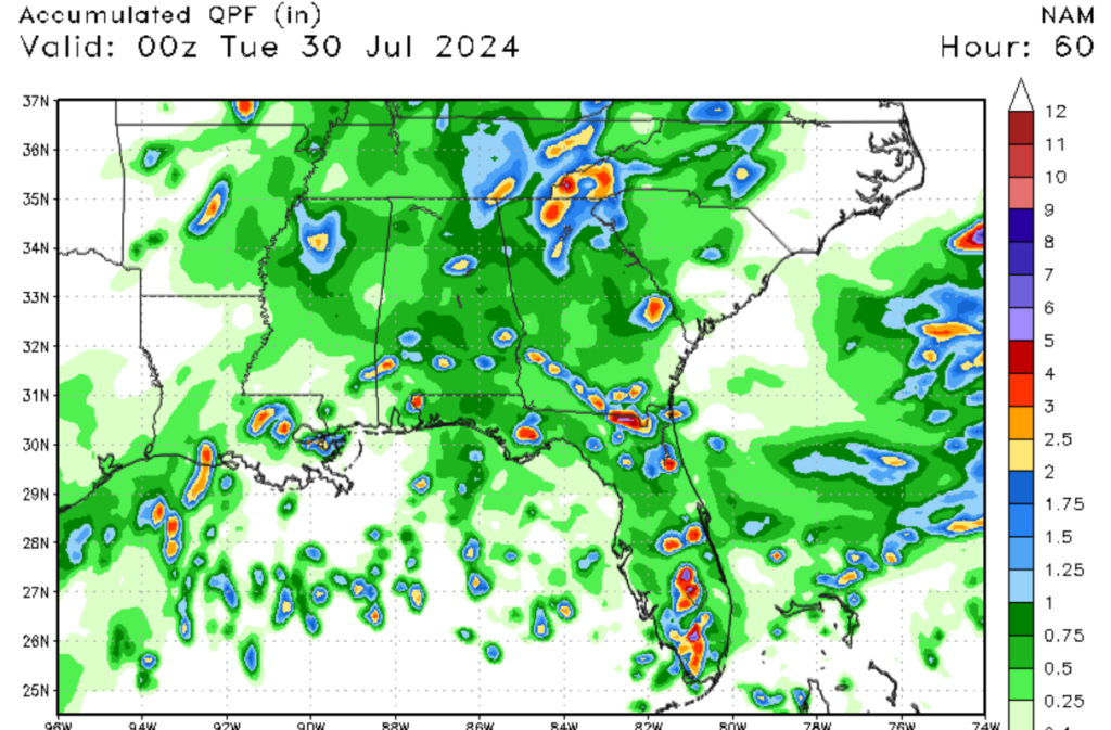
Looking at the map to the left, you can see the expected rainfall for the region; I expect convective showers and thunderstorms to develop around the lunch hour. We have had a lot of moisture coming off the Gulf over the last week due to the persistent southerly winds associated with a high-pressure system in the Atlantic. There has also been a stationary front to the north of us, allowing for a lot of moisture in the mid-levels. Both of these systems are expected to weaken and or move away from us, allowing for a pattern shift seen in the video to the right.
Going back to today’s weather, these showers should be scattered in nature, although our coastal communities should expect more rainfall compared to areas north of Interstate 20. Some of these storms could bring heavy downpours, possibly leading to flooding in some areas. Please remember never to venture into flooded areas. This trend of afternoon showers and thunderstorms is expected to continue for Sunday and Monday before the pattern shift I mentioned earlier takes hold.
The heat and drier weather will return

Looking ahead into next week, our current weather pattern is expected to change by early next week. The stationary front is expected to weaken and move away from us. This will allow for drier air associated with a high-pressure system to set itself up in the Centeral U.S. Consequently, drier weather is expected as a shift in the mid-level winds will pump in drier air from the Southwestern U.S. This will allow for our rain chances to be reduced for next week and allow for more sunshine. The bad news from this is temperatures are expected to climb back into the 90s. Because of the moist ground, relative humidity values are also expected to be high, creating a humid and sticky air for the region. Since it is still summer, one can expect isolated showers and thunderstorms next week.
Something is brewing in the tropics

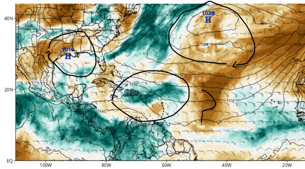
It’s been quiet for the last couple of weeks in the tropics after Beryl moves through. That trend may change in the next week or two as some of the ingredients are starting to come together in the Atlantic Basin. A small area of disturbance shown in the left image is expected to interact with a wave of moisture shown in the image to the right. As these ingredients meet near the Lesser Analies, the possible formation could happen as the system moves west-northwest through this next week. We will be keeping a close eye on this developing situation as this week progresses, so make sure to stay up to date on the latest tropical information.


