Happy first day of August, I hope you are looking forward to our last month of meteorological summer. The heat that’s been cooking the region over the last couple of days is expected to last through tomorrow as this center of high-pressure system sitting in the Great Plains continues to bake the region. Heat advisories have been issued for Southern Mississippi and Southern Louisiana, while excessive heat warnings have been issued for areas north of Jackson, Mississippi, as well as the New Orleans Metro area. These weather statements are in effect through at leat Friday evening. By this weekend, a mid-level trough is expected to increase our rainfall chances, but due to the high-pressure system, only slight cooling is expected
More hot weather ahead
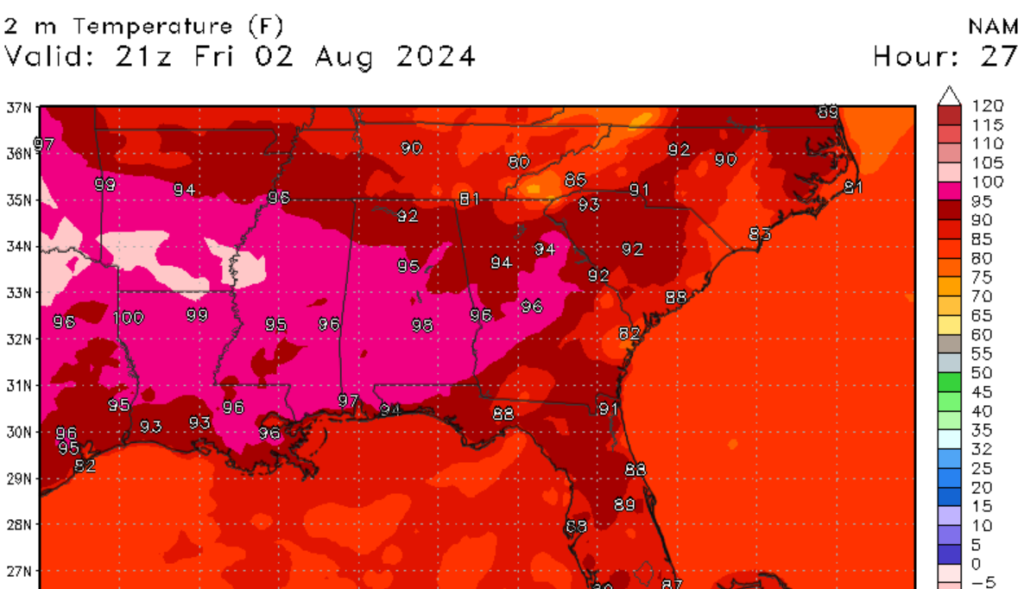
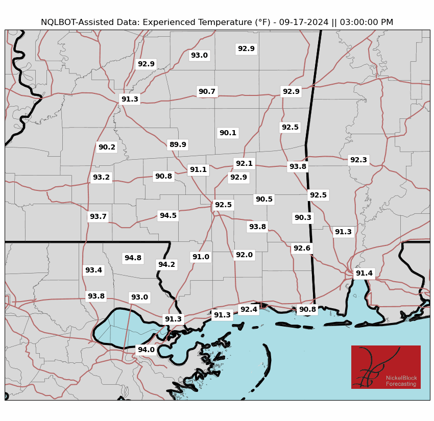
The high-pressure systems that are baking the Central U.S. are causing our temperatures to stay well above average through the next day or two. Today and tomorrow, one should expect high temperatures well into the 90s. Even a few 100-degree Ferinheight readings are not out of the question. Keep in mind that these are air temperatures, not the heat index. The good news is that relative humidity values are expected to be between 40-60% by the afternoon. Although relative humidity values won’t be too high, this does not mean that heat index values won’t be extreme. I expect that most of the region will see heat index values of over 105 degrees Ferinheight as seen in the image below.
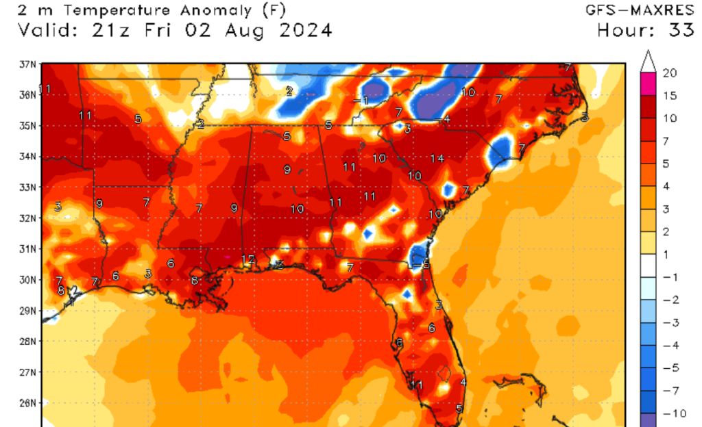
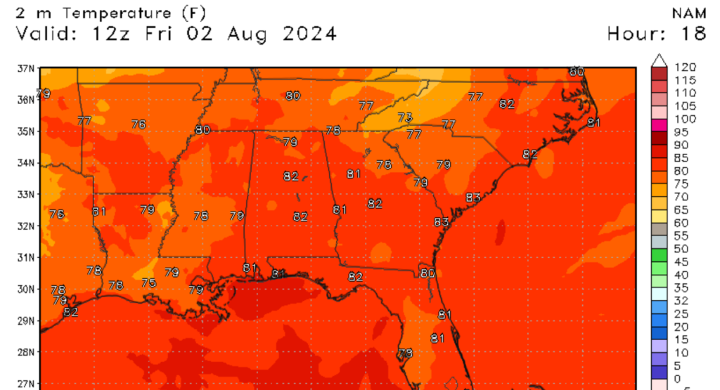
Looking at the upper left image, overnight lows won’t provide much relive for the region, with low temperatures struggling to drop below 80 degrees Ferinheight. Looking at the image to the lower right, our temperature anomalies are much above average for the region. If you are outside, watch for heat illnesses, and stay hydrated.
A slight change for the weekend
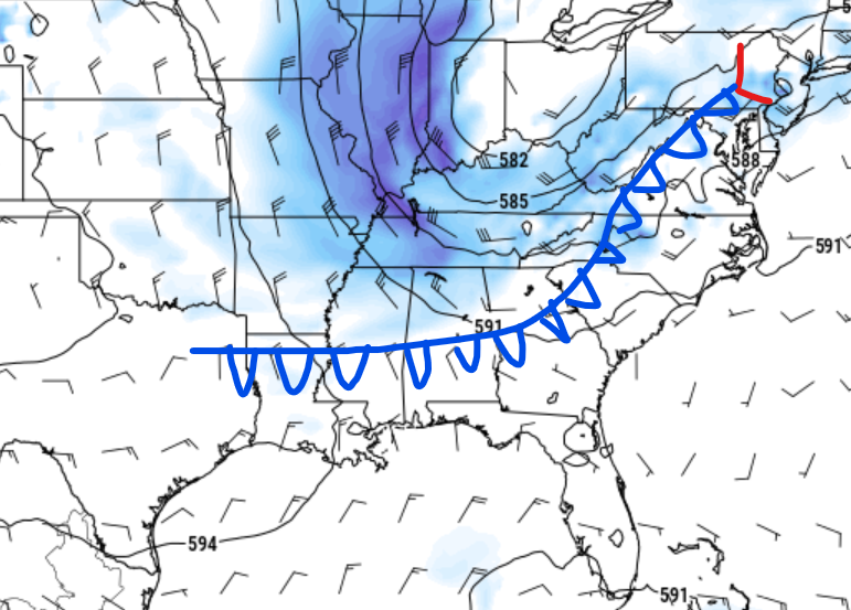
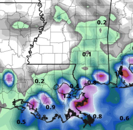
Over the weekend, a slight change in our weather pattern is expected at a low-pressure system, and a cold front is expected to move close to our region. Unfortunately, I don’t think we will see much effect from the front, as our upper-level system is expected to keep the front to our north. The only effect that we could see is a slight increase in rainfall as seen in the image to the right. Most of the rainfall should stay in the region south of Interstate 20, as a few showers and storms could make their way off the Gulf. The bottom line is don’t expect any rainfall and be plenty surprised if it does rain.
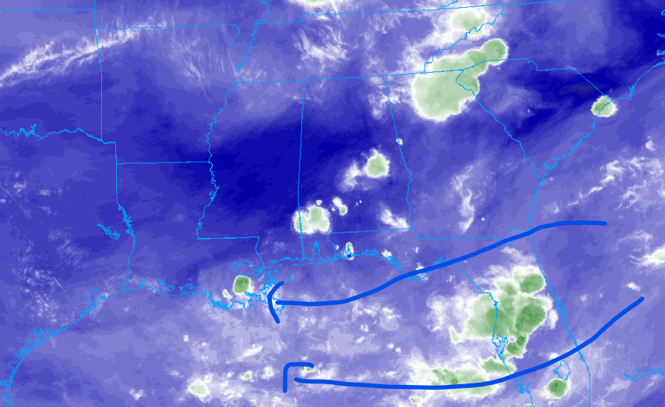
Keeping an eye on the tropics

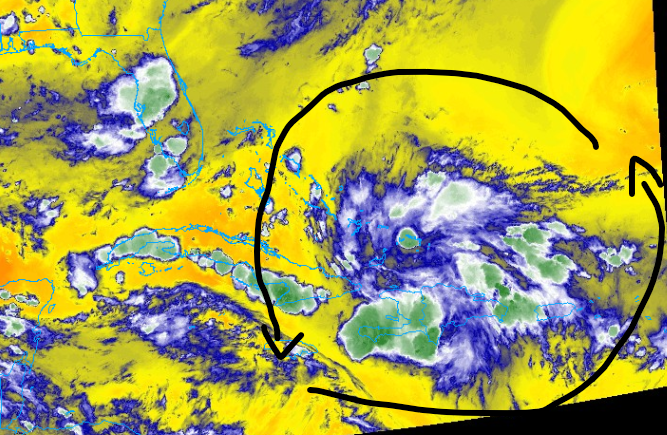
Looking at the tropics, we are more and more confident that a tropical depression could form early next week in the Gulf, near the Florida Peninsula. This area of showers and thunderstorms is currently over the Dominican Republic, Haiti, and Puerto Rico. Although this system is expected to slowly move northwest, Plenty of moisture, low windshear, and warm ocean temperatures will promote storm organization into early next week. Those living in the region should be keeping a very close eye on this potential tropical system.


*Fahrenheit